
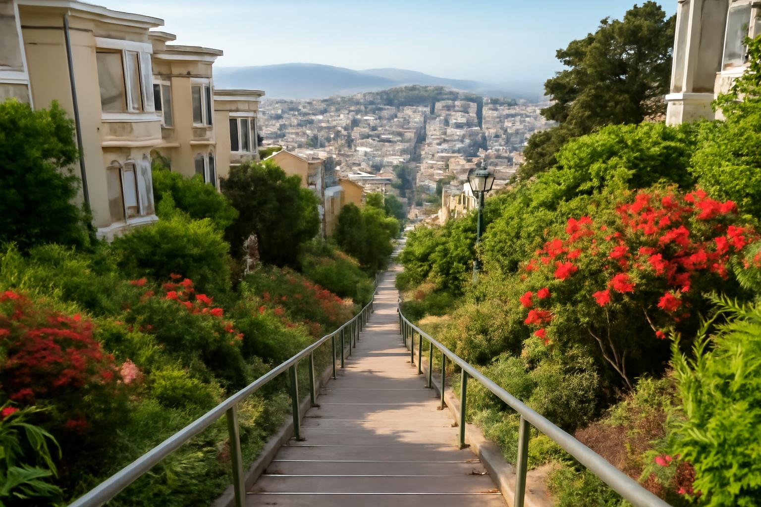
San Francisco public stairways walking routes work best when you treat them less like a citywide checklist and more like hill-aware neighborhood traverses. The stairs are the connective tissue: they pull you into gardens, viewpoints, mosaic art, residential lanes, and pocket-sized corners of the city that are easy to miss if you stay on the standard street grid.
That matters especially on a site built around calmer, smarter visitor routing. Most visitors do not need to spend every day climbing. A stairway walk usually works best as the main exertion of one morning or one full day, then paired with a flatter add-on, a transit ride, or a neighborhood meal rather than more uphill backtracking.
What follows is a curated synthesis of third-party stair maps, directories, route guides, and walking organizations rather than an official city route system. The goal is practical: help you choose between a compact art-focused cluster, a postcard-heavy northside route, or a true full-day urban hike without pretending every stair count or route spec is universally settled.
What Are San Francisco’s Public Stairways?
For route-planning purposes, the clearest working definition in this source set comes from Doing Miles, a detailed personal hiking guide: public stairways are outdoor stairs that are part of the landscape, not stairs used only to access a building, and they count only if they have at least 3 steps.
That definition helps because San Francisco stairway counts vary depending on what gets included. A long landscaped stair street, a short pedestrian cut-through, railroad-tie trail steps, and a famous mosaic staircase can all belong in the same conversation. Tiny curb step-ups and building-entry stairs usually do not.
For visitors, the number matters less than the function. These routes solve San Francisco’s hills in interesting ways. They connect neighborhoods through parks, gardens, public art, and ridge views. Instead of walking one commercial strip at a time, you can move from a café start to a garden stair, to a lookout, to a lunch neighborhood in one readable line.
They are still closer to urban hiking than casual sightseeing. Doing Miles explicitly frames many of its outings as roughly 10- to 12-mile full-day legs and warns that stairway routing can require unusually careful navigation (Doing Miles route guide). That is the right mindset to bring even if you choose a much shorter version.
Essential Maps and Resources for Planning
If you want a broad discovery tool, Urban Hiker SF’s stairway project is the best starting map in this evidence set. It says it has documented 1,000+ stairways and counting, with map pins color-coded by impressiveness tier and black pins used for unverified or incomplete entries.
If you want a more selective directory, SF Stairways is easier to browse by individual stairway name. It lists 369 public stairways with neighborhoods and approximate heights, while also being clear about its limits: it excludes tiny stairways of only a couple of steps and leaves out many park-internal stairways. Its height figures are described as very rough Google Earth estimates.
For actual route execution, Doing Miles is the most itinerary-ready source here. It provides GPX files and CalTopo maps for its San Francisco stairway series and gives published start points, finish points, and distances for three especially useful visitor legs: 10.2 miles from Mission Blue at 144 Leland Ave to Mission and Santa Marina; 12.0 miles from Cafe Bello at Bosworth and Diamond to West Portal Muni Station; and 11.4 miles from Peet’s at 54 West Portal to Philz at Douglass and 24th (Doing Miles route guide).
A practical workflow is simple:
- use a large map to discover neighborhoods
- use a named directory to confirm what is actually there
- use a published GPX route when you want a full walking day
- treat books and route blogs as curated third-party planning tools, not official city infrastructure
That last point is important. The maps help you see possibility. The route files help you actually walk.
Route 1: Visitacion Valley to Bernal Heights (10.2 Miles)
Best for: visitors who want one full-day stairway walk through less-touristed southern neighborhoods, without turning it into an all-city epic.
Route card
- Published start: Mission Blue, 144 Leland Ave (Doing Miles route guide)
- Published finish: Mission and Santa Marina (Doing Miles route guide)
- Published distance: 10.2 miles (Doing Miles route guide)
- Source type: detailed personal hiking route with GPX, CalTopo, lunch-stop notes, and transit notes (Doing Miles route guide)
According to the Doing Miles route guide, this leg runs from Visitacion Valley through McLaren Park and on toward Bernal Heights. It is part of a broader San Francisco stairway series of about 120 miles, which the authors built after a 2014 walk of 82 miles that counted 568 stairways (Doing Miles route guide).
For visitors, this is one of the most useful long routes because it feels like a real traverse. You begin at the city’s southeastern edge, gain a park section early, then work through more residential stair connectors and hillside transitions as the day develops. That shape gives the walk a narrative: not just a list of famous stairs, but a progression through distinct parts of San Francisco.
McLaren Park is a big reason the route works. It breaks up the day before the walk becomes more navigation-heavy. After that, the experience shifts toward the details stairway walkers usually remember: planted landings, houses turned at odd angles to the slope, small view openings between blocks, and pedestrian passages that feel much more intimate than the street grid below.
This route is also useful because Doing Miles publishes it as a one-way day rather than a loop. That is the right instinct for most visitors. If you try to improvise a loop on stair-heavy terrain, you often spend your last hour reclaiming elevation you already earned once.
The tradeoff is concentration. Doing Miles specifically warns that stairway routing in San Francisco can demand vigilant navigation, and this part of the city is a good example of why. Residential connectors, park edges, and side-street stairs can blur together once you are tired. If you want the most operational version of the walk, use the published GPX rather than trying to recreate it from memory alone (Doing Miles route guide).
A visitor-friendly adaptation is to keep the full 10.2-mile line as the ideal plan but define a softer success condition before you start: one park section, several neighborhood stairs, and one strong viewpoint. If you get that and decide to stop early, you still got the point of the day.
Route 2-3: Glen Park to Noe Valley via Mount Davidson and Twin Peaks (23.4 Miles Total)
Best for: strong walkers, travel partners with different energy levels, or visitors who want two linked central-south routes that can be done separately.
Route 2 card
- Published start: Cafe Bello, Bosworth and Diamond (Doing Miles route guide)
- Published finish: West Portal Muni Station (Doing Miles route guide)
- Published distance: 12.0 miles (Doing Miles route guide)
Route 3 card
- Published start: Peet’s Coffee, 54 West Portal (Doing Miles route guide)
- Published finish: Philz at Douglass and 24th (Doing Miles route guide)
- Published distance: 11.4 miles (Doing Miles route guide)
Taken together, the two published legs total 23.4 miles and create one of the smartest split-route structures in the stairway material here (Doing Miles route guide). The key is West Portal. It is both the end of Route 2 and the start of Route 3, which gives you an obvious meal break, a transit bailout, and a clean decision point for groups.
Route 2: Glen Park to West Portal via Mount Davidson
This first segment is the more terrain-led leg. In the Doing Miles route guide, its center of gravity is Mount Davidson, which gives the day a more wooded and trail-adjacent feel than many San Francisco stair walks. The attraction is less about one iconic staircase and more about how the route mixes urban neighborhoods with greener hillside movement.
That makes it a good choice for visitors who want a stairway day that still feels varied and spacious. It is long enough to be the main event, but the West Portal Muni Station finish keeps it forgiving. If the weather turns, a knee starts complaining, or the group simply feels done, the route has a natural stopping point built in.
Because this leg is published by a personal hiking site rather than a city agency, it is best read as a field-tested third-party itinerary, not a signed official route. That is not a criticism. It is the reason to download the GPX before you go.
Route 3: West Portal to Noe Valley via Inner Sunset and Twin Peaks
The second segment shifts the mood. The published route leaves West Portal, works through the Inner Sunset and Twin Peaks side of the city, and finishes near Douglass and 24th in Noe Valley (Doing Miles route guide). Compared with Route 2, this one feels more like classic San Francisco stairwalking: more view-driven, more neighborhood contrast, and a little more mentally demanding as the route stitches together different hillside passages.
It is rewarding for visitors because it connects places people often experience separately. Instead of choosing between west-side residential hills and central city views, you move through both in one line. The Noe Valley-side finish also makes the route easier to end as a meal or café stop rather than as another climb.
Doing Miles notes that San Francisco stairway routing is complex in general, and this is the kind of route where that matters most. It is not difficult in the sense of technical hiking, but it is easy to lose rhythm if you keep stopping to confirm every turn.
Should you link them in one day?
You can, but most visitors should treat the combined 23.4 miles as a serious urban hike, not a casual sightseeing walk (Doing Miles route guide). Repeated stair climbing changes what the mileage feels like.
For most people, the better strategy is:
- start with coffee in Glen Park
- complete Route 2 to West Portal
- stop for food and reassess honestly
- continue onto Route 3 only if time, weather, and legs still agree
That design is why these routes are so useful. West Portal gives you a real midpoint rather than a psychological one. If you stop there, the day still feels complete. If you continue, the walk turns into a memorable city traverse.
These two legs are especially good for friends traveling together because they create a polite split point. One person can end at West Portal while another keeps going, and nobody has to undo the entire day to get home.
Neighborhood Clusters: Golden Gate Heights and Inner Sunset
If you want the cleanest short-format San Francisco public stairways walking route, this west-side cluster is the easiest place to start.
Tailor-Made Itineraries describes the 16th Avenue Tiled Steps as a 163-step sea-to-stars mosaic created by artists Aileen Barr and Colette Crutcher, with the Hidden Garden Steps about a 5-minute walk away and Grandview Park above for the payoff view.
For relative scale, the SF Stairways directory estimates the 16th Avenue Tiled Steps at about 90 feet high, while explicitly warning that its height figures are only rough Google Earth estimates rather than surveyed measurements (SF Stairways directory).
ROAM Family Vacation notes that the 16th Avenue Tiled Steps were dedicated in 2005 and also describes San Francisco stairwalking as something that ranges from quick neighborhood outings to much more strenuous climbs.
For visitors, the reason this cluster works is efficiency. You can build a real stairway outing without committing to a full-day endurance project. A simple version looks like this:
- start near the base of the 16th Avenue Tiled Steps
- climb slowly enough to actually see the tilework
- continue up to Grandview Park for the view
- walk over to the Hidden Garden Steps
- finish in the Inner Sunset for coffee or lunch
That sequence gives you art, elevation, and a neighborhood landing without much dead walking.
It is also one of the easiest places to customize. If you want just the famous mosaic, you can stop there. If you want a fuller west-side wander, Golden Gate Heights has enough surrounding stairs in the map and directory tools to justify adding one or two nearby connectors. The trick is restraint: build around one anchor staircase and one secondary stair, not a district-wide sweep.
This is the best entry point for visitors who want beauty and payoff without turning the day into mileage accounting. There is still climbing, but the format is modular.
Iconic Northside Routes: Telegraph Hill, Russian Hill, and Pacific Heights
Northern San Francisco gives you the most classic postcard mix of Bay views, dense hillside neighborhoods, and well-known stair corridors. It also gives you the easiest opportunity to overbuild a route.
Hello Ruby Doodle describes the Filbert Steps as 284-foot wooden stairs rising toward Telegraph Hill. The same source lists the Lyon Street Steps at 288 steps, but published Lyon counts are not fully settled in this evidence set: ROAM Family Vacation gives 332 stairs instead.
That is useful even if you are not following an event route. For most visitors, the smartest northside day is not “all the famous stairs.” It is a compact chain with one major ascent, one strong top-of-hill zone, and one elegant finish.
A practical self-guided version is:
- begin in or near North Beach
- climb either Filbert or Greenwich toward Telegraph Hill
- spend time at the top instead of treating it as a checkpoint
- move west through Russian Hill’s lanes and smaller stair connectors
- add Lyon only if you still want one last major effort
That sequence keeps the route scenic without turning it into a stair-count obsession.
The tradeoff on the north side is temptation. You are close to several major visitor areas, so it is easy to keep adding one more landmark until the walk loses shape. If your goal is a beautiful route rather than a fitness challenge, Telegraph Hill plus Russian Hill is usually enough. Lyon works better as an optional extension than as a compulsory finale.
Practical Tips: Preparation, Transit, and Pacing
San Francisco stairway days reward ordinary hiking habits more than ordinary city-stroll habits. ROAM Family Vacation notes that some stairway routes can be strenuous or muddy and recommends good shoes, while Doing Miles says stairway routing can require unusually careful navigation; Hello Ruby Doodle also notes that popular stairs can attract local fitness users and that nearby parking can be limited or metered (ROAM Family Vacation; Doing Miles route guide; Hello Ruby Doodle roundup).
The biggest visitor mistake is forcing a loop. These routes usually work better as one-way walks with a separate return plan. West Portal is the clearest example because it is a published route finish and a transit node at the same time, but the logic applies widely: finish somewhere useful, then move on with your day instead of reclaiming the same elevation twice.
If you want the rest of the day to feel calmer, pair a stair-heavy morning with a flatter add-on such as a self-guided Golden Gate waterfront walk rather than another hilly neighborhood. One demanding route plus one easy landscape usually works better than two demanding routes back to back.
Pacing matters more than speed. The west-side mosaic cluster and a 10- to 12-mile Doing Miles leg are not versions of the same activity; one is a compact neighborhood outing, the other is a full urban hike (Doing Miles route guide).
A good way to keep the day readable is to set an exit condition before you start. That might be:
- your lunch stop
- West Portal or another transit node
- a neighborhood where you want to spend the afternoon
- a turnaround rule based on energy rather than on pride
Navigation deserves respect too. San Francisco stairway walks often mix named stair streets, pedestrian cut-throughs, park edges, and ordinary sidewalks. Doing Miles specifically recommends GPS support for some routes, and that is sensible advice once fatigue sets in (Doing Miles route guide).
Finally, go early if you want the most famous stairs to feel calmer. Hello Ruby Doodle notes that some of the best-known stairways are regular exercise spots for locals, not just photo stops, so timing can matter as much as route choice (Hello Ruby Doodle roundup).
Other Notable Stairways and Guided Options
Beyond the headline routes, Hello Ruby Doodle’s roundup highlights the Lincoln Park Steps as a revived public-art staircase and the Tompkins Stairway Garden in Bernal Heights as a succulent-and-tile stair stop with a distinctly neighborhood feel.
Those names are useful not because each one needs its own full outing, but because they plug neatly into days you may already be having. Tompkins works best as an add-on if you are already south of downtown. Lincoln Park fits better as a scenic northwest-side stop than as the center of a long stair mission. Corona Heights, Saturn, and Vulcan are better treated as a neighborhood tangle to explore than as one single must-see object.
If you want route logic and local history without doing all the stitching yourself, San Francisco City Guides offers free stairway-focused walks in Corona Heights, Russian Hill, and Telegraph Hill, with a Golden Gate Heights version offered seasonally in May and October.
That guided option solves a real self-guided problem: knowing which stairways are interesting because of views, which because of architecture, and which because they simply connect two useful parts of the city. If you like narrative and context more than route fiddling, a City Guides walk is often the better first exposure.
Past event routes can also help as planning models. The Walk SF Stair Challenge is useful precisely because it shows how compact a strong northside route can be. Just treat event descriptions as inspiration, not as proof of a current scheduled walk.
How many public stairways does San Francisco have?
There is no single settled number. Urban Hiker SF says its project documents 1,000+ stairways and counting.
A narrower SF Stairways directory lists 369 urban stairways because it excludes tiny stairways and many park-internal stairs, while Walk SF’s interview with Mary Burk describes San Francisco more broadly as having 900+ public stairways. In practical terms, visitors should think in ranges, not one definitive total.
What are the most artistic public stairways?
Tailor-Made Itineraries credits the 16th Avenue mosaic to Aileen Barr and Colette Crutcher, and Walk SF’s Mary Burk names the Hidden Garden Steps at 16th and Kirkham as her favorite because of that tilework (Tailor-Made Itineraries; Walk SF interview).
Lincoln Park Steps is another strong art-focused stop, and Tompkins Stairway Garden is a good south-side choice if you want planting and tile together (Hello Ruby Doodle roundup).
Are there downloadable GPX or map files for routes?
Yes. The clearest route-specific files in this source set come from Doing Miles, which offers GPX files and CalTopo maps for its San Francisco stairway walk series (Doing Miles route guide).
That is different from the large discovery tools. Urban Hiker SF and SF Stairways are better for browsing locations and building your own ideas; Doing Miles is better when you want a prebuilt line to follow.
Which routes have verified start/end points and distances?
If by “verified” you mean the most clearly published start points, finish points, and mileages in this evidence set, the strongest examples come from the Doing Miles route guide:
- Visitacion Valley to Bernal Heights — 10.2 miles, from Mission Blue at 144 Leland Ave to Mission and Santa Marina (Doing Miles route guide)
- Glen Park to West Portal via Mount Davidson — 12.0 miles, from Cafe Bello at Bosworth and Diamond to West Portal Muni Station (Doing Miles route guide)
- West Portal to Noe Valley via Inner Sunset and Twin Peaks — 11.4 miles, from Peet’s at 54 West Portal to Philz at Douglass and 24th (Doing Miles route guide)
Because these are published by a personal hiking resource rather than by the city, it is best to think of them as detailed third-party route specs, not official municipal trail designations.
How physically demanding are these stairway walks?
It depends entirely on the format. A short west-side art cluster can feel like a compact neighborhood outing, while Doing Miles explicitly treats 10- to 12-mile stairway legs as full-day walks and ROAM Family Vacation warns that some routes can be strenuous or muddy (Doing Miles route guide; ROAM Family Vacation).
Linking Route 2 and Route 3 into 23.4 miles is strenuous for most visitors, especially once repeated climbs are added in (Doing Miles route guide). Walk SF’s Mary Burk gives the most useful mindset: do not be intimidated, take stairs slowly, and feel free to do partial walks rather than full completions (Walk SF interview).