
Feature
How High Is Buena Vista, Colorado—and What Does That Mean for Visitors?
By Elena Park ·

The short answer: Buena Vista is about 7,960 feet high
Buena Vista, Colorado, is approximately 7,960 feet—or about 2,430 meters—above sea level. For everyday travel planning, it is reasonable to describe the town as sitting at roughly 8,000 feet. The commonly cited town profile lists 7,960 feet in its infobox, rounded there to 2,430 meters, and attributes the figure to the Geographic Names Information System. The underlying GNIS record was not independently reviewed for this article. See the Buena Vista town profile and elevation listing.
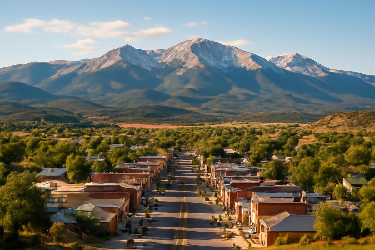
This answer refers to the statutory town of Buena Vista in Chaffee County, central Colorado—not to another park, street, neighborhood, or community with the same name. Buena Vista lies in the Upper Arkansas River Valley near the Collegiate Peaks.
The word approximately matters. A town occupies an area rather than a single point, and its terrain is not perfectly level. A representative municipal elevation should not be interpreted as the exact height of every street, building, riverbank, or property within the town boundary.
The supplied sources also do not identify the exact reference point, survey benchmark, vertical datum, or measurement method behind each published figure. Without that information, describing 7,960 feet as an indisputably exact and uniform elevation would create false precision.
The most useful formulations are:
- Direct factual answer: about 7,960 feet
- Rounded metric equivalent: about 2,430 meters
- Travel-planning shorthand: roughly 8,000 feet above sea level
The 2,430-meter figure is rounded to the nearest 10 meters. A closer mathematical conversion of 7,960 feet is approximately 2,426 meters, but that extra precision does not resolve where within town the representative elevation was measured.
For visitors, the practical point is straightforward: Buena Vista is a high-elevation Colorado town. Whether a source uses 7,954, 7,960, or 7,965 feet does not materially change how travelers should understand the setting.
Why published elevations range from 7,954 to 7,965 feet
Published elevations for Buena Vista cluster within a very narrow range:
| Published elevation | Consistent metric conversion | Published by |
|---|---|---|
| 7,954 feet | Approximately 2,424 meters | A regional tourism and information page reports this lower figure. View its Buena Vista elevation listing. |
| 7,960 feet | Approximately 2,426 meters | The town profile cited above lists this figure in its infobox. |
| 7,965 feet | Approximately 2,428 meters | Colorado Via Ferrata’s commercial tourism article reports this upper figure. See its Buena Vista town facts. |
The lowest and highest values differ by 11 feet. That discrepancy is real, but it is negligible for ordinary travel planning. All three values place the town at approximately 8,000 feet above sea level.
The evidence is not divided neatly by publisher type. Clark Hess Real Estate’s elevation comparison uses 7,954 feet (2,424 meters), matching the lower endpoint rather than the 7,960-foot central answer. Review the published 7,954-foot comparison.
A separate Clark Hess high-altitude article gives Buena Vista’s elevation as 7,965 feet above sea level, matching the upper endpoint. It does not provide a measurement location, datum, or methodology for that value. Read the separate 7,965-foot elevation statement.
The town profile itself also contains an internal difference: its infobox lists 7,960 feet, while its article body states 7,965 feet. The source does not explain why those values differ by five feet.
Several factors could plausibly produce such small variations:
- Publishers may use different representative points within town.
- One figure may have been rounded or converted from another unit.
- Sources may follow different databases or editorial conventions.
- Measurements may use different methods or vertical datums.
- A value may have been carried forward from an older secondary source.
These are possible explanations, not established causes. None of the supplied pages provides enough methodological detail to determine why a particular publisher selected its number.
The geographic nature of a town also limits what a single elevation can mean. Even if every publisher used the same measurement system, different reference points could yield somewhat different results.
The metric figures can add another layer of apparent disagreement if they are rounded inconsistently. For example, the town profile pairs 7,960 feet with 2,430 meters, while the closer conversion is about 2,426 meters. Both can be acceptable at different levels of precision, but placing a nearest-10-meter value beside nearest-meter conversions can make a higher elevation appear to have a lower metric equivalent. The table above therefore applies one convention—rounding each conversion to the nearest meter.
For factual writing, about 7,960 feet is a sensible synthesis. It sits near the middle of the supplied range, matches the figure prominently displayed in the town profile, and avoids implying more certainty than the evidence supports.
When reproducing information from a particular publisher, use that publisher’s stated figure and identify it accordingly. For general travel planning, however, the 11-foot spread does not affect the conclusion: Buena Vista is a roughly 8,000-foot destination.
Is Buena Vista actually 8,000 feet above sea level?
Calling Buena Vista an 8,000-foot town is appropriate as a rounded description. It does not mean that the town—or every point within it—has been measured at exactly 8,000 feet.
Local destination material explicitly says Buena Vista rests at “roughly 8,000 feet elevation.” That same description places the town between the Continental Divide to the west and the Fourmile Recreation Area foothills to the east, with the Arkansas River running through the area. Read the local tourism description of Buena Vista.
This wording is consistent with the more specific published figures. Rounding an elevation near 7,960 feet to a convenient travel-planning number produces 8,000 feet without creating a meaningful contradiction. The important qualifier is roughly.
The town motto, “8,000 Feet Above Average,” reinforces the association. It is memorable branding and wordplay, not evidence that a survey established exactly 8,000 feet as the elevation of every part of Buena Vista.
The best wording depends on the context:
- For a factual answer: “Buena Vista is about 7,960 feet, or roughly 2,430 meters, above sea level.”
- For general conversation: “Buena Vista is a mountain town at roughly 8,000 feet.”
- When quoting a publisher: Use that publisher’s stated figure and attribute it.
- For a particular property, road, or trailhead: Use location-specific elevation information rather than the generalized town figure.
This approach avoids two common mistakes. The first is false precision: treating 7,960 feet as the exact elevation of every location in town. The second is false disagreement: treating a rounded 8,000-foot description as incompatible with a more specific number in the 7,954-to-7,965-foot range.
Both descriptions are useful when their intended precision is clear.
Where Buena Vista sits in Colorado’s mountain landscape
Buena Vista is in Chaffee County in central Colorado, within the Upper Arkansas River Valley. It is associated geographically with the Arkansas River and the Collegiate Peaks.
Its position in a valley can be misleading to travelers accustomed to low-elevation river valleys. A valley is lower than the mountains around it, but it is not necessarily close to sea level.
The setting can be understood in three layers:
- The town: approximately 7,960 feet above sea level.
- The Upper Arkansas River Valley: a high-elevation valley containing communities and river corridors at different heights.
- The surrounding mountain terrain: substantially higher ground reached by roads, trailheads, passes, and climbing routes.
These layers should not be confused. Buena Vista has views of high mountain terrain, but the town itself does not sit at summit elevation. Likewise, the presence of nearby fourteeners does not make the municipal elevation comparable to the tops of those peaks.
That distinction matters for practical planning. Visitors can begin an outing at an already elevated base and then gain considerable additional elevation after leaving Buena Vista.
Denver provides a familiar comparison. Using the published figures of 7,954 feet for Buena Vista and 5,280 feet for Denver, Buena Vista is 2,674 feet higher. See the Buena Vista–Denver elevation comparison.
Using the preferred rounded Buena Vista figure of 7,960 feet would make the difference about 2,680 feet. Either calculation leads to the same practical conclusion: Buena Vista sits well over 2,600 feet higher than Denver.
For travelers who know Denver as the Mile High City, this comparison may be more intuitive than a measurement from sea level. Buena Vista begins considerably higher, and mountain outings from town may ascend higher still.
What the elevation may mean during a visit
Some visitors arriving from lower elevations may notice altitude-related effects in Buena Vista, while others may experience little obvious discomfort.
A regional healthcare provider explains that less oxygen is available as altitude increases and that some people can have negative or dangerous reactions requiring medical attention. It identifies altitude sickness, dehydration, sunburn, cold exposure, hypothermia, and lightning among the concerns associated with the Upper Arkansas River Valley’s high-elevation environment. Review the healthcare provider’s high-altitude guidance.
A cautious initial approach is more useful than assuming the altitude will—or will not—cause a problem. General planning measures include:
- Keep the first part of the visit lighter than a normal strenuous day at lower elevation.
- Pay attention to how you feel before increasing exertion.
- Carry water and remain attentive to hydration during outdoor activity.
- Use sun protection.
- Bring clothing appropriate for changing mountain conditions.
- Consider the elevation of the day’s destination, not only the elevation of your lodging.
- Leave room to shorten or modify an outing if conditions or symptoms become concerning.
A local Buena Vista travel page similarly advises travelers to reduce exertion initially and remain attentive to hydration, while noting that altitude sickness affects people differently. Read the local visitor guidance on Buena Vista’s altitude.
These measures should not be treated as guarantees against altitude sickness. The supplied evidence does not support a universal acclimatization schedule that works for every traveler, nor does it establish that hydration alone prevents an altitude-related condition.
The elevation profile of an itinerary also matters. Staying in town at roughly 8,000 feet is not the same as hiking, driving, or climbing into substantially higher terrain.
High-elevation outings can also involve risks separate from altitude illness. Strong sun, dehydration, cold, wet clothing, hypothermia, and lightning exposure require their own attention. It is better to treat these as distinct environmental concerns rather than describing every mountain risk simply as “the altitude.”
A useful planning sequence is:
- Identify where you will sleep. For Buena Vista, use roughly 8,000 feet.
- Check the elevation of the day’s destination. A trailhead, pass, or summit route may be much higher than town.
- Start conservatively. Avoid making the first strenuous outing a test of normal lower-elevation performance.
- Prepare for the environment. Carry water, sun protection, and suitable clothing.
- Stay flexible. Modify the outing if symptoms become concerning or conditions deteriorate.
General travel information cannot diagnose an altitude-related condition, assess an individual’s medical risk, or determine whether a particular person can safely visit or exercise at elevation. Anyone with health concerns should consult a qualified healthcare professional.
Frequently asked questions
What is the elevation of Buena Vista, Colorado?
Buena Vista, Colorado, is about 7,960 feet above sea level. That is approximately 2,426 meters by a close conversion or 2,430 meters when rounded to the nearest 10 meters.
The number is best treated as a representative elevation for the statutory town in Chaffee County, not as the exact height of every location within its boundaries.
Is Buena Vista 7,954, 7,960, or 7,965 feet above sea level?
All three figures appear in the supplied published sources. The full range is only 11 feet, and the sources do not disclose enough about their reference points, datums, or measurement methods to explain the difference definitively.
For general use, about 7,960 feet is the clearest answer. If quoting a particular publisher, preserve that publisher’s stated figure.
Why is Buena Vista described as being at 8,000 feet?
Because 8,000 feet is a reasonable rounded description of an elevation near 7,960 feet. Local tourism material and regional healthcare guidance both use the rounded figure.
The town motto, “8,000 Feet Above Average,” also reinforces the association, but the motto is branding rather than a precise survey result.
Can visitors experience altitude sickness in Buena Vista?
Yes. Some visitors who are not acclimated may experience altitude-related effects, although individual responses vary. Nearby mountain outings can also take travelers substantially higher than the town itself.
Begin at a lighter pace, remain attentive to hydration, use sun protection, and monitor how you feel. These are general precautions, not guarantees against illness.
How much higher is Buena Vista than Denver?
Using the published comparison of 7,954 feet for Buena Vista and 5,280 feet for Denver, Buena Vista is 2,674 feet higher. Using 7,960 feet for Buena Vista makes the difference approximately 2,680 feet.
Either way, Buena Vista sits substantially higher than Denver and should be understood as a high-altitude mountain town rather than simply another mile-high destination.
The practical takeaway
Buena Vista, Colorado, is about 7,960 feet—or roughly 2,430 meters—above sea level. In everyday travel language, it is accurately described as a town at roughly 8,000 feet.
The published range from 7,954 to 7,965 feet is a minor unresolved difference, not a meaningful planning distinction. Visitors should distinguish the town’s elevation from the much higher terrain nearby and allow for a measured initial pace when arriving from lower elevations.