
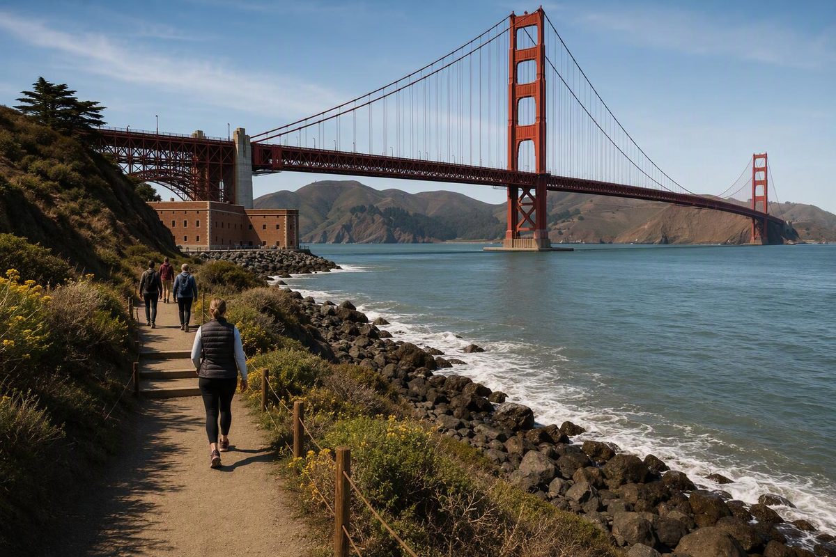
Choose Crissy Field to Presidio Tunnel Tops for the smallest commitment, Tunnel Tops to Fort Point for a longer waterfront walk, or Lands End for a more trail-like coastal outing. The published distances are 0.5 mile and 1.5 miles for the first two options; the shortened Lands End variation below has no published total. Stairs, loose sand and the walk to transit matter as much as mileage.
Choose your priority; the tool shows the route, effort and exit to plan around.
Match the Walk to Your Priority
Crissy Field → Tunnel Tops
Published leg: 0.5 mile; approach walks and the upper park are extra.
Effort: Mostly flat lower route across the marsh and along Mason Street.
Exit: 30 Stockton at Sports Basement, or continue up to Presidio Transit Center.
| Option | Published Distance | Main Caveat |
|---|---|---|
| Crissy Field → Tunnel Tops | 0.5 mile | Upper park and transit add walking |
| Tunnel Tops → Fort Point | 1.5 miles | Retrace, or climb 0.7 mile to bridge transit |
| Merrie Way → Mile Rock Overlook and back; baths from above | — | No published total for this variation; bath descent optional |
Sources: Parks Conservancy walking directions, NPS Lands End trailhead guide and SFMTA route pages. Distances are published legs, not door-to-door totals; — means no published total supplied.
Introduced in July 2026, the Golden Gate Dozen links twelve national park stops between Crissy Field and Fort Funston. It is a newly named itinerary through existing promenades, trails, beaches and neighborhood streets—not a newly built, continuous path. Keep the Conservancy’s map and turn-by-turn directions handy for the connections between stops.
Shorter Legs Have Different Terrain and Transit Costs
These are the Conservancy’s published walking distances, not door-to-door totals or independently measured mileage. Viewpoint detours, visiting the upper lawns at Tunnel Tops and reaching transit add walking. The unusually short Baker Beach label should not be your budget for a beach visit.
| Section | Published Distance | Terrain | Exit |
|---|---|---|---|
| Crissy Field → Tunnel Tops | 0.5 mile | Mostly flat lower route; upper park adds walking | 30 at Sports Basement, or Transit Center above |
| Tunnel Tops → Fort Point | 1.5 miles | Promenade and Marine Drive; no Battery East climb | Retrace, or climb the next leg to the 28 |
| Fort Point → bridge Welcome Plaza | 0.7 mile | Battery East steps and uphill finish | 28 at the bridge |
| Bridge → Baker Beach | 1.5 miles | Coastal hills; optional stairs and sand | Gibson/Bowley for shuttle or 29 |
| Baker Beach → Presidio boundary | 0.1 mile | Sand and a small staircase toward 25th Avenue | Return through parking lots for beach transit |
| Presidio → China Beach → Lands End | 0.7 + 1.2 miles | Streets, climbing, steps and rugged trail | 38R at 48th/Point Lobos |
| Lands End → Sutro Baths → Sutro Heights | 0.6 + 0.3 miles | Optional bath stairs, road crossing, downhill paths | Walk back toward 38R, or continue to Ocean Beach |
The NPS Lands End trailhead guide identifies steps near Eagle’s Point and rugged sections. The full through-walk should not be confused with its wheelchair-accessible western portion from Merrie Way to Mile Rock Overlook.
China Beach access caution: The NPS warning checked October 1, 2026 describes ongoing renovation and fall–winter Sea Cliff Avenue waterline work that can affect access through lane closures and controls. Make the cove detour optional and follow posted controls. Check current park alerts before setting out.
Crissy Field to Tunnel Tops Is the Smallest Sample
Start at East Beach and follow the published half-mile route across the marsh and along Mason Street. Stop at the lower playground and meadow, then decide whether to visit the upper lawns and Visitor Center. This gives you two named stops without committing to Fort Point.
The lower route is mostly flat. Treat the upper park as an additional visit rather than assuming the half-mile figure includes everything at Tunnel Tops.
For transit, take a 30 Stockton long-route bus serving Crissy Field, not a short-route trip. SFMTA lists the Crissy Field extension as operating from 6 a.m. to 8 p.m. daily. Its terminal is at Sports Basement, so reaching East Beach still involves an approach walk. Check the 30 Stockton route details for the trip you intend to use.
Tunnel Tops to Fort Point Avoids the Battery East Climb
Follow the promenade past the Warming Hut to Marine Drive and Fort Point. This 1.5-mile leg gives you bridge views and the fort without the Battery East stair climb. Stop here if stairs are the limiting factor: the next 0.7-mile leg climbs to the bridge Welcome Plaza.
Fort Point is not a convenient bus endpoint. Choose between retracing the lower waterfront or adding that uphill leg to reach the 28 19th Avenue, which serves the bridge and connects toward Fisherman’s Wharf or Daly City BART. Check the 28 route details before treating the bridge as your exit.
The 1.5-mile figure is therefore not the total for a return walk, nor does it include the climb to the bus. Pick the exit before leaving Tunnel Tops rather than deciding at the fort when you are already tired.
If the fort interior matters, its posted schedule is Thursday–Monday, 10 a.m.–5 p.m., with roof access closing at 4:30 p.m. It closes on Thanksgiving, Christmas and New Year’s Day; the exterior is accessible seven days a week. Check the NPS hours page before building the outing around entry. Our Golden Gate waterfront walk offers a broader one-way version.
Start at Lands End Lookout for a Shorter Coastal Variation
Instead of the published China Beach through-walk, begin at Lands End Lookout/Merrie Way. Walk toward Mile Rock Overlook and return, then view Sutro Baths from above. Descending to the ruins is optional; leaving it out avoids another down-and-up stair excursion.
This is a shortened variation, not one of the route’s published point-to-point legs. The draft’s sources do not provide a total distance for this combination, so do not use the table’s Lands End–Sutro Heights figures as its mileage.
Starting from the western end also lets you sample the wheelchair-accessible portion identified by NPS without committing to the steps near Eagle’s Point or the rugged through-route. That designation applies to Merrie Way–Mile Rock Overlook, not to every nearby viewpoint or the descent to Sutro Baths.
The 38R Geary Rapid has a downtown-bound stop at 48th Avenue and Point Lobos Avenue. It is a useful daytime finish rather than continuing south because Ocean Beach looks close. Check 38R stops and service details before setting out.
Baker Beach Detours Can Turn a Short Leg Into a Longer Outing
On the bridge-to-Baker Beach leg, stay on the California Coastal Trail for the simpler version. The Conservancy says the Batteries to Bluffs detour can add 30–60 minutes; the Sand Ladder is another optional beach descent. Neither belongs in the baseline effort for the published 1.5-mile leg.
At Baker Beach, the route’s 0.1-mile onward label covers the short connection toward the Presidio boundary, not a complete beach visit or the walk to transit. Leave time to return via the parking lots toward Gibson Road/Bowley Street for Muni 29 or the South Hills shuttle.
The South Hills shuttle is free and open to everyone. Check its timetable before walking away from your exit. Do not assume the same access rules apply to every Presidio GO service: some weekday commute trips on the Downtown route are restricted.
The full Ocean Beach stretch is not a tiny connecting leg. The Conservancy’s directions describe about three miles toward Sloat, despite an inconsistent 0.3-mile segment label. For a shorter sample, stop around Judah and use the N Judah at La Playa. Treat Fort Funston as a separate outing rather than an automatic finish.
Tunnel Tops Offers an Indoor Stop When Weather Cuts the Walk Short
If fog, wind or rain changes the plan, shorten to Tunnel Tops and visit the Presidio Visitor Center, with indoor exhibits and maps beside the Transit Center. Its posted hours are 10 a.m.–5 p.m. daily, except Thanksgiving, Christmas and New Year’s Day. Check the Visitor Center details before relying on it as an indoor stop.
The Downtown Presidio GO shuttle provides a return option, subject to its weekday commute restrictions. If using the 30 instead, account for the walk back down to its Crissy Field service.
For beach-level extensions, wind and surf can be more consequential than the distance. NPS warns about sneaker waves and says these beaches are not for swimming; follow its beach safety guidance. In rough surf, skip the beach descents rather than trying to complete every named stop.
For the souvenir, the Conservancy’s August 3, 2026 update listed limited-edition trail stickers at the Presidio Visitor Center, Warming Hut and Lands End Lookout, while supplies last. Mention that you’re doing the Golden Gate Dozen, but do not make uncertain sticker availability the reason for a long detour.