
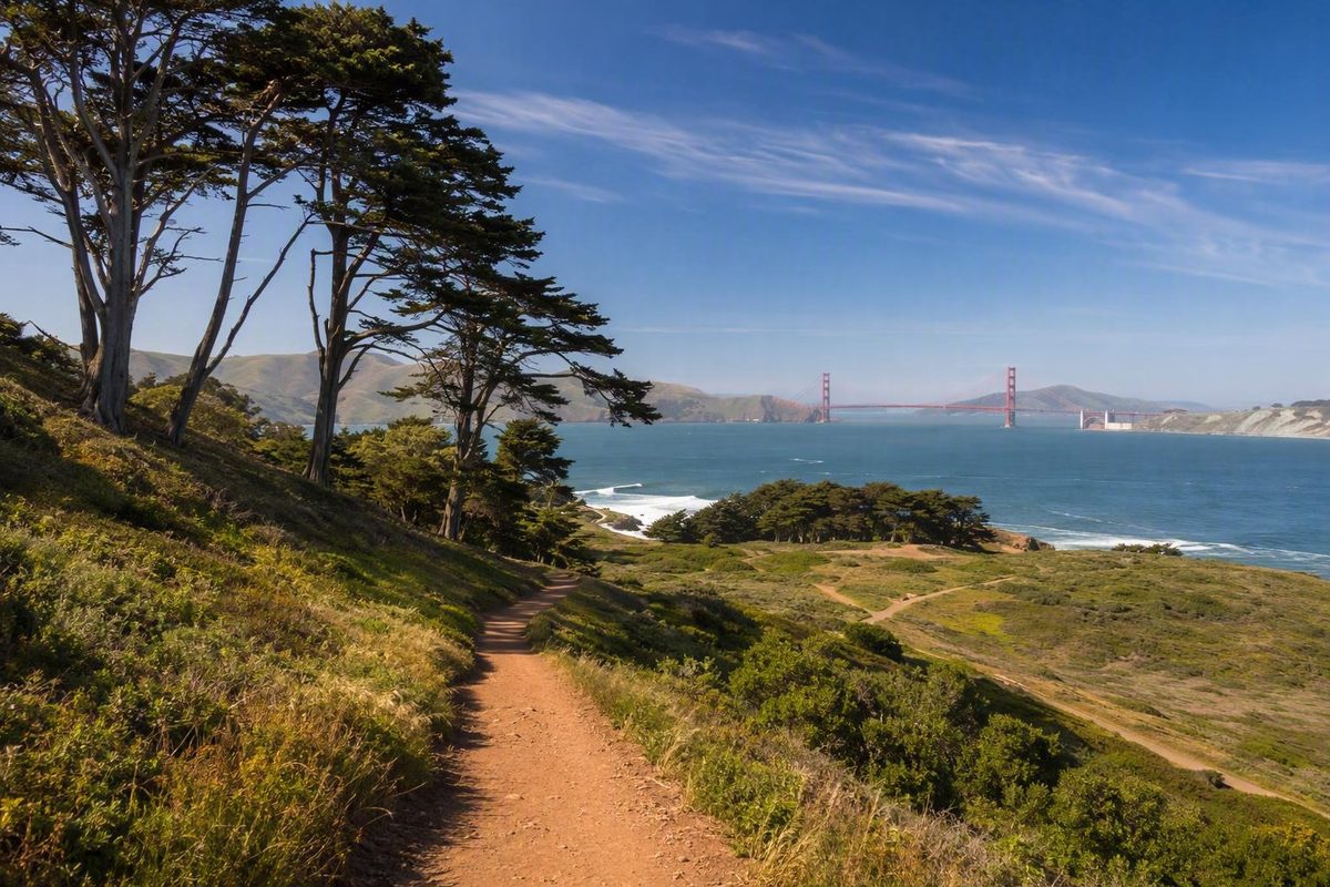
San Francisco’s Presidio trails are easier to compare when you stop looking for one universally “best” hike. The useful choice depends on five practical questions:
- How much time do you have?
- How do you feel about hills, stairs, sand, and exposed terrain?
- Do you want coast, forest, habitat, history, or public art?
- Are you planning a loop, an out-and-back, or a one-way walk?
- How will you return from the endpoint?
Mileage alone can mislead. A path under a mile can include steep grades or substantial climbing, while a route several miles long may carry an easy rating. The same trail name may also describe an official Presidio segment, a round trip, a custom loop, or a longer itinerary that adds beaches and connecting paths.
This guide therefore uses official Presidio segment mileage by default. Third-party loops and extensions are labeled clearly.
Related: Presidio National Park San Francisco: First-Visit Guide.
Start Here: Choose a Presidio Trail by Time and Experience
For a first visit, choose the experience before the trail:
- Very short outing with overlooks and nearby amenities: Tunnel Tops
- Short, easy-rated nature walk: Lobos Creek Valley
- Pacific coast, historic batteries, steps, and climbing: Batteries to Bluffs
- Forest, grasslands, restored habitat, and a bay view: Ecology Trail
- History and public art in a compact distance: Lovers Lane
- Forest, art, overlooks, and a one-way finish toward the bridge: Bay Area Ridge Trail
- Longer, easy-rated shoreline movement: Golden Gate Promenade
- Strenuous sampler: a clearly mapped custom route rather than one official trail
The Presidio identifies 12 major routes totaling more than two dozen trail miles. Official segments range from the 0.6-mile Lovers Lane Trail to the 4.3-mile Golden Gate Promenade/Bay Trail, but those figures are only a starting point: review the Presidio’s official trail overview and linked maps.
For 30 to 60 minutes: Consider the 0.3-mile Tunnel Tops itinerary beginning at the Visitor Center and passing Bay, Crossroads, and Veterans overlooks. The itinerary identifies picnic choices, food vendors, and restrooms nearby, but does not guarantee that every facility will be operating when you arrive. In a September 2025 post, the Presidio described this particular itinerary—not the entire Tunnel Tops area or trail network—as wheelchair-accessible and stroller-friendly. See the Presidio’s dated Tunnel Tops itinerary.
For history and public art: Choose Lovers Lane. It is only 0.6 mile, but short does not mean flat. The official page lists the pedestrian-only trail as moderate, with paved and boardwalk surfaces, a 9% average grade, and a 21% maximum grade. Highlights include Andy Goldsworthy’s Wood Line, an Army-planted forest, historic residences, and a brick footbridge built around 1885. Check the official Lovers Lane details.
For a short coastal hike: The official Batteries to Bluffs segment is 0.7 mile and moderate. Third-party descriptions also report steps and climbing, so this is not a level waterfront stroll merely because the distance is short.
For forest and habitat: It offers an interior alternative to the wind and exposure of the coast.
For forest, art, and a bridge-oriented finish: The official Presidio segment of the Bay Area Ridge Trail runs 2.5 miles from Arguello Gate toward the Golden Gate Bridge. Treat it as a one-way walk unless you deliberately want to retrace it.
For a longer easy-rated outing: Walk all or part of the 4.3-mile Golden Gate Promenade/Bay Trail. It is open to walking, running, and biking and is the clearest choice when sustained shoreline movement matters more than rugged bluff terrain.
Coastal scenery remains conditional. Fog may hide the bridge or headlands, while wind and sun can change how exposed a route feels. Choose a coastal trail for its setting and terrain, not because a particular view is guaranteed.
The 12 Major Presidio Trails Compared
The table below normalizes the Presidio’s 12 named routes. Lengths and difficulty labels refer to official Presidio segments, not every loop, out-and-back, or extended itinerary using the same name. The figures and official descriptions come from the Presidio trail overview.
| Official trail name | Official segment length | Official difficulty | Principal setting or highlight | Route-definition note |
|---|---|---|---|---|
| Batteries to Bluffs Trail | 0.7 mile | Moderate | Pacific Ocean, Marin Headlands, coastal bluffs, historic batteries | Short official segment; longer versions may add approaches, beaches, or adjoining coastal paths |
| Bay Area Ridge Trail | 2.5 miles | Moderate | Forest, art, overlooks, bridge-oriented finish | Presidio segment from Arguello Gate toward the Golden Gate Bridge |
| California Coastal Trail | 2.7 miles | Moderate | Coastal habitat, history, Golden Gate Bridge views | Official Presidio segment, not the longer Lands End-to-bridge itinerary |
| Ecology Trail | 1.4 miles | Moderate | Redwoods, native grasslands, restored habitat, bay view | Nearby detours can increase distance |
| Golden Gate Promenade/Bay Trail | 4.3 miles | Easy | Shoreline movement and bayfront scenery | Multi-use route open to walking, running, and biking |
| Juan Bautista de Anza National Historic Trail | 2.7 miles | Moderate | Historic expedition route and overlooks | Presidio segment of a much longer historic route |
| Lobos Creek Valley Trail | 0.8 mile | Easy | Native dune habitat | Short official segment |
| Lovers Lane Trail | 0.6 mile | Moderate | Historic footpath, forest, residences, Wood Line | Pedestrian-only; steep grades despite its short length |
| Mountain Lake Trail | 2.6 miles | Easy | Mountain Lake and interior park scenery | Associated with one of San Francisco’s last surviving natural lakes |
| Park Trail | 1.7 miles | Easy | Central Presidio, historic sites, connecting overlooks | North–south route through the middle of the park |
| Presidio Promenade Trail | 2.1 miles | Easy | Historic Presidio corridor toward the bridge | Ends near the bridge; “easy” is not a technical accessibility rating |
| Tennessee Hollow Trail | 1.2 miles | Easy | Restored watershed habitat | Short habitat-focused segment |
The Juan Bautista de Anza route follows a path associated with a Spanish expedition and the establishment of the Presidio. That association belongs within California’s colonial history; it should not be framed only as an adventurous founding journey.
Official difficulty labels are broad recreation categories. They do not fully describe steps, sand, grade, width, exposure, curb transitions, or temporary barriers. The overview also does not provide standardized completion times, elevation gains, accessibility ratings, or detailed trailhead information for every route. Those details should not be inferred from distance or from the words “easy” and “moderate.”
Before leaving, open the trail and bicycle maps available through the official overview. Confirm that the route on your map uses the same endpoints and direction as the mileage you intend to walk.
Why Trail Distances and Difficulty Ratings Conflict
A trail name is not always a complete route definition. Four measurements can all be reasonable while describing different walks:
- Official segment: The park-defined trail between designated endpoints
- Out-and-back: The same segment walked in both directions
- Loop: The named trail combined with connectors
- Extended itinerary: The trail plus beaches, overlooks, bridge approaches, streets, or neighboring parkland
Batteries to Bluffs is the clearest example. The Presidio lists a 0.7-mile moderate segment. AllTrails lists a 1.6-mile route as easy while also describing the coastal terrain as rugged and noting steps and climbing. Those figures and ratings are not necessarily contradictory; they come from different route definitions and classification systems. Compare the AllTrails Presidio listing.
California Crossings describes another Batteries to Bluffs outing as 2.3 miles with 435 feet of elevation. Its suggested options include a Marshall Beach detour and a continuation toward the bridge, with the bridge extension adding about another mile. That is an extended itinerary rather than the park’s official 0.7-mile segment. Compare the longer California Crossings itinerary.
The Bay Area Ridge Trail presents the same problem. The official Presidio segment is 2.5 miles, while supplied third-party listings describe a 1.8-mile bridge-area route and a 3.5-mile round trip. Their endpoints, direction, and purposes differ. An unexplained elevation figure attached to the 3.5-mile version should not be treated as the elevation gain of the official segment.
Before comparing two listings, ask:
- Where does each route begin and end?
- Is the mileage one way or round trip?
- Is the route a loop or a linear segment?
- Does it add a beach, overlook, bridge approach, or neighboring parkland?
- Does the measurement include the walk from parking or transit?
- Which surfaces, stairs, grades, and exposed sections are included?
- Was the difficulty assigned by the park, a platform, or an individual writer?
Throughout this guide, an unqualified mileage figure means the official segment. Combined routes are identified as third-party or custom itineraries.
Coastal Trails for Bridge, Ocean, Beach, and Bluff Views
The Presidio’s coastal choices fall into three practical groups: rugged bluffs, a longer coastal traverse, and easy-rated promenades. They should not be treated as interchangeable merely because each may provide coastal scenery.
Batteries to Bluffs is the compact rugged option. The official 0.7-mile segment combines Pacific and Marin Headlands views with coastal habitat and historic gun batteries. AllTrails describes its longer 1.6-mile version as rugged and reports steps and climbing. A third-party “easy” rating therefore should not be interpreted as flat, step-free, or uniformly gentle.
This route suits walkers who want a short, concentrated coastal experience and accept climbing. It is a poor match for someone who requires a step-free route. If an itinerary adds beach access, it may also add sand, distance, and more climbing.
Claims about bridge views need route-specific caution. Some third-party Batteries to Bluffs itineraries include bridge-oriented extensions, but the official overview emphasizes the Pacific Ocean and Marin Headlands. Visibility also depends on fog.
California Coastal Trail requires an especially clear boundary. The official Presidio segment is 2.7 miles and moderate, with coastal habitat, history, and possible Golden Gate Bridge views. A separate AllTrails itinerary runs 4.5 miles from Lands End to the Golden Gate Bridge, passing Baker Beach, Sea Cliff, Marshall Beach, and Batteries to Bluffs. Review the broader San Francisco route listing.
That longer itinerary extends beyond the Presidio and should not be presented as the official 2.7-mile segment. If you choose it, plan for a longer linear outing, varied surfaces, and a separate return.
Golden Gate Promenade/Bay Trail is the longer easy-rated multi-use option. At 4.3 miles, it suits people who prioritize sustained shoreline movement over rugged bluff terrain. Because walkers, runners, and cyclists share the route, remain aware of other users and move predictably.
Presidio Promenade Trail offers a middle-distance bridge-oriented comparison. Its official segment is 2.1 miles, rated easy, and ends near the Golden Gate Bridge. The easy rating does not establish a detailed surface, grade, or accessibility profile.
For a long coastal outing, consider walking in one direction instead of automatically retracing the full route. Decide beforehand whether you will turn around, use transit, meet a ride, or finish at a different destination. San Francisco Know’s Golden Gate waterfront walk explains this broader Marina–Crissy Field–bridge planning approach, but it is not a mapped guide to the Presidio trail system.
Bring a layer and sun protection. Coastal routes can be windy or foggy, while clear conditions can increase sun exposure. If conditions make an exposed route uncomfortable, shortening the outing or switching to an interior walk is a reasonable decision.
Forest, Habitat, History, and Public-Art Walks
The interior Presidio is more than a weather backup. Its forest paths, restored habitats, historic corridors, and artworks create distinct walks with their own terrain and route-planning questions.
Lovers Lane is the compact history-and-art choice. The official page estimates 30 minutes for the 0.6-mile trail, although individual pace will vary. It is pedestrian-only, with paved and boardwalk surfaces. Its 9% average grade and 21% maximum grade are the details to prioritize if steepness affects your choice. Review the official Lovers Lane specifications.
The route is described as San Francisco’s oldest footpath and was used in the 19th century as a shortcut by soldiers. It passes an Army-planted forest and historic residences, crosses a brick footbridge built around 1885, and runs beside Andy Goldsworthy’s Wood Line. An out-and-back includes both uphill and downhill travel, so reversing direction does not remove the grade.
Ecology Trail is a 1.4-mile moderate route through redwoods and native grasslands, with restored habitat and a bay view. It suits visitors who want a nature-focused walk without committing to the open coast. El Polín Spring and Inspiration Point are nearby points of interest, but including either changes the route and timing.
A KQED report published October 9, 2025, described the upper Ecology Trail as pedestrian-only and the lower section as permitting bicycles. The same report connected the route with redwoods, grasslands, El Polín Spring, and Inspiration Point. Because bicycle rules and closures can change, treat that distinction as dated information rather than a permanent rule. Read KQED’s dated Presidio trail report.
Park Trail is the central connector. The official route is 1.7 miles and easy-rated, running through the middle of the Presidio. KQED associates it with the National Cemetery area, Mountain Lake, the golf course, former military sites, and connecting overlooks. It makes sense when you want interior park connections rather than one concentrated coastal destination.
Bay Area Ridge Trail combines forest, public art, interpretation, and a bridge-oriented finish. From the Arguello Gate area, the route passes through forest near Goldsworthy’s Spire, continues near Rob Hill Campground and interpretive features, and heads toward the Golden Gate Bridge. The Bay Area Ridge Trail organization describes its Presidio route as passing through forest and along coastal bluffs before ending at the bridge. View the Ridge Trail organization’s route page and map.
Because the official segment is linear, decide before starting whether you will return by transit, retrace the trail, or stop earlier.
Two easy-rated interior alternatives broaden the choice:
- Lobos Creek Valley Trail: A 0.8-mile route through native dune habitat and a short nature option for someone avoiding a moderate-rated trail.
- Mountain Lake Trail: A 2.6-mile route associated with one of San Francisco’s last surviving natural lakes, suitable for a longer interior outing.
The historical landscape should be interpreted rather than treated only as scenic background. The Presidio’s expedition routes, military buildings, batteries, forests, and residences reflect colonial and military occupation as well as later ecological restoration and public use.
Three Modular Presidio Walking Plans
These three plans are frameworks, not guaranteed completion times. Pace, stops, grades, visibility, detours, and transit waits can all affect the outing. Each plan separates the walk itself from the return strategy.
Plan 1: Tunnel Tops in 30–60 minutes
- Route style: Compact point-to-point wander or out-and-back
- Base route: 0.3 mile
- Start: Presidio Visitor Center
- Sequence: Bay Overlook, Crossroads Overlook, Veterans Overlook
- Likely terrain: Developed park pathways
- Optional additions: Picnic time, a food-vendor stop, or a longer overlook pause
- Shortening point: Turn back after any overlook
- Return strategy: Walk back to the Visitor Center or finish near the Transit Center
This is the plan supported by the Presidio’s dated wheelchair-accessible and stroller-friendly description. Do not automatically extend that description to connecting trails or the wider trail network. Treat food vendors and restrooms as nearby possibilities rather than guaranteed open facilities.
Plan 2: Forest and art in approximately two hours
- Route style: Third-party loop combining Ecology Trail and Lovers Lane
- Reported route: 2 miles with 295 feet of elevation
- Start and finish: Main Post area
- Likely terrain: Interior paths, paved and boardwalk sections, grades, and connectors
- Core experience: Redwoods, grasslands, historic paths, forest, and public art
- Optional additions: El Polín Spring, Inspiration Point, or Wood Line
- Shortening point: Walk only one named trail or omit optional detours
- Return strategy: Follow the mapped loop back to the Main Post
California Crossings reports this loop at 2 miles with 295 feet of elevation, beginning and ending around the Main Post. That measurement is not the official length of either individual trail. Ecology Trail is officially 1.4 miles and Lovers Lane 0.6 mile, but joining them requires connectors and route choices. Review the California Crossings loop description.
Adding El Polín Spring or Inspiration Point changes the distance and timing. Wood Line is associated with Lovers Lane and may be included if your mapped route, available time, and energy allow.
Plan 3: Flexible half-day shoreline walk
- Route style: Linear, with a separate return
- Base route: Part or all of the 4.3-mile Golden Gate Promenade
- Possible components: Presidio shoreline, Crissy Field, and a bridge-oriented endpoint
- Likely terrain: Multi-use waterfront corridor exposed to wind and sun
- Shortening point: Predetermined turnaround time or practical transit exit
- Return strategy: Transit, shuttle, pickup, or a deliberately shorter out-and-back
Do not make the bridge a mandatory finish if weather, fatigue, or timing deteriorates. Establish an exit rule before starting: stop at a chosen time, at a practical transit point, or when conditions make continuing uncomfortable.
If you intend to walk the entire promenade, separate the 4.3-mile walking distance from the logistics of returning. Without a separate return plan, a linear walk can become a substantially longer out-and-back.
Optional strenuous sampler
Trees and Tents describes a custom figure-eight linking Mountain Lake Trail, Lobos Creek Valley Trail, Baker Beach, Batteries to Bluffs, Park Trail, Bay Area Ridge Trail, Ecology Trail, and Lovers Lane. The author reports 8.43 miles and 1,433 feet of elevation gain. Review the custom route, map, and cautions.
This is not one official Presidio trail. The guide reports pavement, dirt, boardwalks, stairs, a sand ladder, beach walking, and narrow bluff-side paths. It also identifies two unmarked sections and possible poison oak near a narrow path.
Use a verified map or GPS file, allow adequate daylight, and establish a shortening plan before attempting it. Do not rely on a prose summary as turn-by-turn navigation.
Getting There Without a Car—and Planning the Finish
The Presidio Transit Center is a useful car-free orientation point because it is near Tunnel Tops and the Visitor Center. From there, visitors can begin the short Tunnel Tops itinerary or make onward connections within the park.
Presidio GO serves the Transit Center, with pickup points reported at the Transbay Terminal, Embarcadero BART, and Van Ness and Union. Muni Route 43 also serves the Transit Center. Stops, schedules, fares, and service notices may change, so verify them with the operators on the day of travel. Check the Golden Gate National Parks Conservancy’s transit guidance.
KQED’s October 2025 report described Muni routes 1 and 28 as options for opposite ends of the Bay Area Ridge Trail. Route 28 has also been suggested for bridge-area trails. These are dated planning leads, not guaranteed current connections; verify the stop, service, and walk between transit and the trail with SFMTA.
The key car-free decision is not simply how to arrive. It is how to finish. Several Presidio routes are linear, and a stop that appears nearby on a map may still require additional walking or a road crossing.
Before starting, identify:
- Your intended endpoint
- A practical shuttle or Muni stop
- The latest time you are willing to continue
- A backup pickup location
- An earlier exit if fog, wind, fatigue, or navigation slows you
- Whether any part of the route must be retraced
The Presidio’s September 2025 Tunnel Tops post described accessible parking spaces near the Visitor Center and a passenger-loading zone on the east side of Graham Street, across from the Transit Center. Those are location descriptions, not assurances that a space or loading area will be available.
California Crossings has reported limited free parking at Baker Beach and paid parking near the Main Post. Because that third-party information is not presented as a current parking notice, do not rely on it for present-day prices, restrictions, or availability. Read posted signs and consult current official information before parking.
The evidence available for this guide does not provide a complete set of current Presidio GO or SFMTA operating pages. Accordingly, treat the transit information here as route-planning context rather than a same-day timetable.
Terrain, Accessibility, Dogs, Bikes, and Same-Day Checks
There is no single suitability label for the entire Presidio trail network. Use route-specific facts, and do not treat an easy rating as an accessibility certification.
| Route or itinerary | Supported suitability information | Important limitation |
|---|---|---|
| Tunnel Tops 0.3-mile itinerary | Described by the Presidio in September 2025 as wheelchair-accessible and stroller-friendly | Applies only to that itinerary; no technical grade or legal accessibility specification was supplied |
| Lovers Lane | Pedestrian-only; paved and boardwalk surfaces | Moderate, with a 9% average grade and 21% maximum grade |
| Golden Gate Promenade | Open to walking, running, and biking | “Easy” is not a complete mobility-access assessment |
| Ecology Trail | KQED reported in 2025 that the upper section was pedestrian-only and the lower section permitted bicycles | Dated third-party account; verify current rules |
| Batteries to Bluffs | Third-party descriptions report steps and climbing | Short mileage and an easy platform rating do not mean step-free |
| Custom figure-eight sampler | Reported mix of pavement, dirt, boardwalk, stairs, sand, beach, and narrow bluff paths | Guide reports two unmarked sections and possible poison oak |
| Most other official routes | Official distance and easy or moderate label may be available | Complete grade, width, surface, and accessibility details were not supplied |
Wheelchair and stroller guidance should remain narrow. The Presidio’s statement supports the specific 0.3-mile Tunnel Tops itinerary; it does not establish that every connecting path or the broader trail system meets the same needs.
For other routes, seek current confirmation of the details relevant to your group: grades, stairs, sand, path width, curb transitions, boardwalk conditions, construction barriers, and distance between rest opportunities. “Easy” is a general recreation category, not a technical statement that a trail is step-free or suitable for every mobility device.
Dog rules vary by trail, beach, and season. Trees and Tents reports that dogs are prohibited on Batteries to Bluffs and warns that seasonal coyote management may affect other parts of its long custom route. Because the guide is undated and rules can change, treat those statements as cautions requiring official confirmation, not current park-wide policy. Read the route-specific dog and coyote cautions.
Bicycle rules are also route-specific. Lovers Lane is pedestrian-only, while Golden Gate Promenade is multi-use. The upper-versus-lower Ecology Trail distinction comes from a dated 2025 report and should be verified before riding. Do not infer bicycle permission from path width or from seeing another cyclist.
The supplied evidence does not include current first-party pages covering every closure, coyote restriction, dog rule, bicycle rule, accessibility condition, or transit disruption. Before departure, use current Presidio, National Park Service, Presidio GO, and SFMTA information to check:
- Closures and construction
- Seasonal coyote restrictions
- Trail and beach dog rules
- Bicycle permissions
- Trail conditions
- Route-specific accessibility information
- Shuttle and Muni changes
- Coastal weather and visibility
Prepare for cool and bright conditions. Carry a layer, sun protection, water, and a light bag. Wear comfortable shoes matched to the actual surfaces. Bluff routes may include steps and climbing; beach additions may include sand; the cited custom route reports narrow paths and possible poison oak.
Use an exit rule rather than forcing completion. Leave or reverse the route when you reach your time limit, fatigue affects your footing, conditions become uncomfortable, or a practical transit stop offers a clean finish.
Frequently Asked Questions
What is the best Presidio trail for a first-time visitor?
There is no objectively best trail. For a brief introduction, consider the 0.3-mile Tunnel Tops itinerary. Choose Ecology Trail for forest and habitat, Batteries to Bluffs for a short coastal route with climbing, Lovers Lane for history and art, or Golden Gate Promenade for a longer easy-rated shoreline outing.
The right first trail is the one whose terrain, route format, and return plan fit your group.
What is the shortest Presidio walk?
The shortest itinerary discussed here is the 0.3-mile Tunnel Tops route beginning at the Visitor Center. Among the 12 major named trails, Lovers Lane is shortest at 0.6 mile, followed by Batteries to Bluffs at 0.7 mile and Lobos Creek Valley at 0.8 mile.
Lovers Lane and Batteries to Bluffs can feel more demanding than their mileage suggests because Lovers Lane has steep grades and Batteries to Bluffs includes climbing.
Why is Batteries to Bluffs listed as both 0.7 mile and 1.6 miles?
The 0.7-mile figure is the Presidio’s official moderate segment. The 1.6-mile figure comes from an AllTrails route using the same trail name but a different route definition and rating system. California Crossings describes a 2.3-mile version that may include approaches, detours, or adjoining paths.
Compare endpoints, direction, round-trip status, surfaces, and included extensions before comparing mileage.
Can I reach Presidio trails without a car?
Yes. Presidio GO and Muni Route 43 serve the Presidio Transit Center near Tunnel Tops and the Visitor Center. A dated KQED report also identifies Muni routes 1 and 28 as options for opposite ends of the Bay Area Ridge Trail.
Confirm current schedules, stops, fares, and service notices before leaving. For any linear trail, identify the return stop before beginning the walk.
Which Presidio trails are wheelchair- or stroller-friendly?
The Presidio specifically described its 0.3-mile Tunnel Tops itinerary as wheelchair-accessible and stroller-friendly in September 2025. That statement should not be generalized to the entire Tunnel Tops area or other Presidio trails.
For other routes, complete accessibility information is not available in the supplied overview. Verify grades, stairs, sand, path width, curb transitions, surfaces, and temporary barriers according to your needs. Lovers Lane, for example, has paved and boardwalk surfaces but a listed maximum grade of 21%, while third-party descriptions of Batteries to Bluffs report steps and climbing.
Choose the setting first. Then confirm whether the mileage describes an official segment or a longer itinerary, check the terrain, decide whether the walk is one-way or round trip, establish the return, and review current official notices. A short route that fits your time and mobility is more useful than trying to combine every beach, overlook, forest, and bridge approach into one outing.