
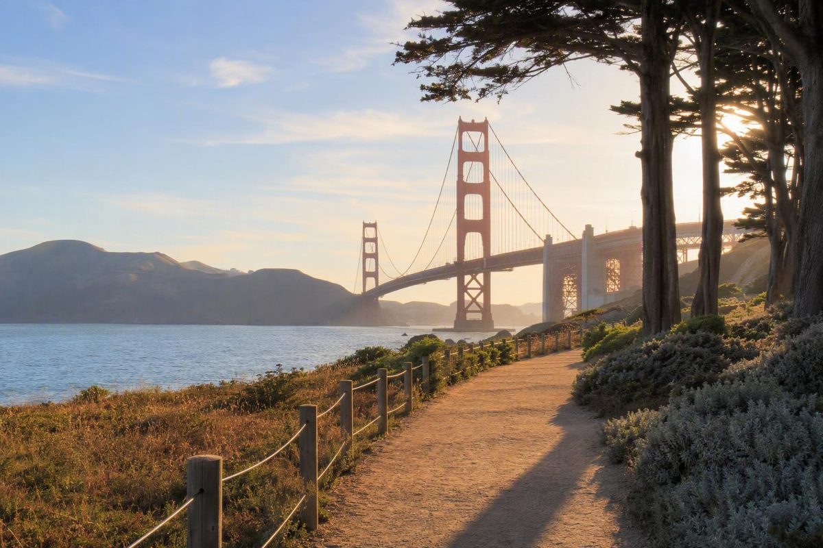
How to plan the Crissy Field waterfront walk without following the wrong trail
The complication is that maps and guides use different endpoints. Some describe only the central Crissy Field waterfront; others extend east toward the Marina or west toward Fort Point. As a result, published distances vary considerably.
The most reliable approach is to define your start, finish or turnaround, and return method before estimating mileage. Then allow the route to shrink or expand according to weather, visibility, energy, and time.
First, identify the right Golden Gate promenade
East Beach and West Bluff are practical access points, with Crissy Marsh, open lawns, beaches, and the shoreline between them.
The Presidio also uses Golden Gate Promenade/Bay Trail for a broader shoreline connection between the Marina Gate area and Fort Point. This wider definition helps explain why some guides include more of the Marina or the western bridge area than others.
A separate route called the Presidio Promenade Trail runs inland. It connects Lombard Gate with the Golden Gate Bridge area and passes Main Post attractions rather than following the Crissy Field shoreline. The trail is listed at 2.1 miles, with an average grade of 2.9% and a maximum grade of 10.8%. Although it is described as an easy, predominantly paved multi-use trail, its grades and visitor experience differ from those of the nearly level waterfront route. Check the official Presidio Promenade Trail description if there is any doubt about which trail appears on your map.
A simple mental map helps:
WATERFRONT ROUTE — generally westbound

Marina area
    |
East Beach
    |
Crissy Marsh
    |
Crissy Field shoreline and lawns
    |
West Bluff
    |
Warming Hut area
    |
Torpedo Wharf / Fort Point — optional extensions


SEPARATE INLAND ROUTE

Lombard Gate — Main Post — Tunnel Tops area — bridge area
             Presidio Promenade Trail
This is a linear waterfront landscape, not an attraction with one unquestionable front door. A directory address may identify one point beside the trail without defining its official entrance or boundaries.
For an unambiguous waterfront start, use Crissy Field/East Beach, which the National Park Service identifies as the trailhead for its Crissy Field Promenade description.
The distinctions imply different outings:
- Crissy Field Promenade or Waterfront Walk: the generally level shoreline experience.
- Golden Gate Promenade/Bay Trail: a broader waterfront connection whose published mileage is not clearly identified as one way, round trip, or another format.
- Presidio Promenade Trail: a separate inland trail with more grade and Main Post landmarks.
- Third-party loops: custom routes that may add the Palace of Fine Arts, city sidewalks, steps, inland paths, or a different return line.
If your priority is a low-hill Golden Gate Bridge walk, build the day around East Beach, Crissy Marsh, West Bluff, and the Warming Hut area. Treat Fort Point and the bridge plaza as optional additions.
Why published distances range from 2 to 4.3 miles
A trail distance is useful only when it comes with four details:
- The starting point
- The endpoint or turnaround
- Whether the distance is one way, round trip, or a loop
- The path used for the return
Without those details, “How long is the Golden Gate Promenade?” has no single dependable answer.
The National Park Service presents a 2.3-mile Crissy Field Promenade and also describes an approximately two-mile loop that combines the waterfront with the Mason Street trail. These are separate route descriptions. The 2.3-mile figure should not be treated as one side of the shorter loop.
The NPS page supplying the detailed route and accessibility specifications was last updated on September 11, 2020. Its measurements remain useful for understanding the defined route, but current closures, facilities, surfaces, and seasonal equipment should be confirmed before visiting.
| Route | Endpoints or format | Published distance | Published time | Terrain | Best use |
|---|---|---|---|---|---|
| NPS Crissy Field Promenade | Waterfront route with Crissy Field/East Beach identified as the trailhead; the overview does not define a more precise endpoint | 2.3 miles | About 1 hour | About 10 feet of elevation gain; generally level, mixed surfaces | Planning the core waterfront experience; see the NPS route specifications |
| NPS waterfront and Mason Street loop | Waterfront in one direction and Mason Street for the return | Approximately 2 miles | No separate definitive time stated | Generally level waterfront plus a paved return with dedicated pedestrian and bicycle lanes | Visitors who prefer a predefined loop |
| Presidio Golden Gate Promenade/Bay Trail | Broader shoreline connection between the Marina Gate area and Fort Point | 4.3 miles | About 90 minutes | Described as flat and easy, with dirt and paved paths | Understanding the wider waterfront connection; the Presidio listing does not clarify whether the mileage is one way, round trip, or a broader Bay Trail measurement |
| Presidio Promenade Trail | Inland route from Lombard Gate to the Golden Gate Bridge area | 2.1 miles | About 45 minutes | Paved except for a short wooden bridge; maximum listed grade 10.8% | Main Post and inland Presidio attractions, not a substitute for the waterfront |
| Third-party Palace of Fine Arts and Crissy Field loop | Expanded loop that includes the Palace of Fine Arts and more than the core promenade | 3.6 miles | 1 to 1.5 hours | Listed as mostly paved or gravel, with 22 feet of elevation gain | A longer eastern sightseeing circuit; figures are from the third-party AllTrails itinerary |
The published times mainly describe walking. Photography, birdwatching, beach time, picnics, children’s play, food stops, or nearby attractions can make the actual visit much longer.
Instead of chasing a universal mileage, choose an exit rule:
- Turn around after a fixed amount of time.
- Reassess at Crissy Marsh.
- Finish at West Bluff even if another attraction is visible ahead.
- Continue to the Warming Hut only if everyone remains comfortable.
- Consider Fort Point only after checking the current pedestrian connection.
An exit rule makes the plan resilient. The outing remains successful even if fog, wind, fatigue, or a delayed start changes what is practical.
A westbound walk through Crissy Field
East Beach is the clearest place to begin a westbound waterfront walk. It is the NPS trailhead and offers an immediate introduction to the landscape: beach, open bay, Crissy Field, broad sky, and—when visibility permits—the Golden Gate Bridge to the west.
East Beach: orient yourself before committing
Use the first few minutes at East Beach to assess the weather and group energy. Accessible parking and restrooms are listed here, along with an accessible picnic site and beach facilities.
East Beach can also be the entire destination. Visitors with young children, uncertain stamina, mobility considerations, or limited time can sample the waterfront and nearby marsh without committing to West Bluff.
If the wind already feels uncomfortable or fog has hidden the bridge, a short walk around East Beach and the established marsh paths can still provide a complete outing.
Crissy Marsh: slow down rather than rushing through
Moving west, Crissy Marsh introduces the ecological side of the waterfront. It is reclaimed tidal wetland habitat used by birds migrating along the Pacific Flyway.
Observe the marsh from established trails, bridges, and boardwalks. Avoid approaching the lagoon edge or disturbing vegetation and wildlife.
The marsh is also a practical early turnaround. Walking from East Beach to the marsh, pausing to watch birds or study the habitat, and then returning still captures the defining character of Crissy Field.
Across Crissy Field: open views and mixed surfaces
The waterfront continues through the broad Crissy Field landscape. Depending on the exact line followed, surfaces can include compacted natural material or decomposed granite, asphalt, boardwalk, and wood bridge decking. The route is generally level, but it is not one uninterrupted strip of pavement.
Possible views include the Golden Gate Bridge, San Francisco Bay, Alcatraz, marsh habitat, beaches, and surrounding shorelines. Fog, glare, wind, and low cloud can alter or remove some of those views.
This section is used by walkers, runners, cyclists, photographers, and families. Make predictable movements, remain aware of faster users, and step away from the main travel line before stopping for photographs.
West Bluff and the Warming Hut area
West Bluff is another useful access or turnaround area. Accessible parking and restrooms are listed there, making it suitable for visitors who prefer a shorter western outing or do not want to begin at East Beach.
The Warming Hut area is a logical pause near the western side of Crissy Field. Water, restrooms, and food have been listed in official visitor information, but current availability and operating hours should be checked before the visit.
If the weather or energy level is deteriorating, this is a reasonable finish. The fact that the bridge is visible ahead does not obligate you to continue beneath it.
Torpedo Wharf, Fort Point, and the bridge area
Torpedo Wharf can provide a closer western viewpoint, but it is not a guaranteed component of every definition of the promenade.
Fort Point should likewise be treated as an optional extension beneath the Golden Gate Bridge, not as the automatic endpoint of the core walk. Confirm the current pedestrian connection, closures, and destination access before proceeding. Do not improvise a route along an unverified roadside shoulder.
The Golden Gate Bridge plaza can become another distinct addition. Visitor information, historical interpretation, exhibits, overlooks, and nearby trails may be available; use the official Golden Gate Bridge visitor page to check current operating information.
Presidio Tunnel Tops and the Outpost playground are nearby across from the waterfront. They work particularly well for families, but adding them changes a simple shoreline walk into a broader Presidio visit.
A westbound plan can therefore have several valid finishes:
- Crissy Marsh: short waterfront sample
- Central Crissy Field: flexible scenic stroll
- West Bluff: practical standard turnaround
- Warming Hut area: longer core waterfront walk
- Torpedo Wharf: optional viewpoint
- Fort Point or bridge plaza: separate extension after verification
Choose a short stroll, standard walk, or longer outing
There is no reason to force every visitor into the same route. Match the outing to available time, mobility needs, weather, and the rest of the day.
For each option, decide on the start, turnaround or endpoint, and return method before estimating distance.
Short accessible-minded sample
Start: East Beach Turnaround: Crissy Marsh or an earlier comfortable point Endpoint: East Beach Return: Retrace the same waterfront segment
This option samples the bayfront and marsh while remaining near the facilities at East Beach. It is useful for visitors who want to evaluate the surfaces and conditions before making a longer commitment.
Confirm current parking, restroom, surface, and accessibility-equipment status before leaving the East Beach area. If a surface or crossing does not suit your needs, turn around; flexibility is the point of this itinerary.
Because the exact marsh turnaround can vary, do not assign this version a standard mileage without mapping the chosen endpoint.
Standard waterfront walk
Start: East Beach Turnaround: West Bluff or the Warming Hut area Endpoint: East Beach Return: Retrace the waterfront
This is the most straightforward Crissy Field experience. Walk west from East Beach, pass the marsh, cross the open waterfront landscape, and turn around at the preselected western landmark.
Allow extra time for photographs, birdwatching, a beach stop, or a picnic. Before starting, decide whether West Bluff or the Warming Hut is the intended limit. A named turnaround reduces the chance of making the return substantially longer than expected.
If you do not want to retrace the route, arrange and verify a separate transportation plan before departure rather than improvising one at the western end.
Waterfront and Mason Street loop
Start: East Beach or another clearly chosen Crissy Field access point Turnaround: The confirmed junction where the planned route leaves the waterfront Endpoint: Original starting area Return: Mason Street trail
The National Park Service describes an approximately two-mile loop using the waterfront promenade in one direction and Mason Street in the other. Mason Street has dedicated pedestrian and bicycle lanes.
This is a predefined itinerary, not an on-the-fly return from any arbitrary point near West Bluff or the Warming Hut. Confirm the current connection before setting out.
The two sides offer different experiences: the waterfront emphasizes the beach, marsh, and bay, while Mason Street is an inland transportation corridor. Choose an out-and-back instead if continuous waterfront scenery matters more than route variety.
Longer Marina or Palace of Fine Arts outing
Start: Marina area or Palace of Fine Arts Turnaround or endpoint: A preselected Crissy Field landmark, West Bluff, or the Warming Hut area Return: Retrace the route or use a separately confirmed transportation plan
Starting farther east creates a longer urban waterfront itinerary. It can connect the Marina or Palace of Fine Arts with East Beach before joining the Crissy Field promenade.
This route exceeds the core promenade. It works best when the walk is the main event rather than one item in a day already containing Tunnel Tops, Fort Point, bridge exhibits, and a bridge crossing.
Optional Fort Point extension
Start: One of the defined routes above Extension point: Western Crissy Field or the Warming Hut area Endpoint: Fort Point Return: Planned separately after checking current access
Attempt this extension only after confirming the pedestrian connection, closures, destination access, and return route. It adds time and can increase exposure to waterfront wind.
San Francisco Know’s suggested one-direction planning approach is to separate the outbound walk from the return problem and choose an exit rule before starting. This is an editorial planning method rather than an official route definition, but it can prevent an enjoyable outbound stroll from becoming an exhausting mandatory round trip.
Do not depend on a particular transit line, pickup point, or rideshare location without same-day verification.
Surfaces, slopes, accessibility, and shared-trail use
For the core NPS route, the listed specifications are approximately 10 feet of elevation gain, an average slope of 0%, and a maximum slope of 1.4%. Surfaces include compacted natural material or decomposed granite, asphalt, boardwalk, and wood bridge decking. Accessible parking and restrooms are listed at East Beach and West Bluff. East Beach also has an accessible picnic site, a seasonal beach mat, and two beach wheelchairs, subject to current availability. Review the NPS accessibility and trail specifications before depending on any facility or equipment.
These specifications apply to the defined core Crissy Field route, not every extension, inland return, or third-party loop.
“Generally level” does not mean:
- Uniformly paved
- Free of loose material
- Barrier-free during construction or temporary closures
- Suitable for every wheelchair configuration
- Equally comfortable for every stroller
- Unaffected by sand, rain, or maintenance conditions
- Applicable to Fort Point, the bridge approach, Tunnel Tops, or the inland Presidio Promenade
Wheelchair and stroller users should assess the route segment by segment. East Beach is a practical place for a short trial because facilities are nearby and an early return is simple. West Bluff can provide another access option, but a particular parking space should never be assumed available.
Before departure, verify:
- Current surfaces and construction conditions
- Temporary closures and detours
- Accessible parking status
- Restroom availability
- Seasonal beach-mat installation
- Beach-wheelchair availability and access procedures
- Grades, curb transitions, and surfaces on any optional extension
The waterfront is a shared multi-use environment. Walkers, runners, cyclists, families, and photographers may move at very different speeds.
Useful shared-trail habits include:
- Keep to a predictable side where appropriate.
- Look behind you before changing direction.
- Step off the travel line for photographs or conversations.
- Keep children close at crossings and busy junctions.
- Slow down around pedestrians, boardwalks, and congested areas.
- Expect sightseeing traffic rather than an uninterrupted exercise lane.
The Mason Street alternative has dedicated pedestrian and bicycle lanes, but it remains a different return environment. The inland Presidio Promenade must also be judged separately because its maximum listed grade is substantially higher than that of the core waterfront route.
Restrooms, water, food, parking, and arrival planning
Facilities are distributed along the waterfront rather than concentrated at one formal entrance. Verify anything essential to your visit, especially restrooms, drinking water, food, or accessibility equipment.
| Area | Parking | Restrooms | Water | Food and other useful features |
|---|---|---|---|---|
| East Beach | Accessible parking is listed; confirm availability, payment rules, and time limits | Accessible restrooms are listed | Drinking water is listed | Accessible picnic site, picnic facilities, seasonal beach mat, and beach wheelchairs are listed |
| West Bluff | Accessible parking is listed; confirm current rules and space availability | Accessible restrooms are listed | Do not assume water without checking | Picnic facilities are available in the waterfront area |
| Warming Hut area | Parking conditions depend on the nearby location | Restrooms are listed | Drinking water is listed | Food has been listed at the Warming Hut; operations and hours are time-sensitive |
| Golden Gate Bridge Plaza | Check current official parking and access guidance | Verify current bridge-area facilities | Drinking water is listed by the NPS | Visitor information and exhibits may be available |
| Tunnel Tops and Outpost | Follow current Presidio guidance and posted parking rules | Restrooms are listed at the Outpost playground | Check current availability | Presidio Pop Up food service may operate; vendors and schedules can change |
The Presidio lists restrooms at East Beach, the Outpost playground, and the Warming Hut area. It also lists food at Presidio Pop Up and the Warming Hut, plus broader promenade amenities such as bike parking and wheelchair-accessible picnic tables. These broader amenities should not be assigned to a particular location unless current location-specific information confirms it.
Official and third-party parking descriptions can conflict, including whether a particular area is free or paid. Use current official guidance and posted signs—not an old article, review, or map label—for prices, restrictions, and availability.
Similarly, do not build the walk around an unverified transit route, fare, stop, rideshare point, or pickup area. Choose how you would like to arrive and return, and then check the relevant operator on the day of travel.
Same-day checklist
Before leaving, confirm:
- Park alerts and closures
- Construction or event restrictions
- Parking rules, payment requirements, and time limits
- Current transit service
- Restroom status
- Drinking-water availability
- Food-service hours
- Seasonal beach-mat availability
- Beach-wheelchair availability
- The pedestrian connection for a Fort Point extension
- The intended connection if using the Mason Street loop
Save the essential route information in advance. A screenshot showing the start, turnaround, return line, and backup finish can be more useful than a general attraction pin.
Carry enough water and a small snack to remain comfortable if a fountain or food service is unavailable. This is a backup measure, not an assumption that facilities will be closed.
Plan for wind, fog, sun, and changing visibility
Crissy Field is an exposed waterfront environment. Conditions can shift between sun, wind, fog, and cold, and the shoreline may feel less comfortable than inland parts of the city.
Clear views of the Golden Gate Bridge cannot be guaranteed. Fog or low cloud can hide part or all of the span, while wind can make a modest walk feel more demanding. Traveler reports frequently mention cool, foggy, or windy visits, but such reviews are anecdotal and do not establish a dependable daily pattern; one example is this Tripadvisor visitor report.
Bring:
- A wind-resistant layer
- Comfortable walking shoes
- Water
- Sun protection
- A light bag
- Essential medication or mobility supplies
- A saved route and return plan
A layer can be useful even when the start feels warm. Sun protection remains sensible in cool conditions, and supportive shoes are preferable on mixed surfaces.
Use a flexible turnaround rule. Stop or shorten the route when:
- A fixed amount of time has elapsed
- You reach Crissy Marsh, West Bluff, or the Warming Hut
- Wind or cold begins to reduce comfort
- A child or another group member starts to tire
- Visibility makes a western extension less appealing
- You need to preserve energy for the rest of the day
Shortening the walk does not remove its value. East Beach, Crissy Marsh, and the central shoreline contain the main elements of the Crissy Field experience.
If fog hides the bridge, shift the focus to marsh habitat, birds, beaches, the former military landscape, or a picnic if conditions permit. Tunnel Tops, the Warming Hut area, Fort Point, and bridge exhibits may provide alternatives, but their access and operating status should be checked first.
Avoid claims that one particular time of day guarantees clear views or lighter crowds. Weather, season, events, and local conditions make that kind of promise unreliable.
Add ecology, history, and nearby landmarks without overloading the day
Crissy Field is more than a foreground for bridge photographs. It was formerly a military airfield and was restored in 2001, giving the waterfront both historical and ecological context. The Crissy Field Waterfront Walk overview describes the restored landscape as a place for walking, cycling, picnicking, field activities, and bay views.
Crissy Marsh is reclaimed tidal wetland habitat that attracts birds migrating along the Pacific Flyway. Observe from established trails and boardwalks rather than approaching wildlife or entering fragile lagoon habitat.
Responsible use is straightforward:
- Stay on established trails and boardwalks.
- Avoid disturbing marsh vegetation and wildlife.
- Do not feed animals.
- Carry out waste.
- Secure food and loose packaging in the wind.
- Follow posted rules for each beach, trail, and habitat area.
Beaches and picnic areas are the easiest additions because they do not require a complicated detour.
For families, compatible stops include:
- East Beach
- Crissy Marsh
- Waterfront picnic areas
- The Outpost playground
- Presidio Tunnel Tops
The Outpost and Tunnel Tops are outside the core shoreline line, so include them intentionally and account for the return.
History-focused visitors can add Fort Point or the bridge exhibits, subject to current pedestrian access and operating information. Both deserve separate time rather than being treated as incidental stops.
For a longer eastern itinerary, the Palace of Fine Arts can be paired with the Marina and Crissy Field. It is not part of the core promenade and can create a substantially longer loop or one-direction walk.
Torpedo Wharf can work as a photography extension, but it should not define every visitor’s finish. Likewise, the bridge plaza can be a destination without requiring a bridge crossing.
Choose no more than one or two additions:
- Family outing: East Beach, marsh, and Outpost
- History outing: Crissy Field and Fort Point
- Photography outing: East Beach, West Bluff, and Torpedo Wharf
- Long urban walk: Palace of Fine Arts and Crissy Field
- Simple picnic day: East Beach, marsh, and a waterfront lunch
Combining the Palace of Fine Arts, the full Crissy Field waterfront, Tunnel Tops, Fort Point, bridge exhibits, and a bridge crossing can turn a calm walk into a day of backtracking and schedule pressure.
The best decision sequence is simple: confirm that you want the Crissy Field waterfront promenade, choose exact endpoints and a return method, check current alerts and facilities, bring a layer, and let the outing shorten or expand with conditions. Build the walk around East Beach, Crissy Marsh, West Bluff, and an optional western extension—not around one disputed mileage figure.
Is the Golden Gate Promenade the same as the Presidio Promenade?
No. The Golden Gate Promenade generally refers to the Crissy Field shoreline or the broader Bay Trail waterfront connection. The Presidio Promenade Trail is a separate inland route between Lombard Gate and the Golden Gate Bridge area.
The waterfront route is generally level and follows the bay. The inland route passes Main Post attractions and includes considerably steeper grades. The cited route comparison above provides the official published figures for each.
Is the Golden Gate Promenade 2.3 miles or 4.3 miles?
Both figures appear in official descriptions, but they do not clearly represent the same boundaries or trip format.
The shorter figure belongs to the NPS Crissy Field Promenade description. The larger figure belongs to the Presidio’s broader Golden Gate Promenade/Bay Trail listing, which does not specify whether its mileage is one way, round trip, or a larger Bay Trail measurement. Use the cited comparison table rather than treating either number as universal.
Can I make the Crissy Field Promenade into a loop?
Yes. The National Park Service describes a predefined loop using the waterfront promenade in one direction and the Mason Street trail for the return.
Confirm the current junction before starting. The Mason Street side is inland, so the loop does not provide continuous waterfront scenery.
Is the Golden Gate Promenade wheelchair and stroller accessible?
The core Crissy Field route is generally level and has strong official accessibility specifications, but it uses mixed surfaces rather than continuous pavement.
Suitability depends on the user, equipment, current surface condition, temporary barriers, and any optional extension. Review the detailed accessibility section above and confirm parking, restrooms, surfaces, the seasonal beach mat, and beach-wheelchair availability before visiting.
Can I continue from the promenade to Fort Point and the Golden Gate Bridge?
Potentially, but Fort Point and the bridge area should be treated as optional extensions rather than automatic parts of the promenade.
Before continuing west, verify the current pedestrian connection, closures, destination access, and return plan. Do not follow an unverified roadside route. Reaching Fort Point or the bridge can make the outing substantially longer than the core Crissy Field walk.