
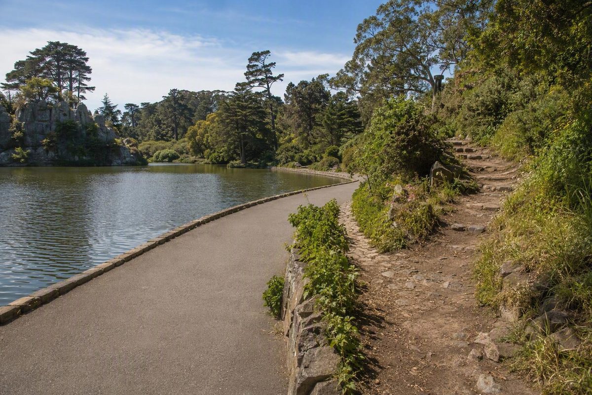
Strawberry Hill occupies an island in Blue Heron Lake near the center of Golden Gate Park. For a first visit, treat it as two separate choices: a relatively level paved walk around the lake and an optional climb on rougher island paths. San Francisco Recreation and Parks identifies Strawberry Hill as the park’s highest point, lists Blue Heron Lake Drive as the access location, and notes the island’s diverse shrubbery. (San Francisco Recreation and Parks)
Strawberry Hill at a glance
Blue Heron Lake is the current name for the body of water formerly called Stow Lake. Older maps, addresses, listings, and walking guides may still use the former name, so searches for either can refer to the same destination.
Two bridges connect Strawberry Hill to the surrounding lakeshore. On the island, wooded trails and dirt steps circle the hill and climb toward an open summit. You can therefore keep the visit short and lakeside, cross over for selected landmarks, or add the full climb.
A third-party reference lists Strawberry Hill at approximately 404 feet. It also identifies the Golden Gate Pavilion, Huntington Falls, and the summit ruins of an observatory built in 1891 and destroyed in the 1906 earthquake. The elevation is a third-party figure, not an official park specification. (Strawberry Hill overview and history)
This is a compact urban park walk rather than a wilderness hike, but the hill still introduces uneven surfaces, steps, junctions, and a noticeable climb. Decide whether you want a lakeside walk or a hill walk before committing to the island’s interior paths.
Choose your walk: lakeside, summit, or full loop
The best route depends less on distance than on your tolerance for climbing, stairs, and uneven ground.
| Option | Distance and time | Terrain | Best for |
|---|---|---|---|
| Paved lakeside walk | Commonly described as about 1 mile (Komoot) | Relatively level and paved; continuous accessibility not verified | A short outing with the lowest terrain commitment |
| Lake-and-summit loop | One mapped variation is 2.3 miles, with about 160 feet of gain and a 30–60 minute estimate (AllTrails) | Pavement plus dirt, rock, grades, and possible steps | Visitors comfortable with a short mixed-surface climb |
| Slower sightseeing visit | Allow 1–2 hours (Tripadvisor) | Choose lakeside and island sections as comfortable | Landmarks, birdwatching, photographs, and breaks |
Paved lakeside walk
Choose the lakeside circuit if you primarily want water views and an easy-to-follow outing without automatically committing to the hill. Its commonly described paved, relatively level surface makes it the clearest lower-terrain-commitment option.
That description does not establish a fully accessible itinerary. Conditions between your arrival point and the path, pavement quality, curb transitions, temporary barriers, and bridge access can all affect the outing.
Lake-and-summit loop
Choose the combined loop if you are comfortable moving from pavement onto natural or rocky surfaces and dealing with grades or steps. The published distance, elevation gain, and walking time represent one mapped route variation rather than an official or uniquely defined trail.
A brisk walker may finish near the low end of the estimate. First-time visitors should expect to take longer if they pause at landmarks, check the map at junctions, or descend cautiously.
Slower sightseeing visit
A slower visit gives you time to circle part or all of the lake, cross onto the island, visit the pavilion and waterfall, and decide on the spot whether to continue to the summit. It is the better choice when the landmarks matter more than completing a defined loop.
A broader 4.1-mile Golden Gate Park loop also passes Blue Heron Lake and Strawberry Hill, but it includes destinations such as the Conservatory of Flowers and other park landmarks. It is not necessary for a visit focused on Strawberry Hill.
A practical landmark sequence for the visit
Use these four features as a checklist rather than as turn-by-turn directions. The supplied route descriptions do not establish which bridge or junction offers the easiest ascent.
1. The lakeshore and bridges
Begin beside the lake and use the first part of the walk to assess the weather, surfaces, and your energy. A partial or complete lakeside circuit can still make a satisfying visit if you decide against the climb.
Two bridges connect the shore to Strawberry Hill. After crossing, expect wooded paths, junctions, dirt trails, and steps rather than one continuous summit walkway.
2. Golden Gate Pavilion
The Golden Gate Pavilion is a Chinese peace pagoda near the water. Taipei, San Francisco’s sister city, gave it to the city in 1976. It can serve as an island destination even if you skip the summit. (Strawberry Hill overview and history)
Reaching it may require leaving the main lakeside circuit. Check posted park information or a live map before choosing an island path, particularly if you want to limit climbing.
3. Huntington Falls
Huntington Falls is an artificial waterfall descending toward Blue Heron Lake. Treat it as a landmark rather than assuming it will be operating or flowing strongly during your visit.
The nearby terrain should not be confused with the smooth lakeside path. A direct-looking approach may include steps, dirt, or a steeper grade.
4. The summit and observatory ruins
The summit contains the ruined foundations of Sweeny Observatory, built as a public viewpoint in 1891 and destroyed in the 1906 earthquake. What remains is a historical footprint in an open area, not a standing observatory building.
Third-party reports indicate that island junctions can be confusing. Use a live map or posted information as you go. If the descent options are unclear, returning by a path you already know is more dependable than improvising a new route.
Terrain, stairs, and realistic accessibility
The most important distinction is between the path around Blue Heron Lake and the routes inside Strawberry Hill.
The lakeside circuit is generally described as paved and relatively level. Island approaches may include hard-packed dirt, natural or rocky surfaces, gradual climbs, stairs, and dirt steps. A third-party guide also describes walking trails and steps leading toward the summit. (10Adventures)
Some trail platforms give the overall area broad wheelchair- or stroller-friendly labels, but the available descriptions do not supply consistent measurements for grades, clear widths, cross-slopes, barriers, or stair counts. They also do not establish a continuous step-free route across the island and up the hill.
If you use a wheelchair, walker, mobility scooter, or stroller—or otherwise need to avoid steps—verify current conditions with San Francisco Recreation and Parks before attempting an island crossing or summit route. This is a precaution: the supplied official park listing does not provide a current accessibility audit or closure report.
Use this decision rule:
- Stay lakeside if rough ground, stairs, or uncertain grades are a concern.
- Cross but skip the summit if the visible bridge and nearby paths suit you but the climb does not.
- Add the summit only when the surface, weather, and return route fit your mobility.
What to expect at the summit
The top of Strawberry Hill is an open area containing the observatory ruins, surrounded by the island’s trees and shrubs. The climb provides a distinct sense of elevation above the lake, but its visual payoff varies.
Trees may partly screen the outlook, and fog can reduce visibility. Do not plan the climb around a guaranteed Golden Gate Bridge view, an unobstructed city panorama, or clear weather.
The more reliable appeal is the progression from paved lakeshore to wooded paths, followed by the pavilion, falls, summit, and park history. Birds or other wildlife may be present around the lake, but sightings vary. Crowd levels and noise also depend on the day, so quiet conditions should be treated as a possibility rather than a promise.
Before you go: a cautious planning checklist
Wear comfortable shoes that can handle pavement, dirt, rocks, and steps. Carry a layer even when conditions seem mild at the start. One third-party guide specifically recommends layered clothing for possible fog and changing weather and suggests that weekday mornings may be less busy than weekends. Both are planning guidance, not guarantees. (10Adventures)
Avoid building a tight schedule around immediately finding a nearby space.
Third-party route guidance reports no general entrance fee for Golden Gate Park.
Verify before leaving
Check the current San Francisco Recreation and Parks information or contact channel for:
- trail or bridge closures
- Huntington Falls operation or maintenance
- official dog rules and restricted areas
- parking restrictions and charges
- transit routes and service changes
- restrooms, drinking water, and food availability
- construction, events, or temporary access changes
For the simplest outing, remain on the paved lakeside path. Add the wooded Strawberry Hill climb only when the visible surfaces, stairs, weather, and return route suit you.
Frequently asked questions
Is Strawberry Hill the highest point in Golden Gate Park?
Yes. San Francisco Recreation and Parks identifies Strawberry Hill as the highest point in Golden Gate Park. A separate third-party reference lists its elevation at approximately 404 feet.
Is Blue Heron Lake the same place as Stow Lake?
Yes. Blue Heron Lake is the current name for the lake formerly called Stow Lake. Older maps, addresses, listings, and guides may still use the former name; some third-party pages use both names for the same destination.
How long should I allow for Strawberry Hill?
Allow about an hour for a direct lake-and-hill walk if you keep moving; one organized route description estimated approximately 50 minutes for its version of the loop.
Allow one to two hours if you want to pause at the pavilion and falls, explore the summit, take photographs, watch birds, or rest along the way.
Is Strawberry Hill free to visit?
Third-party route guidance reports no general park entrance fee for this walk.