
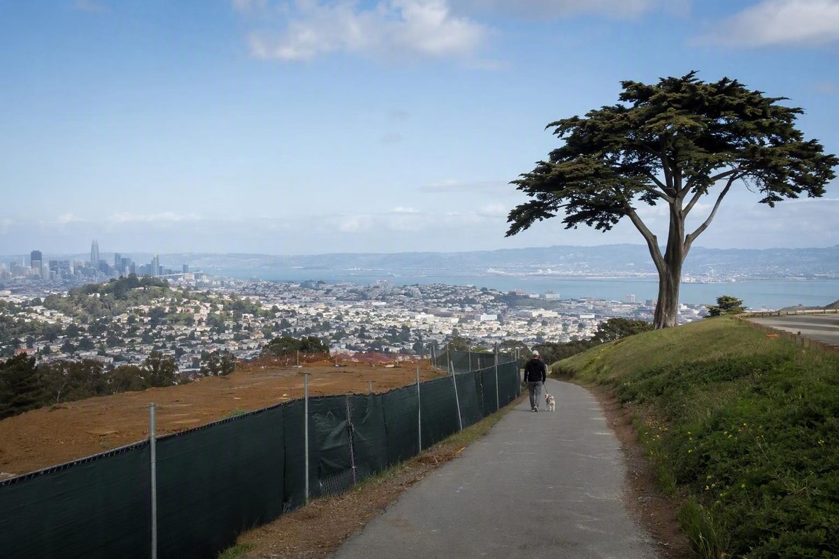
Yes, you can still visit part of Twin Peaks in San Francisco, but the park is not fully accessible during Promenade construction. The fenced Promenade work site and Crestline Trail are closed. For the simplest visit with the least backtracking, make Christmas Tree Point your target and, if driving, enter through the Portola Drive gate. Check official park notices immediately before leaving because published updates cannot confirm conditions at your exact arrival time.
Related: How Tourists Can Park in San Francisco Amid Car Break-Ins.
Twin Peaks is partly open: the short answer
Status: Last verified from an official update: September 2, 2026.
The qualified answer is yes, Twin Peaks remains partly accessible. The latest dated update said construction was incomplete and instructed visitors to remain outside the closed, fenced Promenade site. It also reported that demolition was complete and work was temporarily paused while the project team adjusted design details, finalized change orders, and awaited laboratory soil testing. The contractor was scheduled to remobilize on September 8, but that schedule does not establish that work resumed on that date, according to the September 2 construction update from SF Recreation and Parks.
The key distinction is between the closed project area and Twin Peaks as a whole. The update confirms that the construction site remained off-limits; it does not say that the entire park, every approach, or Christmas Tree Point was closed.
This is not a live status confirmation. Construction activity, maintenance, weather, or an emergency could affect a gate, road, trail, or viewpoint after an update is posted. A map app’s “open” label or a travel website’s normal hours should not override barriers, posted notices, or staff instructions at the park.
What is open and closed at Twin Peaks
The official access plan supports a focused viewpoint visit rather than a complete walk across the peaks. The dates in the table matter: some entries are confirmed closures, while others describe the city’s planned access arrangement during construction.
| Location | Latest official position | Practical implication |
|---|---|---|
| Promenade construction area | Closed and fenced as of September 2 | Stay outside all construction fencing |
| Crestline Trail | Closed when construction began in May | Use the signed connecting-trail detour north toward Christmas Tree Point |
| Christmas Tree Point roadway and overlook | Planned to remain open during construction | Best-supported viewpoint target, subject to same-day restrictions |
| Portola Drive gate | Designated vehicle entrance | Use this approach when driving |
| Burnett Avenue gate | Closed to vehicles; retained for walking and bicycling | Do not use it as a vehicle entrance |
| Noe Peak, south switchback, and Marview Trail | Phase 1 work completed and listed as open | Follow current signs because temporary restrictions remain possible |
The Promenade project area and Crestline Trail closed to the public when construction began on May 13. Hikers affected by the Crestline closure were redirected north to the Christmas Tree Point connector, according to the May construction update.
Christmas Tree Point has a different status. The city’s construction plan said the vehicle roadway to Christmas Tree Point and the overlook itself would remain open while the Promenade work proceeded. Other connector trails were to remain open where feasible. That wording supports Christmas Tree Point as the most practical destination, but it is not a guarantee of access at a particular hour or on a particular day. See the April 29 construction notice.
Vehicle access is routed through Portola Drive. The Burnett Avenue gate is closed to vehicles, while the Burnett side retains space for people walking, rolling, and bicycling toward Christmas Tree Point Road, according to the city’s implemented Twin Peaks access configuration. This distinction is important if a navigation app tries to send a driver toward the northern gate.
Separate from the active Promenade work, SF Recreation and Parks identifies Noe Peak, the south switchback, and Marview Trail as completed and open Phase 1 improvements on the Twin Peaks Trails Improvement and Promenade project page. That does not rule out a temporary construction or maintenance restriction, so on-site signs take priority.
The simplest construction-aware visit
For a short, low-backtracking viewpoint stop, make Christmas Tree Point the destination rather than attempting a full summit circuit. This keeps the plan aligned with the roadway and overlook that the city intended to preserve during construction.
If driving:
- Approach Twin Peaks from Portola Drive.
- Enter through the Portola Drive gate.
- Follow the vehicle roadway toward Christmas Tree Point.
- Obey posted traffic controls and remain outside the fenced work area.
- Turn back if a barrier, sign, or staff member indicates that access has changed.
Do not aim for the Burnett Avenue gate when driving. Although it may appear to offer a direct northern approach on a map, it is not the vehicle entrance under the current access configuration. Starting from Portola avoids arriving at the wrong gate and having to circle the hill.
Once at Christmas Tree Point, treat the overlook as the visit’s anchor rather than assuming you can continue across every trail or complete a loop. The Promenade site cannot be used as a shortcut, and the Crestline Trail closure removes one of the usual pedestrian connections.
If walking and you encounter the Crestline closure:
- Follow the designated detour north toward the connecting trail to Christmas Tree Point.
- Stay on established paths.
- Do not step around a barricade or cross construction fencing.
- Be prepared to turn back if temporary signs change the available route.
The published closure notice does not quantify the detour’s distance, climbing, or travel time. Allow flexibility rather than committing to a tightly timed summit crossing.
Pedestrians and cyclists can use the Burnett Avenue side because the closure there applies to vehicles. However, that does not establish that every connecting path will be continuously available. Construction may affect how the approach joins the usable area, so follow current signs rather than relying on an older route description.
Plan around what has been confirmed, not what is normally available. Current parking capacity, restroom access, and the ability to complete a full circuit have not been established for your arrival time. If any of those details are essential, verify them before climbing the hill and have a turn-back point in mind.
What transit riders should know about the Crestline closure
Twin Peaks remains reachable without a car, but construction makes the usual advice less straightforward. The official park information identifies Muni 37 along Crestline Drive and Muni 48 along Portola Drive as nearby services. The same page warns visitors to expect strong winds at Twin Peaks, another reason to bring a layer even if conditions feel mild before the climb. These route and weather details appear on the official Twin Peaks facility page.
The complication is that Crestline Trail was described as the main pedestrian and Muni-adjacent access route before it closed for construction. As a result, older guides that recommend taking Route 37 to Crestline Drive and then following the usual direct trail approach may no longer match the site layout.
The official detour sends affected hikers north toward a connecting trail leading to Christmas Tree Point. It does not state how much additional distance, elevation, or time that route requires. That makes it unwise to assume the Crestline stop is still the easiest choice for every visitor, especially for anyone limiting steep walking.
Route 48 along Portola Drive may appear better aligned with the vehicle side of the park, but the available evidence does not establish the precise pedestrian connection from a current stop, the amount of climbing involved, or whether service is operating normally when you travel. Neither nearby route can therefore be declared universally easiest without checking the day’s service and closure information.
Before leaving:
- Check current Muni arrivals and service alerts.
- Review the latest construction map rather than an older visitor map.
- Leave extra time for a signed detour or a return to the same stop.
- Avoid treating a viewpoint visit as a tight connection between two timed activities.
If minimizing walking is the priority, compare the current transit approach with another transport option before committing. The hill’s road access and its pedestrian access are not interchangeable during construction.
Check these details before climbing the hill
Immediately before departure, check the latest SF Recreation and Parks construction update and the official Twin Peaks facility page. The construction update is the better source for the Promenade and trail closure, while the facility page covers the park’s general access configuration. On arrival, posted signs and barriers take priority over both.
Third-party travel listings commonly publish normal hours. Tripadvisor, for example, lists 5 a.m. to midnight and includes visitor reports that the summit can be windy, cool, or obscured by fog. Those details can help with general planning, but they are not authoritative proof of construction-period hours or live access to a particular gate, road, trail, or overlook. See the Twin Peaks attraction listing and visitor reports.
Fog is especially relevant if the view is the main reason for going. A park can be accessible while the skyline and bay are hidden, so check current visibility before spending time and energy on the climb. Wind can also make the exposed summit feel colder than lower neighborhoods; bring a layer that is easy to add at the top.
Do not treat the scheduled September 8 contractor remobilization as proof that work restarted on schedule or that the access arrangement stayed unchanged. The September 2 notice reported the planned date, but it did not document the later outcome.
Use this short pre-departure check:
- Park status: Look for a newer construction update, closure notice, or emergency alert.
- Route: Confirm that Portola Drive remains the correct vehicle approach and avoid routing a car to Burnett Avenue.
- Transit: Verify current Muni service if using Routes 37 or 48.
- Conditions: Review fog, visibility, and wind at the summit rather than relying only on a neighborhood forecast.
- Scope: Keep the outing centered on Christmas Tree Point unless current official signs indicate another usable route.
- Fallback: Be willing to turn back if the roadway, overlook, or connecting path has a temporary restriction.
This preparation matters because “Twin Peaks is open” is too broad to be useful during construction. The important question is whether the specific approach and viewpoint you intend to use are available.
When will the closed Promenade reopen?
There is no confirmed public reopening date for either the Promenade construction area or Crestline Trail.
When construction began in May 2026, the city estimated that the project-area closure would last approximately nine months. That was an initial construction estimate, not a guaranteed reopening date. It also predates the September pause for design adjustments, change orders, and soil testing.
The main project page projects completion in 2027, but it does not provide a firm day when the Promenade or Crestline Trail will reopen. Project completion and public access may also involve different milestones, so the year should be treated as a projection rather than a promise.
For now, the usable decision is straightforward: Twin Peaks remains a viable viewpoint stop, but it should be treated as a partial-access destination. Aim for Christmas Tree Point through the appropriate approach, stay off Crestline Trail, remain outside the fenced Promenade site, and check the latest official notice immediately before setting out.