
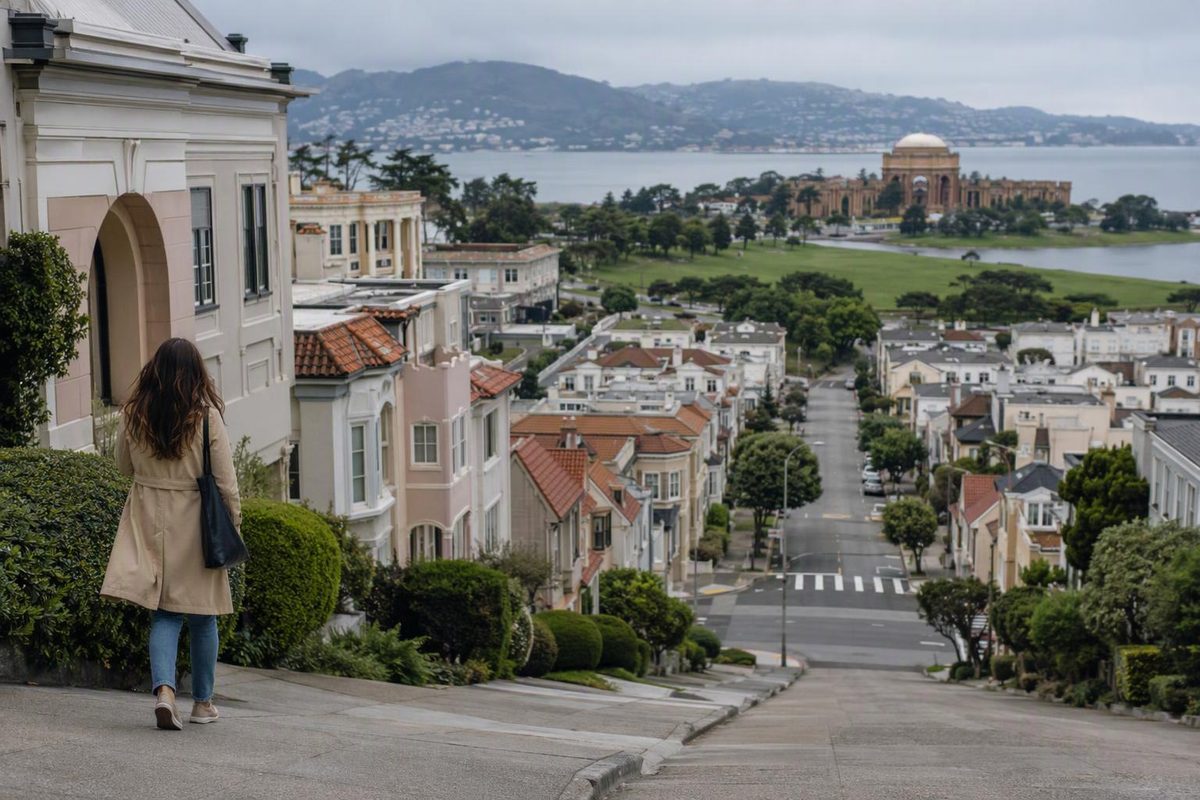
The Marina District works best as a neighborhood-and-waterfront outing, not automatically as the start of a walk all the way to the Golden Gate Bridge. Pair Chestnut Street with the Palace of Fine Arts and Marina Green; add Crissy Field only if the weather and your energy support a longer visit.
Allow roughly two to three hours for the core walk and relaxed stops, longer with a sit-down meal. The route stays on the low northern side of the city rather than climbing into Pacific Heights.
Get your bearings
The Marina sits along San Francisco’s northern shore, between Fort Mason and the Presidio, with busy Lombard Street along its southern edge. Chestnut Street is the neighborhood’s main shopping and dining corridor; Marina Boulevard follows the waterfront. The city’s Chestnut Street guide is a useful directory if you want more food and shopping choices.
Keep three places separate in your plan:
- Chestnut Street: food, shops and an easy place to start or finish.
- Marina Green: open lawn and waterfront views.
- Palace of Fine Arts: the lagoon, rotunda and colonnades at the western side of the neighborhood.
Crissy Field is the adjacent Presidio waterfront, not another shopping street in the Marina. Its flat, hard-packed promenade makes a good extension, but it adds walking distance even when it adds little climbing.
A compact route: Chestnut → Palace → Marina Green
Start at Chestnut and Fillmore streets. This puts you on both the 30 Stockton corridor and the 22 Fillmore route, with food options before you head toward the water.
1. Walk west along Chestnut Street
Browse or eat first rather than assuming you will find the same choice of cafés along the waterfront. For a portable lunch, Lucca Delicatessen at 2120 Chestnut Street sells sandwiches, prepared foods and Italian groceries. Its own website lists daily hours of 9 a.m.–6 p.m., checked October 8, 2026.
Continue west toward Baker Street. This keeps the approach within the neighborhood instead of detouring south toward the hills.
2. Visit the Palace of Fine Arts
At Baker Street, turn north toward the lagoon and explore the paths around it. Give this stop about 30–45 minutes if you want both the view across the lagoon toward the rotunda and a closer look at the colonnades.
The Palace was originally built for the 1915 Panama-Pacific International Exposition. San Francisco Recreation and Parks lists the park’s address as 3601 Lyon Street and its hours as 5 a.m.–midnight. Those are park hours, not a performance schedule for the separate theater.
For photography, our Palace of Fine Arts route guide helps you choose a few backdrops rather than repeatedly circling the lagoon.
3. Head north, then east along the waterfront
Return to the Baker Street side, follow Baker north to Marina Boulevard, and use the crossings to reach the waterfront paths. Head east toward Marina Green.
Marina Green runs beside Marina Boulevard between Scott and Webster streets, with views toward the Golden Gate Bridge, the bay and Alcatraz. Treat it as a place to pause, not merely a connector between attractions.
Finish by returning inland toward Fillmore and Bay for the 22, or continue to Chestnut for the 30. This makes a circuit using different streets rather than retracing your entire outward walk.
Want more waterfront? Choose Crissy Field instead
After the Palace, go west toward Crissy Field rather than east toward Marina Green if the waterfront is your priority. Follow Marina Boulevard west to Mason Street and head toward East Beach. Use the beach as your first decision point: a short promenade walk can be enough without reaching the bridge.
For visitors managing walking effort, NPS describes the Crissy Field pathways as generally level, with accessible restrooms at East Beach and West Bluff. The promenade includes compacted natural surfaces and wooden sections; “flat” does not mean uniformly paved.
Avoid adding Pacific Heights or the Lyon Street Steps casually to this low-level outing. Those turn a waterfront visit into a different kind of walk.
Use Muni for the approach and return
Service details checked October 8, 2026:
- 30 Stockton: useful from downtown and the North Beach corridor to Chestnut Street. Check the destination before boarding: the line has long and short trips, and only the long route serves the Marina and Crissy Field. SFMTA lists the Crissy Field extension as operating from 6 a.m. to 8 p.m. daily, with its terminal in the Sports Basement parking lot. Outside those hours, long-route trips terminate at Divisadero and Chestnut.
- 22 Fillmore: useful between the Marina, Pacific Heights, the Fillmore corridor and the Mission. It serves Fillmore at Chestnut and Bay, saving a climb when your next stop is south of the Marina.
Check live arrivals and stop notices before leaving the waterfront, particularly if you are relying on the Crissy Field extension.
Weather backup—and whether to stay here
Bring a wind-resistant outer layer even for a modest waterfront walk: the Presidio’s East Beach guide specifically recommends a jacket for the wind. Coastal summer fog is a normal part of the Golden Gate area’s seasonal weather; a clear bridge view should be a bonus, not the condition that makes the day worthwhile.
If rain or wind makes the open waterfront unappealing, shorten the walk and return to Chestnut. The Marina Theatre at 2149 Chestnut Street provides an indoor alternative. Check showtimes first: it is not an all-day drop-in attraction.
As an overnight base, the Marina is a sensible choice when you expect repeated waterfront and Presidio visits. For a trip centered on downtown sights and cross-city travel, compare the exact lodging address and daily journeys against a more central base. Our where-to-stay comparison lays out those trade-offs. A pleasant local walk and a convenient citywide base are not necessarily the same thing.