
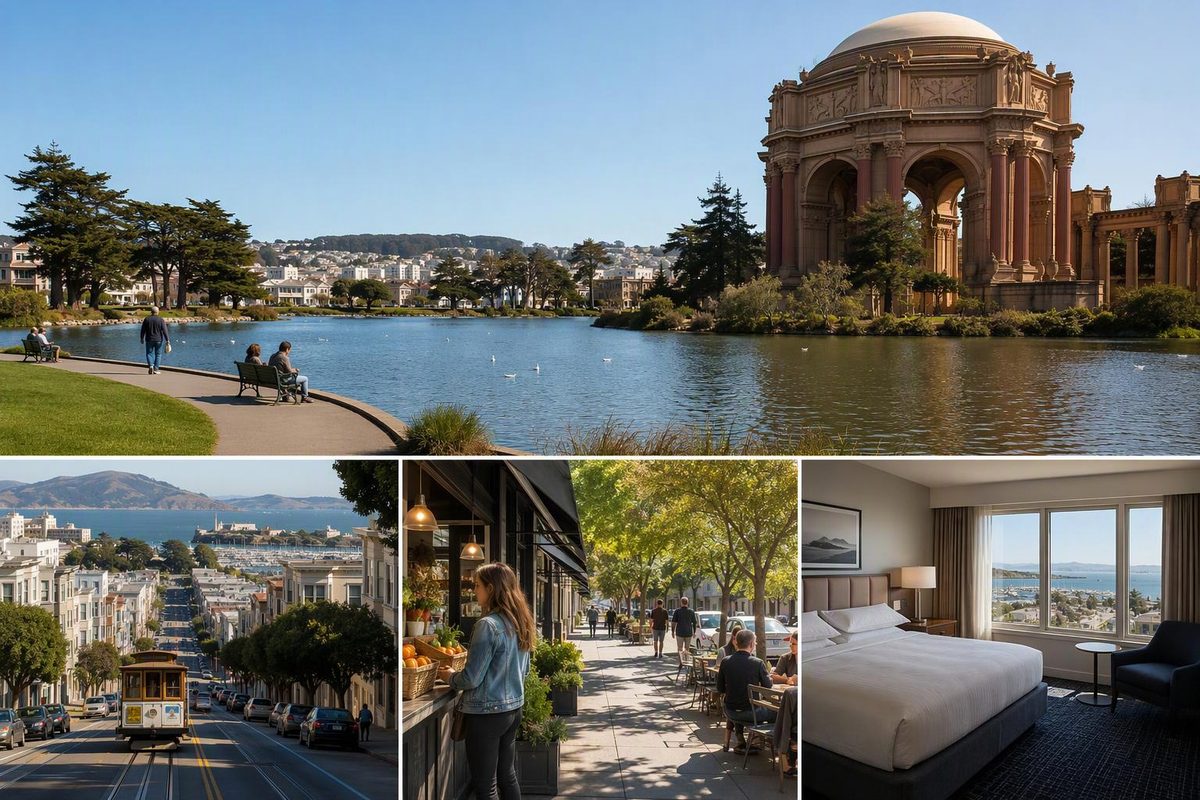
The Marina District in San Francisco works best as a relaxed half-day: eat and browse on Chestnut Street, walk along Marina Green, then visit the Palace of Fine Arts. It’s a good choice for bay views without steep streets dominating the outing. Add Crissy Field only if the weather and your energy hold up; take a bus if the Golden Gate Bridge is your next destination. As an overnight base, the Marina suits a waterfront-focused trip better than repeated downtown journeys.
Choose your waterfront conditions and intended finish; use the route recommendation below.
Finish At The Palace
Chestnut Street → Fillmore Street → Marina Green → Palace of Fine Arts.
Allow roughly three hours with food, browsing and photo stops; this is a planning estimate, not a measured walking time. Return to Chestnut Street for the 30 toward downtown.
Route Limits And Return Options
East Beach: Continue via Marina Boulevard and Yacht Road. Choose paved Old Mason Road for a smoother surface; the shoreline promenade can be bumpy or sandy.
Bridge: Use the 28 on Lombard for the bridge visitor area. Yacht Road to the Warming Hut alone is 1.5 miles one way, before the bridge approach.
Fog: Keep the waterfront section short rather than extending the walk for a bridge photograph.
Strong wind or rain: Stay on Chestnut Street for food and browsing. The Palace is an outdoor stop.
30 Stockton: Only long-route buses serve the Marina. Crissy Field service runs 6 a.m.–8 p.m. daily; from 5–6 a.m. and 8 p.m.–midnight, the long route ends at Divisadero and Chestnut. Check the destination and current service.
Sources: SFMTA 30 and 28 route pages (service checked October 8, 2026), Presidio Crissy Field guide and Access California route assessment. Three-hour allowance is a planning estimate.
Chestnut Street And The Waterfront Make The Easiest Route
The Marina sits on San Francisco’s northern shore, between Fort Mason and the Presidio, with Lombard Street along its southern edge. Chestnut Street is the commercial spine; Marina Boulevard is the waterfront side.
For a low-hill outing, stay with Chestnut Street and the bayfront. Southward detours toward Pacific Heights bring a different hill burden. Also distinguish the Marina’s broad Lombard Street corridor from the famous crooked block farther east: our Lombard Street visiting guide treats that as a separate stop.
Crissy Field is the natural westward continuation, but it belongs to the Presidio rather than the Marina’s residential street grid. Reaching its eastern end does not mean you are nearly at the bridge.
Allow Roughly Three Hours For The Core Walk
Roughly three hours allows for browsing, food and photo stops between Chestnut Street, Marina Green and the Palace of Fine Arts. This is a planning allowance, not a measured walking time. A leisurely seated meal can stretch the outing, and the Crissy Field extension adds walking beyond the core plan.
Start With Food On Chestnut Street
Start near Chestnut and Scott streets, then work east toward Fillmore. This gives you a compact stretch of neighborhood businesses before turning toward the water.
For a portable lunch, Lucca Delicatessen, 2120 Chestnut Street, sells sandwiches and prepared sides. Its official site lists daily hours of 9 a.m.–6 p.m., checked October 8, 2026. Buy food before heading to the lawn.
Choose A16 for a seated meal rather than quick picnic pickup. Its San Francisco menu includes Italian pizzas, pastas and main courses. Check service times before building lunch around it. If A16 is your priority, plan the walk around your meal rather than sticking rigidly to the eastbound start.
Turn North On Fillmore To Marina Green
From Chestnut Street, turn north on Fillmore toward Marina Boulevard. Cross at the marked crossing, then head west along the waterfront paths beside Marina Green.
This is the open-view portion of the outing. The park looks toward the Golden Gate Bridge, Alcatraz and Angel Island and is used for running, recreation and picnics, according to SF Recreation and Parks. Stop here for lunch if conditions are comfortable.
The walking effort is relatively low, but exposure matters. An easy grade does not make a windy waterfront feel effortless. Bring a wind-blocking layer even if you began the day in sunshine.
Finish At The Palace Of Fine Arts
Continue west toward Baker Street, using marked crossings to reach the Palace grounds. Allow about half an hour around the lagoon and beneath the rotunda.
The Palace was originally built for the 1915 Panama-Pacific Exposition. Today, the rotunda and park remain open to the public, including when weddings are permitted there. Rec and Park’s Palace page also identifies nearby restrooms at Little Marina Green, at Yacht Road and Marina Boulevard.
Treat the Palace as an outdoor architecture stop, not an indoor art-museum visit. It is not the rain backup for this route.
If you finish here, return to Chestnut Street for the 30 Stockton toward downtown. The 28 on Lombard is another option if your next stop is the bridge.
Crissy Field East Beach Is An Optional Extension
From the Palace, return toward Marina Boulevard and Yacht Road, then follow the waterfront connection west into Crissy Field. East Beach makes a sensible short extension and a place to decide whether you want more walking.
The Presidio describes the nearby Golden Gate Promenade/Bay Trail as one of its easiest places to walk or roll. That does not mean every surface is smooth: the shoreline promenade is dirt and gravel and can be bumpy or sandy. For a smoother surface, use the paved route along Old Mason Road.
From Yacht Road to the Warming Hut alone is 1.5 miles one way, before any further extension toward Fort Point or the bridge approach. Access California’s route assessment gives that distance and distinguishes the shoreline surface from the paved alternative.
That figure applies to Yacht Road–Warming Hut, not the entire Chestnut Street–Palace outing. The draft’s sources do not provide a measured distance for the core walk. If the bridge itself is your goal, make it a separate transit stop rather than treating it as an automatic continuation of this half-day.
Take The Right 30 Stockton For The Marina
Three Muni routes are useful for this plan, but they serve different corridors.
| Route | Best Use | Check Before Boarding |
|---|---|---|
| 30 Stockton | Downtown–Chestnut Street; Crissy Field return | Only long-route buses serve the Marina. Short-route buses end near Fort Mason. |
| 22 Fillmore | Arrival from the Fillmore corridor or the Mission | Useful stops include Fillmore and Chestnut, and Fillmore and Bay. |
| 28 19th Avenue | A separate Golden Gate Bridge stop | Uses Lombard and serves the bridge visitor area, not Chestnut Street. |
As checked October 8, 2026, the 30 Stockton long route serves Crissy Field from 6 a.m. to 8 p.m. daily. From 5–6 a.m. and 8 p.m.–midnight, the long route terminates at Divisadero and Chestnut instead. Check the destination before boarding, especially when planning a return from the waterfront.
The 22 handles the cross-city hills for an arrival from the Fillmore corridor or the Mission. Use the official 22 Fillmore and 28 route pages for current stops and arrivals.
Shorten The Waterfront Walk In Poor Weather
In fog, shorten the waterfront section rather than walking farther solely in pursuit of a clear bridge photograph. You can still visit the Palace, but do not count on distant views as the payoff for an extended walk.
In strong wind or rain, keep the outing on Chestnut Street: browse, have a seated meal and save Crissy Field for another day. The Palace’s outdoor grounds do not substitute for an indoor attraction.
A free indoor pause is the Marina Branch Library, 1890 Chestnut Street. Check its branch hours and closure notices before relying on it; it does not open in the morning every day.
Stay In The Marina For Waterfront Time, Not Downtown Convenience
The Marina is a good hotel base if you want repeated waterfront walks, easy access to Chestnut Street meals and time around the Presidio. Its main advantage is putting that part of the city close to your room.
Choose a more central base if most days involve downtown attractions or destinations scattered across the city. The Marina has useful buses, but budget for those journeys rather than assuming everything is a comfortable walk away.
Before booking, check the exact address, nearby bus stops and whether your room faces busy Lombard Street. Compare the broader trade-offs in our Union Square versus Fisherman’s Wharf hotel-base guide.