
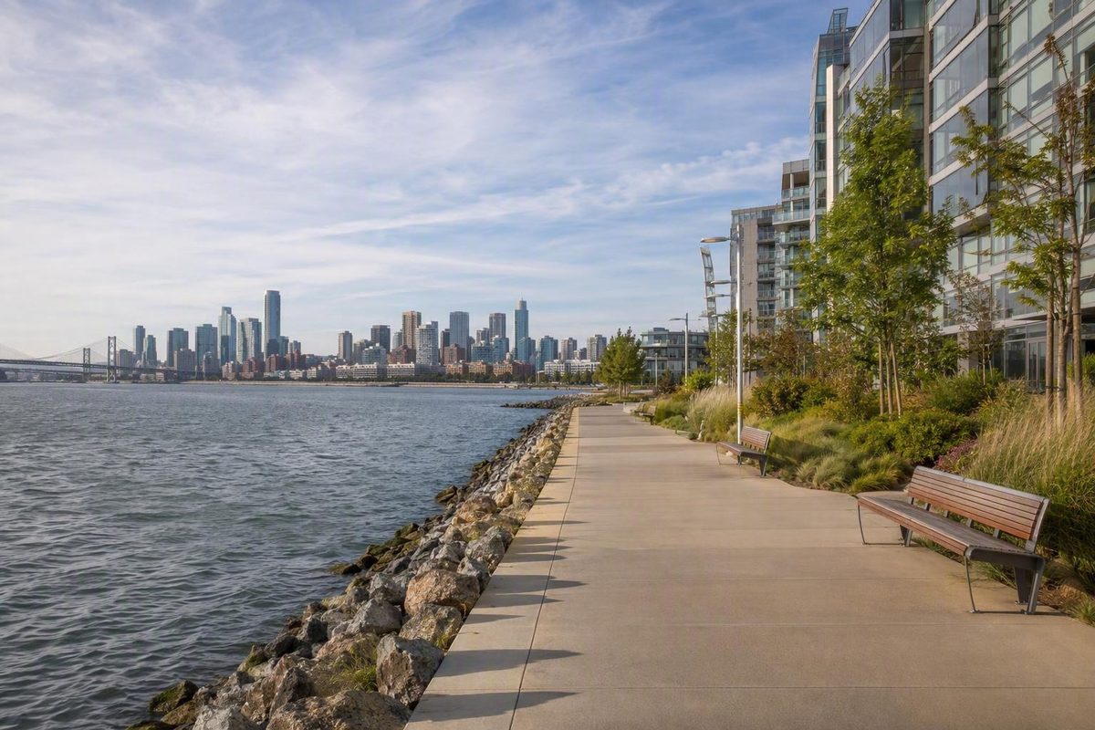
This is the southeastern waterfront walk to choose when you want open bay views, new parks and old industrial infrastructure without San Francisco’s usual climbing. San Francisco Travel’s citywide neighborhood directory includes Dogpatch/Mission Bay as a distinct visitor area, and its neighborhood guide describes the area as flat and transit-accessible. Still, the outing is not a perfectly continuous promenade: arena blocks, working streets and changing development sites interrupt the water’s edge.
The cleanest plan is one way, north to south:
China Basin Park → Bayfront Park and Chase Center → Crane Cove Park
Allow roughly two hours for an unhurried outing with park stops. Add more time for food, an event or the optional Mission Creek prelude. Check the day’s Chase Center schedule before setting out; an event can make the middle of the route considerably busier.
Start at China Basin Park
Begin at China Basin Park, on China Basin Way between Third Street and Terry A. Francois Boulevard. The five-acre park sits across McCovey Cove from Oracle Park. Its Bay Trail segment has views toward the ballpark, Bay Bridge, Yerba Buena Island and downtown, making this a stronger start than simply getting off transit beside the arena. The Port describes the trail as a connection between downtown, South of Market and the southeastern waterfront (Port of San Francisco).
Walk the park’s shoreline before turning south. If you arrive from Fourth and King streets and want a longer opening, first use the esplanade at Mission Creek Park South between Fourth and Third streets. That park has lawns, an amphitheater and restrooms at the pavilion at 290 Channel Street (San Francisco Recreation and Parks). Cross Third Street afterward and continue to China Basin Park.
Follow the water through Mission Bay
From China Basin Park, continue south toward Terry A. Francois Boulevard. Keep the bay on your left whenever the public path permits. The route passes modern Mission Bay blocks before reaching Bayfront Park and the Chase Center area.
This middle section is useful as a decision point rather than a compulsory attraction stop. If you want food or a longer break, turn into Thrive City. If the plaza is crowded or an event is loading in, stay on the perimeter and keep moving. Thrive City describes itself as a community gathering space and lists its current program and venue schedule online (Chase Center).
For an early exit, use the UCSF/Chase Center T Third stop. For a later one, continue toward Third Street and 20th Street. Both are official T Third stops, and the line runs north through the Central Subway to Chinatown; SFMTA currently lists regular rail hours as 6 a.m.–midnight on weekdays and 8 a.m.–midnight on weekends, with T Bus service in the earlier morning gaps (SFMTA). Check live arrivals and elevator status rather than building the day around a printed frequency.
Finish in Dogpatch at Crane Cove Park
South of the arena district, follow the signed public route toward Illinois Street and Crane Cove Park. Do not insist on hugging every pier: this is where active streets and development can make a map’s apparent shoreline line misleading. Use marked crossings and follow temporary signs if access shifts.
Crane Cove Park is the natural finish. The Port completed the park project in 2020 as part of the Blue Greenway, its chain of shoreline paths, parks and open spaces. The design preserves maritime resources while opening this former industrial shoreline for public recreation (Port of San Francisco).
This endpoint makes the neighborhood transition legible: Mission Bay’s newer parks and arena give way to Dogpatch’s shipyard landscape. San Francisco Travel places Dogpatch south of Mariposa Street, so Crane Cove is not merely another Mission Bay lawn—it is the point where this walk becomes a genuine two-neighborhood outing (San Francisco Travel).
When finished, walk back to Third Street for the T Third rather than retracing the waterfront. The Third Street and 20th Street stop is the most useful nearby option shown on SFMTA’s route list.
Shorten it when wind or rain takes over
Do not turn bad waterfront weather into an endurance test. Use this reduced version:
- Start at China Basin Park for the cove and skyline views.
- Walk south only as far as Bayfront Park and the Chase Center area.
- Take the T Third from UCSF/Chase Center.
That preserves the best Mission Bay sequence and gives you a clear transit exit. If conditions improve, continue to Crane Cove; if not, save Dogpatch for another outing.
This route works best as its own half-day rather than an add-on to Fisherman’s Wharf or the Golden Gate waterfront. For a broader first-visit structure, use the San Francisco itinerary designed to limit backtracking.