
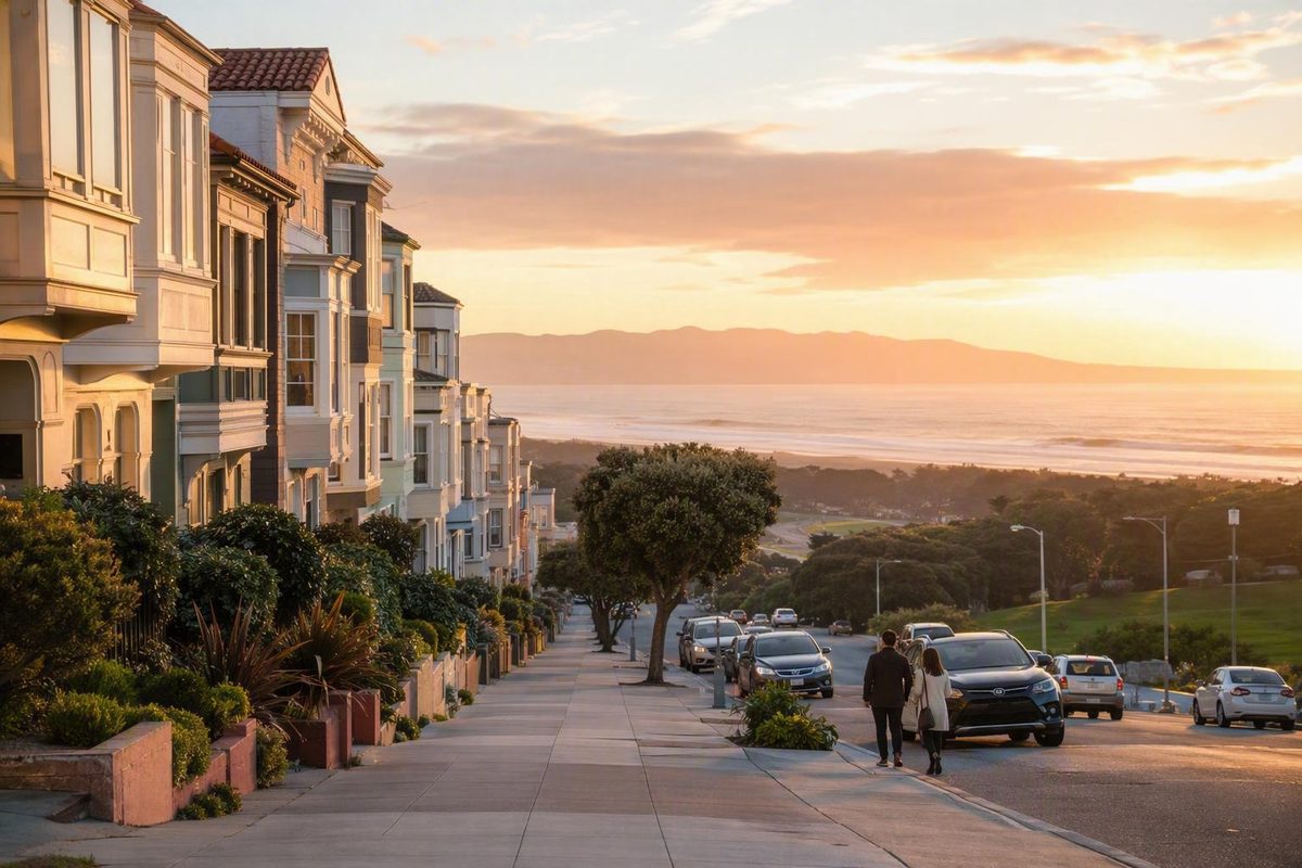
For a first visit to San Francisco’s Sunset District, use 9th Avenue and Irving Street as your organizing point. Explore the nearby commercial blocks, walk north on 9th Avenue toward Lincoln Way and Golden Gate Park’s southern edge, then decide separately whether Ocean Beach deserves a second phase.
This is not the only worthwhile part of the Sunset, nor is it an objective “best.” It is simply the clearest compact option for combining neighborhood time with the park without trying to cross the entire West Side. For broader context before choosing among city districts, see SF Travel’s neighborhood directory.
The short answer: where a first Sunset visit should begin
Begin around 9th Avenue and Irving Street in the Inner Sunset. The surrounding streets form an established dining and shopping cluster immediately south of Golden Gate Park, so you get both a neighborhood center and an obvious next move.
Use this basic sequence:
- Explore a few commercial blocks around 9th Avenue and Irving Street.
- Choose one meal, café, or shop rather than assembling a long checklist.
- Walk north on 9th Avenue toward Lincoln Way.
- Enter Golden Gate Park only if you want to add more walking or a separately verified attraction.
- Make Ocean Beach an optional second phase, not the automatic finish.
This focus matters because the Sunset extends across a broad part of western San Francisco. Commercial activity is distributed along corridors including Irving, Judah, Noriega, and Taraval, while much of the district is residential.
The strength of 9th and Irving is adjacency: neighborhood blocks first, park edge second. That makes it easier to stop when you have seen enough rather than continuing simply because a district-wide checklist says you should.
Where the Sunset is—and why its boundaries feel imprecise
The Sunset occupies a large part of San Francisco’s West Side. Golden Gate Park lies along its northern side, while Ocean Beach and the Pacific form its western edge. Between them is an extensive street grid containing residential blocks and several long commercial corridors.
Inner Sunset, Central Sunset, and Outer Sunset are useful planning labels, but their dividing lines are not universally agreed. Some descriptions use all three names; others divide the area mainly into Inner and Outer Sunset. Parkside may also be included in broader uses of “the Sunset,” even though it can be treated as a separate neighborhood.
Official maps do not eliminate that ambiguity. San Francisco’s analysis neighborhoods were created by grouping census tracts to support consistent reporting of demographic, socioeconomic, environmental, and government-program data. Those analytical units serve a reporting purpose and need not match every historical, colloquial, or resident definition, as the city’s analysis-neighborhood methodology explains.
For visitors, the street grid is more useful than debating every boundary. Numbered avenues generally increase as you travel west toward Ocean Beach. Moving from the single-digit avenues into the 30s or 40s therefore means moving considerably closer to the coast.
The district’s form also explains why an all-in-one walking tour is awkward. The area developed from former dunes and coastal scrub—historically associated with the Outside Lands—into a largely residential streetcar suburb. Long transit-aligned shopping streets and extensive blocks of attached housing emerged from that growth. The Sunset is therefore easier to experience through selected corridors than as one concentrated collection of landmarks.
A compact 9th Avenue and Irving Street park-edge plan
Treat this as a neighborhood-choice framework rather than a timed or fully verified walking itinerary. Arrive near 9th Avenue and Irving Street, explore the surrounding commercial blocks, then walk north on 9th Avenue toward Lincoln Way and the park boundary. Continue into Golden Gate Park only after choosing a current, verified destination or deciding that an unstructured park walk suits the day.
Irving Street from roughly 5th to 12th avenues and 9th Avenue between Lincoln Way and Judah Street are commonly identified as the Inner Sunset’s principal commercial area. This gives you enough room to browse without turning the neighborhood portion into a search for every possible business.
Choose one anchor: a meal, a café break, a shop, or time to walk the corridor. If you want a park activity as well, choose one and verify it directly. Business status, opening hours, reservation policies, entrances, and attraction operations can change.
| Route field | Practical choice |
|---|---|
| Start | 9th Avenue and Irving Street |
| Neighborhood focus | Nearby blocks of Irving, Judah, and 9th Avenue |
| Park-edge connection | Walk north on 9th Avenue toward Lincoln Way |
| Optional stopping point | The park boundary or one attraction confirmed with its operator |
This arrangement limits backtracking by keeping the commercial and park portions beside each other. It also prevents “adding Golden Gate Park” from quietly becoming a second large itinerary.
No specific park attraction, entrance, restroom, or accessibility feature is presented here as currently verified. Before selecting one, confirm its hours, admission rules, reservation requirements, correct entrance, and accessibility directly with the operator. Do not assume the nearest point shown on a map is the appropriate entrance or that every path will work for every visitor.
Inner, Central, or Outer Sunset: choose by the experience you want
Use these names as planning distinctions rather than fixed official boundaries.
| Area | Visitor focus | Useful pairing | Main tradeoff |
|---|---|---|---|
| Inner Sunset | Dining and shopping around 9th Avenue and Irving Street | Golden Gate Park’s southern edge | Concentrated first stop, but not a coastal experience |
| Central Sunset | Primarily residential middle area with activity along parts of Irving and Noriega | Slow neighborhood exploration or a specific destination | Less concentrated and not sharply bounded |
| Outer Sunset | Ocean Beach and commercial stretches of Judah, Noriega, and Taraval | A deliberate coastal outing | More wind and fog exposure and greater separation from central San Francisco |
Choose the Inner Sunset when you want the most compact combination of commercial blocks and park access. Choose the Central Sunset when the residential grid or a specific destination is the reason for going. Choose the Outer Sunset when proximity to the Pacific matters more than keeping the outing tightly contained.
These are not rankings. A visitor who wants an ocean walk may prefer the Outer Sunset, while someone seeking a manageable neighborhood introduction with a park connection will usually find the Inner Sunset easier to structure.
When to extend the outing toward Ocean Beach
Ocean Beach forms the Sunset’s western edge, but it is not an effortless walking add-on to an Inner Sunset visit. Starting around 9th Avenue and finishing at the Pacific means covering a much broader cross-section of the district.
Choose between two formats:
- Compact outing: Explore 9th and Irving, continue to the park boundary, and finish there.
- Coastal second phase: Complete the Inner Sunset portion, then use transit planned with current operator information to reach the beach.
Add the coast when Ocean Beach is a genuine priority—not simply because it appears within the same neighborhood label. Before leaving the Inner Sunset, confirm the route, boarding stop, service status, accessibility, and return plan using current SFMTA information.
Treat Ocean Beach primarily as a place for scenery, walking, and watching experienced surfers. Before approaching the water, consult current safety notices from the responsible public authority and follow posted instructions. This article does not independently verify current surf or water hazards, lifeguard coverage, closures, or access conditions, so it should not be used as beach-safety guidance.
The tiled stairways and Grandview Park offer a different kind of extension. Reaching those viewpoints involves stairs and climbing, making them a more strenuous alternative rather than a casual addition to the compact park-edge plan. They should not be described as universally accessible.
Choose among the park, coast, and hillier viewpoints according to the experience you actually want. Trying to combine all three works against the purpose of a focused Sunset visit.
Great Highway road, path, and beach-access arrangements may also change. Check a current authoritative city source before building your route around a particular access point or roadway condition.
Plan for the Sunset’s coastal conditions
Chilly or foggy conditions can occur during summer, so a coastal extension should remain flexible rather than depending on clear views or mild wind.
Carry a layer even if the forecast appears comfortable. Wear shoes suitable for neighborhood walking and any park paths you intend to use; a short plan can still grow as you browse or explore.
If the coast looks unappealing, use the commercial corridor and nearby park boundary as the complete outing. Save Ocean Beach for another day rather than committing more time to an exposed walk you are unlikely to enjoy.
Avoid rigid assumptions about Sunset weather. The district is not necessarily foggy throughout every visit, and the available evidence does not support predicting when fog will clear. Check the forecast, assess conditions after arrival, and keep the coast easy to drop from the plan.
Is the Sunset a good place to stay?
The Sunset can be a useful base if Golden Gate Park, Ocean Beach, and western San Francisco are central to your trip. It may be less convenient if most of your plans are downtown, on the northeastern waterfront, or in other central visitor districts.
The exact address matters more than the neighborhood name. An Inner Sunset location near 9th and Irving creates a different daily travel pattern from an Outer Sunset address near Ocean Beach. Do not book solely because a listing says “Sunset District.”
Consider staying in the Sunset when:
- Golden Gate Park will be a repeated destination.
- Ocean Beach or western neighborhoods are priorities.
- You prefer a residential setting to immediate proximity to major central visitor areas.
- The exact address has a practical current transit connection to your planned stops.
Compare other bases when:
- Most days begin downtown or near the northeastern waterfront.
- Your plans require repeated cross-city journeys.
- Late-evening transportation is important.
- You want to walk to a high proportion of your main destinations.
Travel convenience cannot be determined from the district name alone. Before booking, identify the closest transit stop and test the exact address against several places you will actually visit. Verify current service, disruptions, accessible boarding, late-evening options, transfers, and point-to-point travel times through official trip-planning information.
Do not rely on old forum journey estimates as current evidence. Conditions, routes, starting points, and destinations vary too much for those figures to settle whether a particular address will work for your trip.
What to verify before you go
The durable part of this plan is the choice of 9th and Irving as a compact neighborhood center beside Golden Gate Park. Operations are the changeable part.
The supplied research was reviewed on September 18, 2026, but it does not independently confirm current transit, attraction, business, beach, or Great Highway operations. Recheck these items for the date of your visit, and again on the day itself when conditions or service may change:
- Transit: Current Muni routes, stops, disruptions, journey times, transfers, and accessible boarding. Use SFMTA’s official trip-planning and service information.
- Golden Gate Park: Attraction hours, admission, reservations, entrances, restrooms, closures, and accessibility. Check the relevant operator.
- Food and shopping: Current business status, address, hours, reservations, and any market schedule. Confirm directly with the business or organizer.
- Ocean Beach: Current public-authority safety notices, posted warnings, closures, and access conditions before approaching the water.
- Great Highway area: Current road, path, and access arrangements from an authoritative city source.
- Tiled steps and viewpoints: The required climbing and whether the route is appropriate for every member of your group.
For a first visit, the useful decision is simple: make the Inner Sunset commercial blocks and nearby park boundary the main outing. Add Ocean Beach, the western avenues, or the tiled-step viewpoints only when one of them is a deliberate priority.