
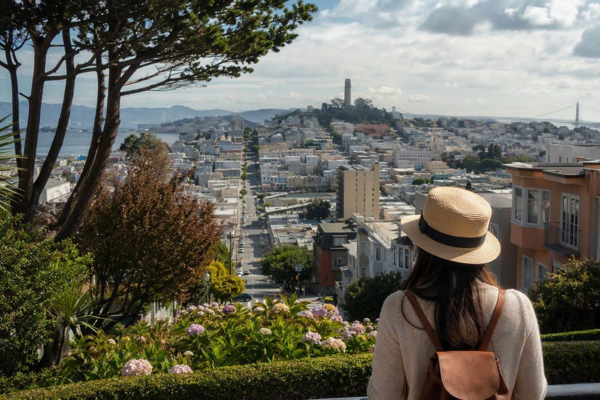
San Francisco is easier to understand as a collection of overlapping visitor areas than as a fixed list of neatly bounded neighborhoods. Cultural history, commercial streets, parks, terrain, weather, and transportation often matter more to a visitor than the precise line on an administrative map.
This is a selective guide to neighborhoods in San Francisco, CA—not an inventory of every neighborhood, subdistrict, cultural district, development, or piece of parkland. It is designed to help you decide where to stay, what to explore, and which areas can reasonably be combined without turning a short day into a cross-city obstacle course.
The guide uses municipal mapping as its geographic baseline, then draws cautiously on tourism guides, local travel writing, and commercial neighborhood overviews for visitor orientation. Because transit, businesses, construction, parking, and weather can change, confirm time-sensitive details before traveling.
Start With the Map: Why San Francisco Neighborhood Lists Disagree
There is no single neighborhood count that works for every purpose. Municipal agencies need boundaries for notification, transportation, and planning. Tourism organizations group places into recognizable visitor areas. Residents use historical or colloquial names. Cultural districts can overlap conventional neighborhoods, while property listings use another set of labels.
For practical geographic and transportation planning, the municipal framework is the most useful starting point. The SFMTA neighborhood directory says its definitions follow San Francisco Planning Department neighborhood notification maps. Its pages connect areas with transportation information, projects, and local updates. Administrative boundaries may still differ from how residents describe their blocks, but they provide a consistent baseline.
Reported counts need context:
- A collaboratively edited neighborhood list says the Planning Department identifies 36 neighborhoods, but the page carries a citation warning and marks the statement as needing support. Treat 36 as a reported figure, not a settled official total. The list also illustrates how major neighborhoods, smaller subsections, historical districts, and overlapping areas can become mixed together in one taxonomy.
- San Francisco Travel presents 19 major visitor areas, while acknowledging that the answer depends on whom you ask and that the city contains more areas than its visitor coverage includes. Its map combines neighborhoods, districts, and tourism-oriented labels.
- Compass organizes the city into 10 Realtor districts for market reporting. Those districts bundle numerous neighborhoods and subdivisions; they are not a definitive municipal taxonomy.
This explains why familiar names shift between maps. Union Square may be treated as a district, neighborhood, shopping zone, or hotel area. Cow Hollow may appear independently or alongside the Marina.
The Presidio and Golden Gate Park introduce another complication. Both are principally parklands, not conventional residential neighborhoods, yet visitor guides often include them because they occupy large, important parts of the city and connect directly to surrounding neighborhoods.
Use neighborhood names as orientation tools rather than immutable borders. A commercial street, park, plaza, transit station, or landmark is often more useful than a disputed edge. For current geographic and transportation context, consult SFMTA’s directory and the Planning Department mapping resource linked from it.
Choose by Daily Experience, Not by a Universal Ranking
Choosing where to stay and choosing where to explore are separate decisions.
A neighborhood can be a practical lodging base because it has hotels and transit without becoming your favorite sightseeing area. Conversely, an appealing place to spend an afternoon may have limited lodging or inconvenient connections to the rest of your itinerary.
The following matrix is a quick comparison of selected visitor bases and clusters rather than a complete ranking:
| Area | Strongest visitor interests | Signature anchors | General terrain | Broad transit picture | Weather planning | Useful pairing | Main trade-off |
|---|---|---|---|---|---|---|---|
| Union Square | Hotels, shopping, central connections | Union Square and nearby downtown streets | Mixed, with hills rising toward adjacent northern areas | BART, Muni, cable cars | Check same-day conditions | Chinatown or Financial District | Convenient, but primarily a commercial and hotel district |
| Chinatown and North Beach | Cultural history, food, public spaces, cafés | Grant Avenue, Portsmouth Square, Washington Square | Rolling, with steeper extensions | Muni and cable-car access in the broader area | Check conditions before adding high viewpoints | Best combined with each other | Telegraph Hill adds a substantial climb |
| Mission and Castro | Murals, food, nightlife, parks, LGBTQ+ history | Valencia Street, mural sites, Dolores Park, Castro streets | Mixed, with climbs toward adjoining hills | BART in the Mission; Muni Metro in the Castro | Check the forecast for the full day | Strong two-area combination | Activity, noise, and terrain vary by block |
| Marina and Presidio | Waterfront scenery, bridge views, outdoor time | Marina Green, Palace of Fine Arts, Crissy Field | Gentler along parts of the waterfront; side connections climb | Surface-transit options vary by route | Cool or windy waterfront conditions are a planning concern | Natural one-direction outing | A return plan matters |
| Haight-Ashbury | Music and counterculture history, vintage shopping, murals | Haight Street, Buena Vista Park, Golden Gate Park edge | Rolling | Surface transit | Bring a layer and check current conditions | Eastern Golden Gate Park | Continuing deep into the park substantially expands the day |
| Inner Sunset | Golden Gate Park and western commercial streets | Irving Street and park entrances | Mixed | Muni and buses | Western fog is a broad tendency, not a forecast | Golden Gate Park | Farther from northeastern attractions |
| SoMa and Yerba Buena | Museums, events, selected nightlife, transport links | SFMOMA and the Yerba Buena area | Varies across a large district | BART, Muni, Caltrain, and road connections | Conditions depend on the specific subarea | Downtown or Embarcadero | Too large and varied for a district-wide generalization |
The most useful comparison factors are hills, access to the transit you will actually use, distance from your planned attractions, noise tolerance, waterfront or park access, and how often you expect to return to the area. Short distances on a flat map can conceal steep or tiring connections.
Union Square demonstrates the difference between convenience and personal appeal. It has substantial hotel inventory and access to Muni, BART, and cable cars, making it a practical base for travelers moving among several parts of the city. Whether it feels exciting, overly commercial, or simply useful is subjective.
For common interest profiles:
- Choose the Mission for murals, Mexican food traditions, nightlife, Dolores Park, and BART access.
- Choose the Marina and Presidio for waterfront scenery and outdoor time.
- Combine Chinatown and North Beach for a compact cultural and food-oriented outing.
- Use the Sunset when Golden Gate Park or the Pacific side is central to the day.
- Consider Union Square or downtown when hotel choice and broad transit access matter more than staying inside the area you most want to explore.
A practical base-selection method is to consider hills, transit, and the places you expect to revisit. The San Francisco Know neighborhood-base guide presents that framework as planning advice, not a guarantee of easier travel. The useful question is not “What is the best neighborhood?” but “Which location makes my repeated journeys simplest?”
Avoid blanket rankings based on safety, affordability, authenticity, or family suitability. The supplied evidence does not provide consistent current data for those judgments, and conditions can vary by block, hour, and individual needs.
Chinatown, North Beach, Nob Hill, and Russian Hill
These central and northeastern areas sit close together on a map, but they should not be treated as one interchangeable district. Chinatown and North Beach work naturally as a focused pairing. Nob Hill and Russian Hill are more elevation-heavy additions.
Chinatown can be oriented around Grant Avenue, the Dragon Gate, and Portsmouth Square. These anchors provide a clearer structure than trying to visit every alley, storefront, temple, restaurant, or historical marker. Cable cars serve the broader area, but check the current service pattern rather than assuming a particular route will operate as expected.
North Beach lies beside Chinatown and is associated with Washington Square, Italian food traditions, cafés, bookstores, literary history, and the Beat movement. It also sits near Telegraph Hill and the northern waterfront. Chinatown and North Beach are adjacent, but their cultural histories remain distinct; combining them should not blur their identities.
A focused outing can begin around Chinatown’s central public spaces and continue north toward Washington Square and North Beach’s café and restaurant streets. From there, decide whether to add the climb toward Telegraph Hill. It should be an optional extension rather than an obligatory final stop.
Nob Hill is a historic, hilly district with prominent architecture and cable-car service, including service along California Street. It is near Union Square, Chinatown, and the Financial District, but geographic proximity does not remove the elevation between them.
Russian Hill is associated with steep terrain, cable-car routes, Lombard Street, and Ina Coolbrith Park. A property-management company’s neighborhood overview also identifies California Street cable cars in Nob Hill and Lombard Street and cable-car routes in Russian Hill; because this is a commercial rental guide rather than a municipal source, its descriptions are most useful as broad orientation rather than definitive mapping.
Do not assume Nob Hill and Russian Hill are effortless walking extensions because their labels appear close on a phone screen. Identify the steep segment first and decide whether transit should handle it. The same principle applies when approaching from Union Square or the waterfront.
Food, cafés, bookstores, bakeries, and restaurants are useful planning categories here. Check individual businesses close to your visit because openings, hours, reservations, and operating conditions change.
The Northern Waterfront: Marina, Cow Hollow, and the Presidio
The Marina and Cow Hollow are adjacent, but sources classify them inconsistently. Some treat Cow Hollow as a separate neighborhood; others group it with the Marina or place both in a broader northern district. For visitors, Chestnut Street and Union Street are practical commercial-corridor references regardless of the label used.
The Marina is oriented toward Marina Green, waterfront paths, the Palace of Fine Arts, Crissy Field, and Golden Gate Bridge views. Its strongest visitor appeal is visual and recreational: open space, water, bridge perspectives, and a route that can continue west.
The Presidio is principally parkland on a former military post rather than a conventional neighborhood. A personal travel overview describes the Presidio as a large park on a former military site and also groups Cow Hollow with the Marina; those classifications are useful for visitor orientation but are not an official neighborhood taxonomy.
The most efficient way to combine the Marina and Presidio is usually to move in one direction. Begin near the Marina’s commercial or waterfront edge, continue toward Marina Green and Crissy Field, and proceed into as much of the Presidio as your time and energy allow. Repeatedly returning inland or retracing the waterfront can complicate an otherwise straightforward outing.
Make four decisions before starting:
- Choose a clear direction. Follow the waterfront toward the bridge instead of building unnecessary loops.
- Plan the return separately. Decide whether you will use transit, arrange a pickup, or finish somewhere different from where you started.
- Set an optional turnaround point. Treat farther trails and viewpoints as additions rather than requirements.
- Bring a layer. Open waterfront conditions can feel cool or windy even when another part of the city feels comfortable.
This adapts the San Francisco Know waterfront-planning approach, which recommends separating the scenic walk from the return journey and preserving the option to stop early if wind, pace, or energy changes.
Side streets, park connections, overlooks, and return journeys can introduce climbs. Consult current accessibility and transportation information if steps, grades, station access, or surface conditions affect your plans.
This cluster is especially useful for scenery and outdoor recreation. That does not make it objectively superior for lodging, affordability, safety, or every traveler’s needs.
The Mission, the Castro, and Bernal Heights
The Mission and Castro form one of the city’s most practical two-neighborhood combinations. Bernal Heights is nearby, but its residential character and terrain make it better as a deliberate extension.
The Mission can be understood through Valencia Street, Mission Street, Dolores Park, Mexican food traditions, nightlife, and public art. Clarion Alley and the Women’s Building are prominent mural anchors, while other streets and alleys broaden the neighborhood’s visual and cultural story.
The neighborhood has BART access, but schedules, station conditions, service interruptions, and onward connections should be checked before travel. Avoid building an itinerary around an assumed frequency or exact journey time.
The Castro has a strong LGBTQ+ historical and community identity and should be approached as a living neighborhood rather than as a single landmark or nightlife category. It has Muni Metro access and sits near the Mission and Noe Valley. Its history, public spaces, businesses, residential streets, and community institutions all contribute to its identity.
A compact Mission–Castro outing might begin around Mission Street or Valencia Street, continue toward selected mural locations, and use Dolores Park or the adjoining streets as the transition toward the Castro. The exact route should depend on current mapping, transit, desired elevation, and how much time you want in each area.
Do not attempt to cover every major Mission corridor before moving on. Choose a few anchors, such as:
- murals, Valencia Street, and Dolores Park;
- Mission Street, food, and the Castro;
- Dolores Park, nearby residential streets, and Castro history.
Bernal Heights lies near the Mission, Bayview, and Portola, with Cortland Avenue serving as its principal commercial corridor. That makes it inappropriate to assume that any specific route will suit limited mobility without current accessibility information.
Adding Bernal Heights changes the shape of the day. A Mission–Castro visit can remain relatively compact; Bernal is better treated as a separate extension reached with a current transit or mapping plan. Include it because you specifically want Cortland Avenue, residential streets, or its elevated setting—not simply because the label looks close to the Mission.
Haight-Ashbury, Alamo Square, Hayes Valley, and Japantown
These areas offer music history, Victorian architecture, shopping corridors, parks, and cultural institutions. They also illustrate why map proximity does not equal one continuous, level walking route.
Haight-Ashbury sits near Golden Gate Park and Buena Vista Park. It is associated with vintage shopping, murals, music history, and the 1960s Summer of Love.1 A coherent visit uses Haight Street as a spine and then continues into a defined part of eastern Golden Gate Park rather than attempting to cross the entire park as an afterthought.
Alamo Square belongs within the broader Western Addition context. Its best-known landmark is the Painted Ladies on Steiner Street facing Alamo Square Park. The surrounding blocks provide an introduction to San Francisco’s Victorian streetscape, but the famous row should not be mistaken for a museum district.
Hayes Valley is oriented around Hayes Street and positioned near Civic Center and the Western Addition. Shopping and dining are useful reasons to visit, but individual businesses should be checked for current hours and availability. Descriptions such as fashionable, calm, lively, or hip are subjective impressions rather than stable geographic facts.
Japantown is a center of Japanese American cultural life. Japan Center and the Peace Pagoda provide clear orientation points, while the surrounding institutions, businesses, and streets deserve more than a quick photo stop when cultural history is the main interest. A personal travel overview identifies the Peace Pagoda and Japan Center as central Japantown landmarks and places the Painted Ladies on Steiner Street at Alamo Square.2
Two combinations work especially well:
- Haight-Ashbury and eastern Golden Gate Park: suitable for music history, vintage shopping, murals, and park time.
- Alamo Square and Hayes Valley, with optional Japantown: suitable for architecture, commercial streets, and cultural institutions.
The second option requires more attention to elevation and onward connections. Choose two as primary stops and use transit for an awkward connection when appropriate.
Union Square, Downtown, the Financial District, and SoMa
Central San Francisco contains several overlapping commercial and visitor districts. They are connected, but they do not provide one uniform experience.
Union Square is best understood as a shopping, hotel, and transportation hub—not as a proxy for the whole city. Its concentration of lodging and access to Muni, BART, and cable cars can make it practical for visitors who plan to move among several parts of San Francisco. Chinatown and the Financial District are nearby, although the effort required depends on elevation and starting point.
Downtown is a broad label that can overlap Union Square, the Financial District, Civic Center, and other central areas depending on who is speaking. When booking lodging, inspect the map rather than relying solely on a platform’s neighborhood name.
The Financial District lies east of Union Square. Toward the Embarcadero, visitors can connect with waterfront destinations, ferries, and central transit options. Current schedules should determine the details of any ferry or transit connection.
SoMa means South of Market. It covers a large, internally varied area rather than one consistent neighborhood experience. Yerba Buena, South Park, and Rincon Hill are examples of areas or subdistricts associated with its broader geography.
Museum-focused visitors can orient themselves around SFMOMA and the Yerba Buena cultural area. Travelers using Caltrain, BART, Muni, or regional roads may choose a particular SoMa subarea for transportation reasons. A commercial travel guide likewise describes SoMa as a large district and identifies South Park and Rincon Hill within it, but its promotional judgments about atmosphere and prices should not be treated as objective facts.
Avoid assigning one atmosphere, noise level, price category, or safety label to all of SoMa. Land uses and street conditions vary by subarea and block. A museum-oriented visit near Yerba Buena is not the same as a stay chosen around Caltrain access or an outing to a venue elsewhere in the district.
The lodging-versus-exploring distinction is especially useful here. Union Square and parts of downtown may work as central bases because of hotel inventory and transportation. In SoMa, select the specific destination or subarea deliberately rather than assuming the entire district offers the same experience.
The Western Side and Less-Covered Neighborhoods
Visitor guides tend to concentrate on central, northern, and northeastern San Francisco. That emphasis should not be mistaken for a complete picture of the city.
The Inner Sunset borders Golden Gate Park and includes the Irving Street commercial area, with UCSF nearby. It can suit visitors whose plans repeatedly involve the park, museums, gardens, or western neighborhoods.
The Outer Sunset extends toward the Pacific and Ocean Beach. It is useful for ocean-oriented plans and for travelers who want to spend substantial time on the western side.
Visitor sources broadly portray the Richmond and Sunset as foggier western areas, but they do not provide precise neighborhood-by-neighborhood or seasonal climate measurements. Treat “foggier” as a planning tendency, not a forecast. Bring layers and check current conditions.
The Inner Richmond can be oriented around Clement Street, food and shopping, and access to Golden Gate Park. This is an introduction to one part of the Richmond District, not a comprehensive profile of the larger area.
For a west-side day, organize around one major anchor:
- Golden Gate Park with the Inner Sunset;
- Golden Gate Park with the Inner Richmond;
- Outer Sunset with Ocean Beach;
- a park visit followed by one commercial corridor rather than several distant districts.
Elsewhere, Bernal Heights is associated with Cortland Avenue. A citation-deficient tertiary list says Bayview extends along Third Street and is served by the T-Third light-rail line; because transit service is time-sensitive, verify the current route through SFMTA rather than relying solely on that description.
The municipal directory demonstrates how much lies beyond the usual visitor core. Its listed areas include Bayview/Hunters Point, Glen Park, Excelsior, Crocker Amazon, and Diamond Heights, as well as familiar central districts. SFMTA organizes these pages around neighborhood transportation information and Planning Department notification-map definitions.
The available visitor-focused material does not support equally detailed profiles of every southern, southeastern, and southwestern neighborhood. A lack of tourism coverage should not be treated as a judgment about an area. Use current SFMTA pages, official mapping, cultural organizations, and destination-specific information rather than extrapolating from a short commercial description.
Build a Car-Free, Hill-Aware Neighborhood Plan
A successful neighborhood day usually has one primary cluster and one optional extension. It rarely requires walking continuously across several disconnected parts of San Francisco.
Four adaptable clusters provide a useful starting point:
-
Chinatown and North Beach Begin around Grant Avenue or Portsmouth Square, continue toward Washington Square, and decide separately whether to climb toward Telegraph Hill.
-
Mission and Castro Select a few Mission anchors—such as Valencia Street, mural locations, or Dolores Park—then continue toward the Castro. Use transit for the wider day instead of forcing every segment into one walk.
-
Marina, Crissy Field, and the Presidio Keep the waterfront portion linear, walk toward the bridge, and establish a separate return plan. Shorten the route if weather or energy changes.
-
Haight-Ashbury and part of Golden Gate Park Use Haight Street as the neighborhood spine, then explore a defined section of the park. Crossing the entire park is not required to make the outing complete.
A fifth option is Alamo Square and Hayes Valley, particularly for architecture and street life. Check elevation and onward transportation before adding Japantown or another district.
Public transportation makes these combinations possible without a car. Depending on the route, visitors can use Muni buses, Muni Metro, BART, cable cars, or another current transportation option for steep or geographically separated segments. Verify service, station conditions, accessibility information, and alerts through SFMTA before departure.
Drivers should not assume that an outer or residential neighborhood will reliably provide easy parking. Availability, restrictions, events, street cleaning, construction, and local demand vary. If you drive, confirm current rules and avoid building a tight schedule around finding a space immediately.
Neighborhood conditions are time-sensitive. Transit changes, construction, business hours, weather, parking restrictions, and event traffic can all affect a plan. Confirm the important details on the day you travel, particularly when an attraction requires timed entry or a final connection has limited alternatives.
For a multi-day visit, choose a lodging base near the area you expect to revisit—not merely near a landmark you will see once.
A simple planning sequence is enough:
- Choose the interests that matter most.
- Select one geographic cluster.
- Identify the steep or awkward segment.
- Assign transit to that segment.
- Make the final stop optional.
- Verify current service and weather before leaving.
Frequently Asked Questions
How many neighborhoods are there in San Francisco?
There is no single definitive number because municipal, tourism, cultural, colloquial, historical, and real-estate systems serve different purposes.
- A citation-deficient collaborative list reports 36 Planning Department neighborhoods, so that figure should be treated as attributed rather than settled.
- San Francisco Travel presents 19 major visitor areas, not a universal municipal count.
- Compass uses 10 Realtor districts for market reporting, not an official list of all neighborhoods.
For practical mapping and transportation, use the Planning Department notification-map framework referenced by SFMTA.
Which San Francisco neighborhoods are good for a first-time visitor to explore?
Useful starting points include Chinatown and North Beach for cultural history and food; the Mission and Castro for murals, parks, nightlife, and LGBTQ+ history; the Marina and Presidio for waterfront scenery; and Haight-Ashbury with Golden Gate Park for music history, shopping, and park attractions.
Union Square and downtown can be practical when hotel choice and transit access matter most. These are starting points, not rankings: choose according to your interests, terrain tolerance, and available time.
Which San Francisco neighborhoods can be visited together?
The most practical combinations are Chinatown with North Beach, the Mission with the Castro, the Marina with Crissy Field and the Presidio, and Haight-Ashbury with the eastern part of Golden Gate Park.
Alamo Square and Hayes Valley also make a useful architecture-and-commercial-street pairing. Nob Hill, Russian Hill, Bernal Heights, and Telegraph Hill require more deliberate hill planning even when they look geographically close to other areas.
Can visitors explore San Francisco neighborhoods without a car?
Yes. Many visitor areas are connected by Muni, BART, cable cars, and walking routes. The most effective approach is not necessarily to walk every segment, but to assign transit to steep or geographically separated connections.
Check current routes, alerts, station conditions, and accessibility details before departure. Do not infer that a route is step-free or suitable for a particular mobility need merely because two places appear close on a map.
How do hills, fog, and wind affect neighborhood plans?
Hills can make short distances more demanding, particularly around Nob Hill, Russian Hill, Telegraph Hill, and Bernal Heights. Identify the steep segment before leaving and use transit where appropriate.
Visitor sources broadly portray the Richmond and Sunset as foggier western areas, while the northern waterfront can feel cool or windy. These are general planning tendencies, not precise forecasts. Carry a layer, check same-day conditions, and keep the final stop flexible.
The right San Francisco neighborhood depends on the day you want to have, not on a universal ranking. Choose one geographic cluster, account for hills and weather, use transit for the awkward segment, and verify current service before leaving. Boundaries remain fluid, but commercial streets, parks, plazas, landmarks, and adjoining districts make the city understandable without requiring an exhaustive list.