
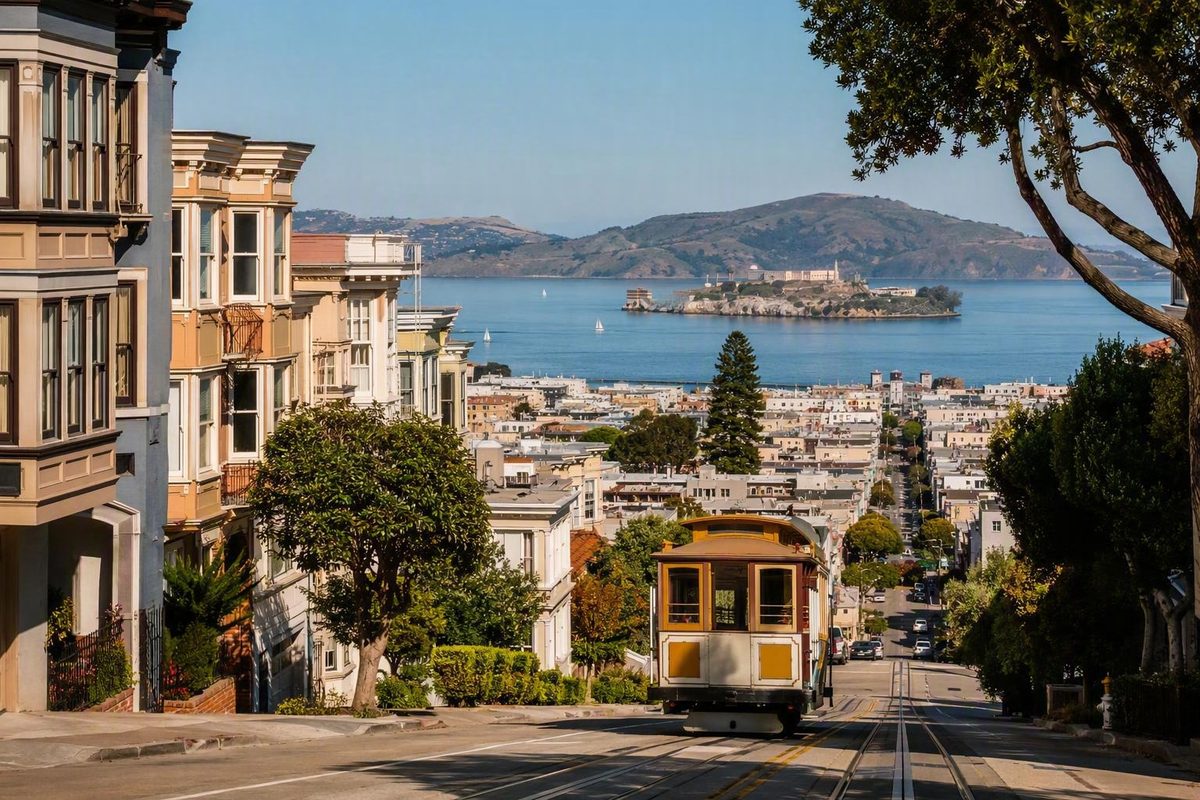
Choosing among the neighborhoods in San Francisco, California, is less about finding one “best” district than matching a base to your itinerary. Ask where you will return most often, how much climbing suits your group, which transit connections matter, and whether the area has appropriate lodging for your dates.
San Francisco works well as a series of overlapping clusters. Chinatown and North Beach make a natural pairing. The Marina, Crissy Field, and the Presidio form a waterfront outing. The Mission and Castro combine food, murals, nightlife, parks, and cultural history. A neighborhood can be rewarding to explore without being the most practical place to sleep.
This is a selective visitor guide, not a complete directory. It compares prominent areas—and several districts that receive less tourism coverage—by location, character, attractions, transit, terrain, weather exposure, and lodging practicality. It does not rank neighborhoods by safety, authenticity, affordability, residential quality, or quality of life.
Why San Francisco Neighborhood Lists Never Quite Match
San Francisco does not have one neighborhood system used consistently for every purpose. Planning maps, transportation agencies, real-estate reports, tourism guides, and everyday speech divide the city differently. A boundary that looks firm on one map may be combined, divided, or renamed on another.
Major districts can also contain smaller historical areas, commercial corridors, hilltop enclaves, or newer developments. The Western Addition may appear as a large district in one framework, while visitors are more likely to search for Alamo Square or Japantown.
The San Francisco Municipal Transportation Agency uses a transportation-oriented framework for neighborhood information, projects, and Muni service. SFMTA states that its neighborhood definitions are based on San Francisco Planning Department neighborhood-notification maps; its directory also combines some places, including Bayview/Hunters Point and Downtown/Civic Center. Review SFMTA’s neighborhood framework and map basis.
Real-estate reporting uses another system. One commonly used taxonomy divides San Francisco into 10 Realtor districts, grouping Pacific Heights with the Marina in one district and placing SoMa, Mission Bay, Potrero Hill, Dogpatch, Bernal Heights, and Yerba Buena in another. These categories organize property-market reporting; they do not establish definitive cultural or civic boundaries. See the 10 Realtor districts and their component areas.
Tourism frameworks differ again. San Francisco Travel introduces 19 major neighborhoods, but the same visitor guide acknowledges that the total depends on whom you ask and that the places it covers are not exhaustive. The figure is therefore an editorial structure for visitors, not a definitive citywide count. Compare the tourism bureau’s 19-neighborhood framework and qualification.
For trip planning, a flexible cluster model is more useful than a debate over exact borders:
- Downtown and the northeast waterfront: Union Square, the Financial District, Embarcadero, Chinatown, North Beach, and Fisherman’s Wharf
- Northern hills and waterfront: Nob Hill, Russian Hill, the Marina, Pacific Heights, and the Presidio
- Central cultural neighborhoods: Japantown, Hayes Valley, Alamo Square, Haight-Ashbury, the Castro, and the Mission
- Western park and ocean districts: Golden Gate Park, the Richmond, and the Sunset
- Southern and southeastern areas: SoMa, Mission Bay, Potrero Hill, Dogpatch, Bernal Heights, Bayview, Hunters Point, Excelsior, Glen Park, Portola, and Visitacion Valley
All geographic descriptions here are approximate. Exact blocks matter when evaluating hills, transit, nightlife, and lodging. Two properties carrying the same neighborhood label may offer very different walking routes, restaurant access, or distances to transit.
San Francisco Neighborhoods at a Glance
The table summarizes visitor tradeoffs rather than ranking neighborhoods. Lodging descriptions are deliberately conservative: substantial is used only where the supplied evidence establishes a major hotel concentration, while limited reflects documented scarcity. “Check current supply” means the available evidence does not support a comparable inventory label, not that lodging is necessarily absent.
| Neighborhood or cluster | Signature experience | Major sights or streets | Terrain and weather considerations | Lodging availability | Best reason to visit |
|---|---|---|---|---|---|
| Union Square | Downtown shopping and transit access | Union Square, nearby retail and theaters | Terrain changes toward Nob Hill; inspect the exact route | Substantial hotel concentration | Broad hotel choice and transit connections |
| Chinatown | Chinese food, markets, and historic commercial streets | Grant Avenue, Dragon Gate, dim sum, produce and herbal shops | Slopes become more pronounced toward Nob Hill and Telegraph Hill | Check current supply by address | Food, street life, and proximity to North Beach |
| North Beach | Italian-influenced cafés, restaurants, nightlife, and literary associations | Washington Square, nearby Telegraph Hill | Mixed grades; steeper toward adjoining hills | Check current supply by address | Dining, cafés, nightlife, and cultural history |
| Fisherman’s Wharf | Concentrated waterfront attractions | Pier 39, Alcatraz departure area, waterfront | Some waterfront routes are gentler than hill districts, but exact routes vary | Established visitor hotel area; compare live options | Direct access to major waterfront attractions |
| Nob Hill and Russian Hill | Cable cars, views, historic architecture, and classic streetscapes | Hilltop streets, Grace Cathedral area, nearby Lombard Street | Steep terrain; mobility and parking require planning | Nob Hill lodging is comparatively limited | Architecture, views, and a hilltop setting |
| Marina and Presidio | Waterfront recreation and park landscapes | Chestnut Street, Palace of Fine Arts, Crissy Field, bridge approaches | Waterfront conditions can be cool, exposed, or windy | More lodging in the Marina than the park; verify current supply | Waterfront walks, recreation, and bridge access |
| Pacific Heights | Residential architecture, parks, and views | Alta Plaza Park, Lyon Street Steps | Hills and stairways can be demanding | Comparatively limited | Victorian architecture and residential streets |
| Mission | Latin influence, murals, food, shopping, and nightlife | Valencia Street, Clarion Alley, Balmy Alley, Mission Dolores Park | Route length and grades vary by destination | Check current supply by address | Food, murals, nightlife, and cultural life |
| Castro | LGBTQI+ history and nightlife | Castro Street and surrounding commercial blocks | Grades vary toward adjoining hills | Check current supply by address | Cultural history and evening activity |
| Haight-Ashbury | Counterculture history and vintage shopping | Haight Street, murals, older houses, nearby parks | Rolling terrain; park distances can add up | Check current supply by address | 1960s history, vintage retail, and park access |
| Hayes Valley and Alamo Square | Dining, shopping, and architecture | Hayes Street, Alamo Square, Painted Ladies | Reaching Alamo Square may involve climbing | Alamo Square lodging is limited; compare options near Hayes Valley | Shopping, dining, and Victorian architecture |
| Japantown | Japanese American cultural landmarks and businesses | Japan Center, Peace Pagoda | Convenience depends on the exact approach and destination | Check current supply by address | Cultural history, dining, and central-city access |
| SoMa and Yerba Buena | Museums, conventions, performing arts, and entertainment | Yerba Buena Gardens, museum and convention areas | A large district with substantial variation in distance and setting | Hotel choice varies significantly by subdistrict | Museums, events, and downtown access |
| Richmond | Residential streets, park access, and western attractions | Golden Gate Park edge, routes toward the Presidio and coast | Greater fog exposure than many eastern areas; long east-west distances | Smaller major-hotel concentration than downtown | Parks, food corridors, and a western base |
| Sunset | Ocean, park, and residential San Francisco | Golden Gate Park, Ocean Beach, zoo area | Greater fog exposure than many eastern areas; cross-city distances matter | Smaller major-hotel concentration than downtown | Beach and park access |
Begin by identifying the cluster containing most of your priority sights. Downtown and the northeast waterfront provide the clearest conventional visitor bases. Northern waterfront districts suit park and bridge plans. Central neighborhoods emphasize cultural history, food, shopping, and nightlife. Western districts bring Golden Gate Park and the ocean closer but place the northeast waterfront farther away.
The table does not reveal whether a hotel entrance is uphill from transit, whether a room faces evening noise, or whether a business will be open during your trip. Use it to narrow the search, then inspect exact addresses and current conditions.
Downtown, Chinatown, North Beach, and the Northeast Waterfront
This cluster contains several of San Francisco’s most frequently visited districts, but each produces a different kind of trip.
Union Square is the city’s clearest downtown hotel hub. It combines shopping and theaters with access to Muni, BART, and cable cars. San Francisco Travel says the area contains most of the city’s major hotels, which explains its recurring role in first-visit lodging recommendations.
The tradeoff is emphasis. Union Square is useful when hotel choice and connections matter more than staying amid residential streets. Some travel writers consider it less distinctive than North Beach, the Mission, or Haight-Ashbury, but that is an opinion about atmosphere rather than an objective defect. For a short trip spanning several parts of the city, convenience may matter more.
Immediately east, the Financial District and Embarcadero combine a downtown business area with the waterfront. Depending on the exact origin and destination, available transportation can include Muni, BART, cable cars, and ferries. Do not assume that every property marketed as “Embarcadero,” “Financial District,” or “downtown” provides the same street setting or walking route.
Chinatown is associated with Grant Avenue, the Dragon Gate, Chinese restaurants and dim sum, and produce and herbal shops. The neighborhood extends beyond its most photographed entrance, so allow time for commercial side streets instead of treating the gate as a single photo stop.
Chinatown’s adjacency to North Beach makes the two easy to combine. North Beach is associated with Italian-influenced restaurants and cafés, Washington Square, nightlife, and nearby Telegraph Hill. It sits among Chinatown, Russian Hill, Telegraph Hill, and Fisherman’s Wharf, making it a useful transition point for a food-focused afternoon or evening.
A practical outing begins with the Chinatown streets and food stops that matter most, then continues toward Washington Square. From there, decide separately whether to add Telegraph Hill or the waterfront. Geographic proximity does not mean every extension is level, short, or necessary.
Fisherman’s Wharf concentrates waterfront attractions and visitor services. It provides access to Pier 39, the Alcatraz departure area, Muni, and cable cars. A commercial tour operator characterizes the district as convenient while also describing it as crowded, expensive, noisy, and tourist-oriented; those drawbacks are travel-industry opinions rather than universal conditions. See the operator’s stated access advantages and subjective tradeoffs.
The Wharf is a practical candidate when waterfront attractions dominate the trip or proximity to an Alcatraz departure is important. It may be less appealing to someone who wants nightlife or residential streets directly outside the hotel. Staying there does not require spending the whole trip there: Chinatown, North Beach, the Embarcadero, and the hill districts can remain separate outings.
Nob Hill and Russian Hill provide the sharpest terrain contrast. Both are associated with elevated views, historic architecture, cable cars, and recognizable San Francisco streetscapes. Their appeal is inseparable from their hills. A few map blocks may involve a meaningful climb, and parking can be inconvenient.
Travelers with limited mobility should examine the route between a hotel entrance and the transit stops they expect to use. A property may be close to a cable-car line on a map yet still require a demanding approach from another mode of transit.
For lodging, compare priorities rather than asking which district wins:
- Choose Union Square for the broadest documented hotel concentration and connections across the city.
- Choose Fisherman’s Wharf for immediate access to waterfront attractions and Alcatraz departures.
- Consider Nob Hill for cable cars, historic surroundings, and a hilltop setting—after checking the grade.
- Consider the Financial District or Embarcadero when downtown and waterfront access matter more than a conventional tourism center.
- Consider North Beach when dining, cafés, nightlife, and northeast-city exploration outweigh the need for a large hotel pool.
The Marina, Presidio, Pacific Heights, Japantown, and Alamo Square
Northern and north-central San Francisco suit visitors interested in waterfront scenery, parks, architecture, and a trip less centered on downtown shopping.
The Marina combines residential streets with the Chestnut Street commercial corridor, waterfront parks, the Palace of Fine Arts, and access toward the Golden Gate Bridge. Its visitor appeal is distributed rather than confined to one attraction zone: an outing might include food near Chestnut Street, time around the Palace of Fine Arts, and a walk toward Crissy Field.
The adjoining Presidio is a large park on a former military post, associated with trails, recreation, open landscapes, and a park-like environment. Its scale means that “visiting the Presidio” is not a complete plan. Choose a destination within it and decide how you will return before starting.
The Marina, Crissy Field, the Presidio, and the Golden Gate Bridge area form a logical waterfront sequence, but they do not need to become a mandatory end-to-end hike. San Francisco Know’s first-party Golden Gate waterfront walk guidance recommends treating the route as a flexible, one-direction outing with the return handled separately. That is editorial planning advice, not evidence that one route works for every traveler.
Waterfront conditions can feel cooler or windier than conditions elsewhere in the city, but no microclimate is constant. Carry a layer, keep a shorter alternative available, and research the return connection before beginning a longer walk.
Pacific Heights is primarily residential from a visitor’s perspective. Victorian architecture, views, Alta Plaza Park, and the Lyon Street Steps provide reasons to explore, but the area has fewer concentrated visitor services and lodging options than Union Square or Fisherman’s Wharf. A travel profile of northern San Francisco similarly emphasizes the Marina’s waterfront access, Pacific Heights’ residential character, and the hills around Nob Hill and Russian Hill. Compare these neighborhood characteristics in the local travel account.
Pacific Heights is a good example of a neighborhood that may work better as a focused architectural walk than as a hotel-search area. Routes designed around views and steps will not suit every traveler. Use transit for one direction, begin near a higher point when practical, or choose a compact group of blocks rather than turning the visit into a long climb.
Japantown offers a different central experience through its Japanese American cultural significance, Japan Center, and Peace Pagoda. It can be a cultural and dining destination or one stop in a broader central-city day. Because informal boundary descriptions vary, plan around the exact landmarks and businesses you want to visit rather than trying to identify a universally accepted edge.
Alamo Square is known for Victorian architecture and the Painted Ladies facing the park on Steiner Street. The view is a familiar reason to visit, but lodging immediately around the square is relatively limited. Searching more broadly near Hayes Valley or the Western Addition may produce additional options while keeping the park within reach.
This cluster reinforces the distinction between where to explore and where to stay. Pacific Heights and Alamo Square reward focused visits but offer less lodging than established hotel districts. Japantown occupies a central position but offers a different evening and sightseeing experience from downtown.
The Mission, Castro, Haight-Ashbury, and Hayes Valley
These central neighborhoods are commonly chosen for food, murals, nightlife, independent shopping, and cultural history rather than proximity to Pier 39 or the downtown hotel core.
The Mission is associated with Latin influence, Mexican food, Valencia Street, Clarion Alley, Balmy Alley, and Mission Dolores Park. It rewards a plan based on streets and public spaces rather than a checklist of monumental sights. Valencia Street can anchor shopping and dining, while the mural alleys add a distinct visual focus.
San Francisco Travel highlights Clarion and Balmy alleys in its visitor guidance on public art. Avoid building the day around a supposedly definitive “best” restaurant, burrito, bar, or shop, however. Quality is subjective, and operating hours or business status may change. Save several current options near your route and verify them shortly before visiting.
Mission Dolores Park provides an outdoor counterpoint to the commercial streets and murals. The Mission is extensive enough that combining distant stops can lengthen the day considerably. Select a compact group of destinations rather than assuming the whole district functions as one short walk.
The Castro is historically associated with LGBTQI+ culture and is frequently presented in visitor guides as a nightlife district.
One framework is to begin in the Mission with murals, food, and Valencia Street, pause at Mission Dolores Park, and continue toward the Castro for cultural landmarks or evening activity. Whether to walk every segment depends on distance, grade, energy, mobility, and the hour. Transit can replace part of the route when the day is already long.
The Haight-Ashbury area is associated with 1960s counterculture, vintage shopping, murals, older houses, and proximity to Golden Gate Park and Buena Vista Park. Its commercial identity is easiest to encounter along Haight Street, while nearby residential blocks and parks offer a different experience.
The neighborhood’s relationship with Golden Gate Park makes it useful as the eastern component of a park day. Verify current shops and venues, especially if one business is the primary reason for visiting.
Hayes Valley is centrally located and commonly associated with dining and shopping. It can work as a pause between Civic Center, Alamo Square, and other central areas. The supplied visitor evidence offers less detail about Hayes Valley than it does for the Mission or Haight-Ashbury, so it is best treated here as a compact commercial neighborhood rather than assigned a broader identity.
These areas may feel more culturally distinct to a visitor than a downtown hotel zone, but that is a comparison of travel experiences—not a test of authenticity:
- The Mission offers murals, food, and nightlife, but distances and evening noise can affect the stay.
- The Castro offers cultural history and nightlife, but lodging is less concentrated than in the main hotel districts.
- Haight-Ashbury offers counterculture history and park access, but it is farther from the northeast waterfront.
- Hayes Valley offers central dining and shopping, but it has fewer major destination sights than some nearby districts.
Golden Gate Park, the Richmond, and the Sunset
Golden Gate Park is the main organizing feature. It contains the de Young Museum, Japanese Tea Garden, and California Academy of Sciences, along with other gardens, recreational spaces, and cultural sites. One travel overview describes it as a three-mile-long park, a useful reminder that “in Golden Gate Park” is not a precise location. See the park’s stated length and featured institutions.
The park can anchor a day involving Haight-Ashbury, the Richmond, or the Sunset, but trying to cover all three casually may create more walking and transit than expected. Match the neighborhood extension to the part of the park you plan to visit:
- Pair the eastern end with Haight-Ashbury.
- Use the northern edge to connect with selected parts of the Richmond.
- Use the southern edge for selected parts of the Sunset.
- Treat the far western end and oceanfront as a separate goal when time is limited.
The Richmond is a generally quieter, more residential western district with access to Golden Gate Park, routes toward the Presidio, and the coast. Because it stretches east to west, a hotel, restaurant, or park entrance described simply as “in the Richmond” may be far from another destination carrying the same label.
The Sunset is similarly broad and residential. It provides access to Golden Gate Park, Ocean Beach, and, farther south, the San Francisco Zoo area. These are meaningful advantages when western attractions lead the itinerary, but they do not translate into immediate access to Chinatown, North Beach, or Fisherman’s Wharf.
The Richmond and Sunset commonly receive more fog than many eastern neighborhoods. That is a tendency rather than a promise: a western day is not necessarily foggy, and an eastern day is not necessarily clear. Pack layers and avoid making a single distant view the only purpose of the outing.
The lodging tradeoff is between location and inventory. Some travel writers favor western districts for travelers with cars, while other visitor guides recommend minimizing car use because parking introduces additional rules, costs, and security considerations. Neither approach fits every trip.
Consider the Richmond or Sunset when Golden Gate Park, the Presidio, Ocean Beach, or a western residential setting matters more than immediate access to the northeast visitor core. If most plans involve Alcatraz departures, Chinatown dinners, and North Beach evenings, repeated cross-city journeys may outweigh the western location.
SoMa and Neighborhoods Beyond the Usual Visitor Core
The familiar visitor map overrepresents downtown and northern San Francisco. Southern and southeastern districts still belong on the mental map, even when they are not essential stops on a short first trip.
SoMa, or South of Market, is a large area south of Market Street. It includes or overlaps with smaller districts and developments such as Yerba Buena, South Park, and Rincon Hill. Assigning one atmosphere to all of SoMa is therefore misleading. A hotel near Yerba Buena can provide a different setting and itinerary from one near South Park or farther south. See the travel guide’s discussion of SoMa’s scale and subdistricts.
SoMa and Yerba Buena are associated with museums, convention facilities, performing arts, shopping, and entertainment. They may suit travelers attending an event or placing museums near the center of the trip. The practical question is not simply whether to stay “in SoMa,” but which subdistrict, block, and transit connection the property actually occupies.
Bernal Heights lies between the Mission, Bayview, and Portola areas in the supplied neighborhood compilation, with Cortland Avenue identified as a principal commercial corridor. Visitor evidence for Bernal Heights is much thinner than for the Mission or North Beach, so it is more useful here as an orientation point than as a fully developed tourism recommendation.
Bayview and Hunters Point are southeastern areas recognized in both Planning-based transportation groupings and Realtor frameworks. Third Street is associated with Bayview in the supplied neighborhood compilation. Because the available evidence does not establish current route details to publication-grade certainty, confirm transit directly with SFMTA rather than relying on a broad district summary.
Glen Park and Excelsior also appear as recognized areas in SFMTA’s transportation framework. Their inclusion demonstrates how incomplete a tourism-only map can be; it does not imply that every visitor should add them to a short itinerary. These names may matter when staying in a less-central rental, visiting friends, or traveling to a specific destination.
The Realtor taxonomy adds further geographic context. Its southern and southeastern groupings include Mission Bay, Potrero Hill, Dogpatch, Bernal Heights, SoMa, Yerba Buena, Bayview, Hunters Point, Portola, Visitacion Valley, Excelsior, and Outer Mission. This remains a property-reporting structure rather than a cultural definition. It can help readers recognize names on lodging maps without suggesting that the communities are interchangeable.
The available visitor evidence is substantially thinner for these districts than for Union Square, Fisherman’s Wharf, the Marina, or the Mission. That gap is a reason to keep the discussion precise. Avoid neighborhood-wide judgments—especially generalized safety claims—when practical conditions depend on the exact destination, block, time, and transportation plan.
How to Choose a Base and Build a Hill-Smart, Car-Free Plan
Start with the places you expect to revisit, not the neighborhood that looks most attractive in photographs. A scenic district can become inconvenient if every morning requires a long connection and every evening ends with a steep climb.
Evaluate each possible property using five factors:
- Repeated destinations: Which neighborhoods or attractions will you visit more than once?
- Transit access: Which modes connect the exact address to those destinations?
- Terrain: Is the hotel uphill from the stop you will use at the end of the day?
- Lodging supply: Does the area have appropriate properties for your dates and needs?
- Evening setting: Do you want activity outside the hotel or a quieter return?
The main visitor-base tradeoffs are:
- Union Square: the strongest documented concentration of major hotels, with access to Muni, BART, and cable cars.
- Fisherman’s Wharf: direct access to waterfront attractions and Alcatraz departures within a concentrated visitor district.
- Nob Hill: cable cars, historic architecture, and a hilltop setting, balanced against steep grades and comparatively limited lodging.
- Marina: waterfront parks and access toward the Presidio and bridge, with different transit connections from downtown and more exposure to wind.
- Financial District/Embarcadero: useful downtown and waterfront connections, with convenience and atmosphere varying by block.
- Mission, Castro, Haight-Ashbury, or Hayes Valley: closer to particular cultural and evening experiences, but without Union Square’s documented hotel concentration.
Appealing areas such as Alamo Square and Pacific Heights may have limited lodging. That does not diminish their value as places to explore. It means that a nearby or transit-connected base may offer a better combination of choice and access.
Always inspect the property’s exact map position. Booking platforms and travel writers may apply neighborhood labels imprecisely, and conditions can change within a few blocks. One lodging guide specifically warns readers not to rely only on the neighborhood name assigned by a booking platform. Read the guide’s address-checking caveat.
A car-free trip can combine Muni buses and rail, BART, cable cars, ferries, walking, and occasional rideshares. No single combination suits every itinerary or mobility requirement. BART helps with selected regional and city connections; Muni reaches many neighborhoods; cable cars can be both transportation and an experience; ferries serve particular waterfront journeys. Walking fills gaps, but distance and grade should influence the choice.
San Francisco Know’s first-party editorial approach recommends grouping stops by elevation, using transit for steep segments, and avoiding unnecessary out-and-back climbs. These are planning suggestions rather than proven outcomes. Use them as a review tool: if a proposed day repeatedly descends and climbs the same hill, consider changing the stop order or replacing one segment with transit.
Three simple frameworks illustrate the method:
Chinatown plus North Beach: Begin with the Chinatown streets or food stops that matter most, continue into North Beach, and decide separately whether to add Telegraph Hill or the waterfront. The logic is adjacency and complementary food traditions, not an obligation to walk every hill.
Marina plus Crissy Field and the Presidio: Start near the Marina or Palace of Fine Arts, follow the waterfront west, and choose a flexible endpoint. Plan the return independently so weather or fatigue does not require retracing the entire route.
Mission plus Castro: Combine selected murals, Valencia Street, Mission Dolores Park, and Castro landmarks or nightlife. Use transit when the total distance, grade, evening hour, or group mobility makes further walking impractical.
If you bring a car, research current parking restrictions, garage arrangements, street-cleaning rules, and prices for your exact dates. Forum contributors repeatedly advise leaving nothing visible or valuable in a parked vehicle and not moving belongings into the trunk after parking; treat that as anecdotal travel guidance rather than citywide crime evidence. Review the forum’s vehicle-security advice and conflicting neighborhood opinions.
Before booking, ask:
- Which attractions or neighborhoods will I revisit?
- How many cross-city journeys would this base create?
- What is the grade between the hotel and nearby transit?
- Does anyone need step-free or lower-exertion routes?
- Do I want restaurants and nightlife nearby or quieter evenings?
- Am I comfortable with greater wind, fog, or waterfront exposure?
- Does the area have suitable lodging for my dates?
- Is the property actually where its neighborhood label suggests?
- Have I checked current transit details and time-sensitive businesses?
- If driving, have I confirmed parking rules and a storage plan?
There is no universally best San Francisco neighborhood. Choose a base according to repeated destinations, transit needs, hill tolerance, mobility, evening preferences, and actual lodging availability. Then explore in adjacent clusters: Chinatown with North Beach, the Marina with the Presidio, or the Mission with the Castro. Verify exact addresses, current transit details, parking rules, and business hours before departure.
How many neighborhoods are there in San Francisco?
There is no single definitive count. San Francisco Travel organizes its visitor material around 19 major neighborhoods, while the real-estate taxonomy discussed above uses 10 broad Realtor districts. Smaller historical areas, developments, overlapping districts, and colloquial names produce still more possibilities.
The answer depends on purpose. Use Planning-based or SFMTA maps for administrative and transportation orientation, Realtor districts for property reporting, and tourism guides for trip planning. Do not assume that those systems have interchangeable boundaries.
Which San Francisco neighborhood is most convenient for a first-time visitor?
Union Square is often the most broadly practical conventional hotel base because it has a substantial hotel concentration and access to Muni, BART, and cable cars. Fisherman’s Wharf may be more practical when Pier 39, Alcatraz departures, and waterfront attractions dominate the itinerary.
Neither is universally preferable. Nob Hill offers a classic hilltop setting but steeper terrain. The Marina suits waterfront and Presidio plans but has different transit and weather tradeoffs. Choose the area that reduces repeated travel to your own priority sights.
Can visitors explore San Francisco without renting a car?
Many visitors can combine Muni, BART, cable cars, ferries, walking, and occasional rideshares. Whether that works comfortably depends on the itinerary, lodging address, hill tolerance, mobility requirements, and any destinations outside the city.
A car may be useful for a broader regional trip, but it also introduces parking rules, costs, and vehicle-security considerations. If you rent one, confirm the lodging’s parking arrangements and do not treat the vehicle as luggage storage.
Which neighborhoods have the steepest walking or most noticeable weather tradeoffs?
Nob Hill and Russian Hill have especially noticeable steep streets. Even nearby sights may justify a transit segment when grade rather than distance is the limiting factor.
The Richmond and Sunset commonly experience more fog than many eastern neighborhoods. The Marina, Crissy Field, and Presidio waterfront can feel cooler or windier. These are tendencies, not guarantees, so layers and flexible plans are more useful than assumptions.
Which San Francisco neighborhoods are safest for tourists?
The supplied visitor evidence does not provide consistent, current data that supports ranking entire neighborhoods by safety. Travel writers and forum contributors disagree, often without a shared method, and practical conditions can vary by block, time, transportation choice, and current circumstances.
Instead of choosing a hotel from a generalized “safest neighborhood” list, inspect the exact address, recent official guidance, late-night transportation options, property access, and the route between the hotel and transit. Apply ordinary urban precautions. Forum advice about leaving nothing visible in a parked vehicle is practical but anecdotal, not a substitute for official or citywide safety data.