
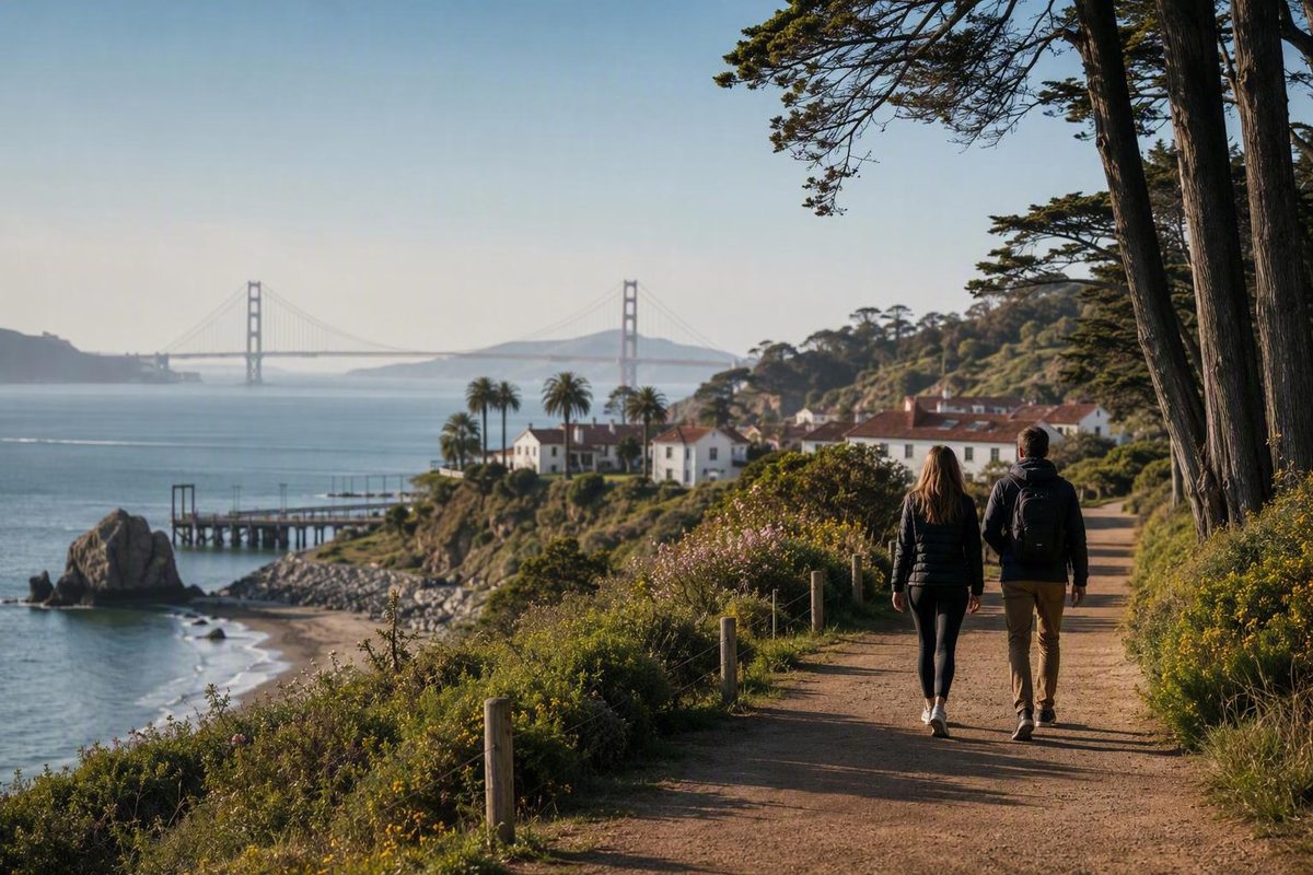
The Presidio is easier to enjoy once you stop treating it as a single attraction. This broad national park site includes waterfront paths, beaches, former military buildings, museums, forests, lawns, playgrounds, public art, viewpoints, businesses, and visitor services.
For a first visit, use the Presidio Visitor Center, Presidio Transit Center, and Presidio Tunnel Tops as your hub. Explore that central area, choose either the Main Post or Crissy Field as your primary cluster, and add no more than one separate destination if time and energy allow. You will see less on paper but spend more of the day enjoying the landscape instead of backtracking.
First, Is the Presidio Actually a National Park?
The Presidio is a national park site within Golden Gate National Recreation Area, not a standalone congressionally designated national park. “Presidio National Park San Francisco” is common visitor shorthand, but it simplifies the site’s administrative status.
The Presidio occupies the northern end of the San Francisco Peninsula beside the southern end of the Golden Gate Bridge. It is both a protected public landscape and a former military post whose buildings, fortifications, roads, forests, and open spaces contribute to its identity as a National Historic Landmark District.
The stewardship structure also differs from what visitors may expect at a conventional national park. The Presidio Trust manages the Presidio, while the National Park Service and Golden Gate National Parks Conservancy participate in stewardship, interpretation, visitor programs, and park projects. The National Park Service’s Presidio page identifies the Presidio Trust as the manager and directs visitors to Presidio.gov for trip planning; Presidio visitor information describes the broader three-organization partnership.
Because responsibilities are distributed, practical information appears on several official and partner websites. Presidio.gov may cover transportation or Tunnel Tops, while National Park Service pages cover Fort Point and federal accessibility resources.
Presidio quick facts
- Status: A national park site within Golden Gate National Recreation Area, not a standalone national park.
- Setting: San Francisco’s northern edge beside the Golden Gate Bridge.
- Character: Public parkland, former military post, National Historic Landmark District, cultural destination, and active community.
- General access: The broader Presidio is reported as open 24 hours a day, but buildings, attractions, programs, parking areas, and services have separate schedules.
- Tunnel Tops admission: Presidio Tunnel Tops is specifically documented as free.
- Possible costs: Parking, museums, food, lodging, camping, golf, and ticketed activities may have separate charges or requirements.
- Planning rule: Check the page belonging to the facility, service, or operator you intend to use.
The Golden Gate National Parks Conservancy’s Presidio overview supports both the reported 24-hour general access and the separate daily schedule for the Visitor Center. Treat those as different facts: access to the wider landscape does not mean that Fort Point, a museum, restaurant, campground, or visitor facility is open.
The same distinction applies to fees. Tunnel Tops is documented as free, but the available evidence does not establish that every Presidio destination or service is free. Verify parking charges, admission, reservations, and other costs directly rather than building a plan around an assumption of universal free access.
Use the Visitor Center and Tunnel Tops as Your Starting Hub
For most first-time visitors, the most practical starting point is the Presidio Visitor Center at 210 Lincoln Boulevard. The center is listed as open daily from 10 a.m. to 5 p.m., but its same-day schedule should be confirmed before departure.
Three useful pieces of visitor infrastructure sit together:
- Presidio Visitor Center, for orientation and current advice.
- Presidio Transit Center, for arrivals and transfers.
- Presidio Tunnel Tops, for views, lawns, family activities, picnicking, and access toward Crissy Field.
Their proximity makes this area a decision point rather than simply another attraction. You can arrive without committing to a rigid full-day route, assess conditions, and then decide whether to remain around the Main Post, descend toward the waterfront, or take transit elsewhere.
Presidio Tunnel Tops is a free, accessible 14-acre outdoor space built over the Presidio Parkway tunnels. It reconnects the historic interior of the Presidio with Crissy Field below. Supported features include lawns, gardens, picnic areas, Golden Gate Bridge views, the Outpost nature playground, and the Field Station. The City and County of San Francisco’s Presidio itinerary places the Visitor Center beside the Transit Center and Tunnel Tops and identifies these principal features.
Families may find that the Outpost provides enough activity to make Tunnel Tops the center of a visit rather than a stop on the way elsewhere. Visitors without children can use the same area for a picnic, an orientation walk, or a relaxed look at the relationship between the Main Post and the bay.
Tunnel Tops is also a practical choice for anyone who wants scenery without immediately committing to a long trail or remote beach. Its lawns and overlooks give you space to pause and decide whether the waterfront portion of your plan still suits the weather, available time, and your group’s energy.
Documented accessibility at the Visitor Center and Tunnel Tops should not be generalized to the entire Presidio. A route that begins at an accessible facility may later encounter a grade, trail surface, beach approach, historic doorway, or transportation connection that does not meet your needs. Confirm the complete route, including the return.
From the hub, make one of three choices:
- Go toward Crissy Field and Fort Point if the waterfront, marsh, bay, and bridge are your priorities.
- Remain around Tunnel Tops and the Main Post for family play, lawns, picnicking, historic surroundings, or nearby cultural attractions.
- Use transit to a separate destination if Baker Beach, a western coastal area, golf, or a museum is the main purpose of your visit.
Physical separation, terrain, facility hours, and different access points can turn an ambitious checklist into a day dominated by movement.
Choose Sights by Area, Not From One Long Checklist
Think of the Presidio as several possible experiences sharing one landscape. Choose a geographic cluster first, then decide which attractions within it deserve your time.
Cluster 1: Visitor Center, Tunnel Tops, and Main Post
Choose this cluster for the simplest introduction. Begin at the Visitor Center if it is open, explore Tunnel Tops, and then spend time on the lawns or in the Main Post’s historic surroundings.
This cluster offers a useful mix of outdoor scenery, family play, military history, public space, food options, and access to cultural attractions. It is comparatively concentrated, but dining operations, museums, vendors, and programs may follow different schedules. Confirm any attraction that will determine the order of your day.
Cluster 2: Crissy Field and Fort Point
Choose Crissy Field for waterfront recreation, bay and bridge views, and access to Crissy Marsh. Birdwatchers may prefer to spend time around the marsh rather than treating it merely as a passage toward the bridge.
Fort Point provides a separate historical experience beneath the Golden Gate Bridge. The National Park Service interprets the fort through the history of the Civil War on the West Coast and the defense of the bay entrance. It has its own operating schedule, so check whether it will be open before making the walk part of your plan.
Do not automatically add Fort Point simply because you are visiting Crissy Field. Include it only when its schedule, your pace, and your return plan support the extension. A slower visit to the marsh, shore, and bridge views may be more rewarding than rushing through every nearby landmark.
Cluster 3: Golden Gate Bridge Area and Viewpoints
There is no universally best bridge viewpoint. Each setting creates a different experience:
- Golden Gate Bridge welcome area: A close approach to the bridge and bridge-oriented visitor facilities.
- Fort Point: A low perspective beneath the bridge combined with military history.
- Torpedo Wharf: A waterfront angle from the Crissy Field side.
- Crissy Field: Broad bay and bridge views with room to pause or recreate.
- Baker Beach: A western coastal setting with a different relationship to the bridge and shoreline.
Choose according to your route, mobility, weather, available time, and whether you want a beach, historic structure, waterfront walk, or direct bridge approach. These viewpoints are distinct destinations, not components of one compact stop.
Cluster 4: Baker Beach and the Western Coastal Areas
Baker Beach is better treated as a separate western destination than as an automatic extension of a Tunnel Tops itinerary. Its documented amenities include picnic tables, grills, restrooms, coastal-trail access, and Golden Gate Bridge views.
This cluster makes sense when the beach or western coast is a principal goal. It is less efficient as a spontaneous detour after a full Main Post and Crissy Field visit. Consider Muni or an internal shuttle rather than assuming every connection should be walked.
Before visiting, check current access conditions, closures, posted hazards, and advisories. The existence of a beach does not establish that swimming is safe or appropriate.
Cluster 5: History, Art, and Culture
The Main Post and Officers’ Club area provide a way to focus on the Presidio’s military and civic history.
The Presidio also includes four named Andy Goldsworthy works: Spire, Wood Line, Tree Fall, and Earth Wall. Their locations mean they should not automatically be combined with Tunnel Tops, Fort Point, and a beach in one short visit. Select one or two based on current access, or make public art the organizing theme of a return trip.
Other specialized choices include:
- Birdwatching at Crissy Marsh, El Polín Spring, or Mountain Lake
- Golf
- Lodging in the Presidio
- Rob Hill Campground
- Coastal trails and forest walks
- Picnicking
- Cycling
- Events and ranger programs
These are customization options, not obligations for a first day. Current availability, prices, opening dates, and reservations should be confirmed with the relevant operator.
| Destination | Primary appeal | Family suitability | Nearby amenities | Documented accessibility | Useful transit | Verify before going |
|---|---|---|---|---|---|---|
| Tunnel Tops | Lawns, picnics, bridge views, play, orientation | Strong option because of the Outpost, Field Station, and open space | Visitor Center, Transit Center, picnic areas | Described as accessible; Cliff Walk is described as wheelchair friendly | Muni 43 or Presidio GO to the Transit Center | Facility hours, events, food, group-picnic rules |
| Crissy Field | Waterfront recreation, marsh, bay and bridge views | Good for outdoor time when conditions and distance suit the group | Amenities vary by exact location | Continuous step-free access across every connection is not established | Muni 30 | Stops, closures, amenities, advisories |
| Fort Point | Historic fort, bridge setting, West Coast Civil War interpretation | Best suited to families interested in history | More limited than the central hub | Confirm access within the historic structure | Use a current trip planner for the bridge or Crissy Field area and final approach | Hours, closures, programs |
| Baker Beach | Beach, coastal setting, bridge views | Suitable for a beach-focused outing with appropriate supervision | Picnic tables, grills, restrooms, coastal-trail access | Accessibility of the complete beach route is not established | Muni 29 | Access rules, hazards, advisories, restrooms, parking |
The table is a selection tool, not a ranking. Tunnel Tops is generally the simplest place to orient yourself; Crissy Field suits a waterfront day; Fort Point adds focused history; and Baker Beach works better as a deliberate western destination.
Flexible Presidio Itineraries for Two Hours, Half a Day, or a Full Day
These are editorial planning frameworks, not guaranteed schedules. Your pace will depend on mobility, children, photography stops, weather, facility hours, transit waits, and temporary closures.
A successful first visit may consist of one coherent cluster and one optional extension. Do not measure the day solely by the number of attractions completed.
Two-hour core visit
Start at the Visitor Center and Presidio Transit Center. If the Visitor Center is open, collect a map and ask about same-day closures or programs. Then explore Tunnel Tops, including its viewpoints, lawns, and whichever play or interpretive features interest you.
If time and energy remain, continue toward one nearby waterfront viewpoint. Set a turnaround time before descending, or finish near a useful transit stop rather than retracing the entire route.
Two hours is a reasonable editorial allowance for this focused introduction, but it is not an official duration or a promise that every feature will be open. It is not enough for the central hub, western beaches, museums, Fort Point, and multiple trails.
Half-day waterfront plan
Begin at the Visitor Center, cross Tunnel Tops, and continue toward Crissy Field. Pause at the marsh or shoreline instead of treating the waterfront only as a route to the bridge.
Add Fort Point or another bridge viewpoint only if:
- The destination is open or accessible.
- Your group has enough energy for the extension.
- The return plan will not require rushed backtracking.
A one-direction structure may be more comfortable than forcing a loop. Choose a turnaround time, a landmark where you will reassess, or a transit stop that can serve as the finish.
Half-day family plan
Keep the focus on Tunnel Tops rather than attempting several dispersed coastal destinations. A straightforward family visit might include:
- The Outpost nature playground
- The Field Station, if open
- Lawns and bridge views
- A picnic
- A short exploratory walk
- Time in the Visitor Center
This leaves room for children to engage with the place rather than moving continuously between adult-oriented landmarks. It also makes it easier to stop if weather, hunger, or energy changes. Larger gatherings should verify whether the intended picnic area requires a reservation.
Half-day history and culture plan
Begin with the Visitor Center’s introduction to the Presidio’s natural, cultural, and military history. Continue through the Main Post, then choose one or two additions:
- Officers’ Club area
- Fort Point
- Selected public art
- Walt Disney Family Museum
Set the order according to hours and ticket requirements. If a museum has timed entry or a historic site closes before the wider grounds, anchor the itinerary around that commitment rather than assuming you can return after a long waterfront detour.
For a mostly outdoor history day, combine the Main Post with Fort Point or selected artworks. For an indoor-outdoor visit, pair the central historic surroundings with one museum.
Full-day first visit
Use the Visitor Center–Tunnel Tops–Crissy Field area as the first cluster. Begin with orientation, spend the morning around Tunnel Tops, and then continue either toward the waterfront or into the Main Post. Bring a picnic or confirm food options in advance so the day does not depend on finding a vendor at the moment you become hungry.
After lunch, reassess. If the group still has time and energy, use transit or an internal shuttle to reach one separate destination, such as Baker Beach. This is usually more efficient than turning the day into one enormous walking loop.
A workable structure is:
- Visitor Center orientation
- Tunnel Tops
- Crissy Field or Main Post
- Lunch or picnic
- Transit to one separate destination
- Return by transit rather than retracing the complete route
Choose the second destination according to interest. Baker Beach supports a coastal day; a museum supports a cultural day; the bridge area supports a landmark-focused visit; and an art, forest, or birdwatching destination creates a quieter outdoor plan.
Outdoor variation
Pair one coastal trail or beach with Tunnel Tops and Crissy Field. Select the route only after checking current access and whether its grade and surface suit your group. Avoid relying on unverified distance or difficulty estimates.
The trail or beach should be the day’s main extension, not one item among museums, Fort Point, playgrounds, golf, and multiple bridge viewpoints.
Use an exit rule
Before the longest walking portion, choose one of the following:
- A fixed turnaround time
- A landmark where the group will reassess
- A transit stop that can become the finish
- A minimum reserve of time and energy for the return
Keep the return journey separate from the scenic walk when that reduces retracing. Carry water, wear comfortable shoes, keep your bag light, and bring an extra layer for changing waterfront conditions.
How to Reach the Presidio Without a Car
A car-free visit is practical using Presidio GO, San Francisco Muni, walking, or cycling. The main caution is that routes, schedules, stops, fare policies, and rider restrictions can change.
The Presidio GO Downtown Route serves the Transbay Terminal, the Embarcadero BART area, and Van Ness Avenue at Union Street before reaching Presidio Transit Center. The Transit Center is beside the Visitor Center and Tunnel Tops, and riders can transfer there to service for other parts of the park.
Official Presidio information describes Presidio GO as a free shuttle, but some weekday Downtown Route trips may be restricted to Presidio residents and tenants. Check the eligibility and fare notes for the exact departure you intend to use rather than assuming every listed trip is available to every visitor. The official Presidio public-transit guide provides current planning links, downtown pickup locations, transfer information, regional connections, and destination-based Muni guidance.
Choose Muni by destination
| Destination | Primary Muni route | Planning note |
|---|---|---|
| Presidio Visitor Center and Tunnel Tops | 43 | Useful for arriving at the central hub |
| Crissy Field | 30 | Choose this when the waterfront is your starting area |
| Baker Beach | 29 | Useful for a beach-first or western Presidio visit |
| Golden Gate Bridge area | 28 | Serves the bridge area; verify the final approach to any separate destination |
| Southern Presidio gates | 1 | Secondary option requiring a walk into the Presidio |
| Outside Lombard Gate | 45 | Secondary option requiring a walk from the gate area |
These route numbers identify likely services, not guaranteed same-day routing. Use a live trip planner before departure.
Arriving from elsewhere in the Bay Area
From the East Bay: Connect through Embarcadero BART, the Transbay Terminal, or the Ferry Building area, then transfer to Presidio GO, Muni, or another current connection.
From the North Bay: Golden Gate Transit serves locations near the Golden Gate Bridge area and other Presidio-adjacent stops. Confirm how far the arrival point is from your intended cluster.
From the South Bay: Reach downtown San Francisco by Caltrain, SamTrans, or BART, then transfer to Presidio GO or Muni.
Walking and cycling can form part of a car-free trip without covering the entire day. A mixed plan—transit to the Visitor Center, walking through Tunnel Tops and Crissy Field, then transit back—often conserves time and energy.
Presidio GO shuttles are documented as having wheelchair ramps and bicycle racks, but that does not guarantee capacity on a particular vehicle or continuous accessible travel after arrival. The National Park Service transportation page documents those vehicle features; because its displayed timetable was updated in 2023, use current Presidio GO and Muni information for schedules.
On the day of travel, check:
- Presidio GO’s live schedule, fare terms, and rider restrictions
- Current Muni routes, stops, and service alerts
- 511 regional information
- A current mapping application
- The final return departure as well as the outbound trip
Planning the return first is especially useful when finishing at Baker Beach, the bridge area, or another destination away from the central Transit Center.
Driving, Parking, Cycling, and Accessibility
Paid parking is available across from the Visitor Center and near Tunnel Tops. Prices, time limits, payment procedures, and overnight rules can change, so follow current signs and official parking information.
The Golden Gate National Parks Conservancy advises that parking near Tunnel Tops can fill quickly on weekends. That is practical partner guidance, not a guarantee about availability at a specific time. If your schedule is inflexible, transit reduces the risk that finding a space becomes a major part of the visit.
ADA parking is documented near Tunnel Tops entrances. Bike racks and lockers are also available at or near Tunnel Tops, and bike-share rentals have been offered near Presidio Transit Center. Muni and Presidio GO vehicles have bicycle racks, although space cannot be guaranteed. These parking, cycling, and access features are summarized in the Conservancy’s Tunnel Tops transportation guide.
The strongest documented accessibility information applies to specific facilities and services:
- The Presidio Visitor Center is described as ADA accessible.
- Tunnel Tops is described as accessible.
- The Cliff Walk at Tunnel Tops is described as wheelchair friendly.
- Accessible parking is provided near Tunnel Tops entrances.
- Presidio GO shuttles have wheelchair ramps.
These claims do not establish continuous step-free access across every trail, beach, overlook, museum, historic building, or connection. Historic structures can present different constraints from modern outdoor spaces, and a beach approach may involve surfaces unlike those at the central hub.
Visitors with specific mobility, sensory, or other access requirements should consult current Presidio information and the accessibility resources linked from the National Park Service’s Presidio page. Ask route-level questions: Where is the accessible entrance? Is the entire connection step-free? What surface and grade should you expect? Are accessible restrooms available? What is the return option if a shuttle or facility is unavailable?
If hills, distance, or energy are concerns, choose one geographic cluster. The Visitor Center, Tunnel Tops, and Main Post offer a flexible central option, while Crissy Field provides a waterfront-focused alternative. Use transit between distant areas rather than assuming that crossing the entire Presidio on foot will be comfortable.
A Short History of the Presidio and Its Changing Role
The Presidio’s history does not begin with its military buildings. The land at the Golden Gate is identified as traditional territory of the Yelamu, associated with the Ramaytush Ohlone peoples.
A Spanish fortification was established in 1776, and the post later passed under Mexican and United States control.
The former United States Army installation transferred to the National Park Service in 1994. Congress created the Presidio Trust in 1996, producing the modern structure in which the Trust, National Park Service, and Golden Gate National Parks Conservancy have distinct or overlapping roles. The 1776 and 1994 milestones are documented by the Presidio’s park partner; the historical chronology of the Presidio also summarizes the 1996 creation of the Trust and the site’s historic designations.
Today, the Presidio is both part of Golden Gate National Recreation Area and a National Historic Landmark District. Visitors are moving through a landscape where Indigenous history, military infrastructure, natural systems, adaptive reuse, recreation, homes, workplaces, and cultural institutions coexist.
Tunnel Tops represents a recent stage in that evolution. Opened in 2022, the 14-acre landscape was built over the Presidio Parkway tunnels and reconnects the historic interior with Crissy Field. Its lawns, paths, overlooks, family spaces, and educational features transformed transportation infrastructure into public parkland. Visit California’s account of the Tunnel Tops project documents the opening, size, connection, accessible Cliff Walk, Outpost, and Field Station.
These layers explain why the Presidio does not feel like a single-purpose park. Coastal defenses coexist with beaches and trails. A contemporary park crosses roadway tunnels. Recognizing those layers makes even a short walk through the Main Post or toward Fort Point more meaningful.
What to Verify Before You Leave
Some facts are relatively stable: the Presidio’s location beside the Golden Gate Bridge, its status within Golden Gate National Recreation Area, its layered military landscape, and the usefulness of the Visitor Center–Transit Center–Tunnel Tops hub.
Operational details are more volatile. Schedules, vendors, closures, parking rules, tickets, transit restrictions, and reservations can change. Concentrate your checks on the details that could disrupt your chosen cluster.
Pre-departure checklist
- Presidio GO: Check the timetable, stop locations, fare terms, final departures, service alerts, and any rider restrictions.
- Muni: Confirm the route, stop, direction, service alerts, and return connection.
- Roads and trails: Look for closures, construction, event restrictions, or changed access.
- Parking: Review current charges, time limits, payment rules, accessible-space locations, and posted restrictions.
- Visitor Center: Verify same-day hours even though it is listed as open from 10 a.m. to 5 p.m.
- Fort Point: Check its schedule independently; wider Presidio access does not determine when the fort is open.
- Museums and cultural attractions: Confirm opening days, admission, timed tickets, and entry procedures.
- Food: Check current restaurants, cafés, and vendors, or bring a picnic that does not depend on vendor availability.
- Events: Review event schedules and possible effects on roads, parking, or access.
- Rob Hill Campground: Verify current operating dates, availability, reservation procedures, fees, and rules.
- Beaches: Check access conditions, closures, hazards, and advisories.
- Accessibility: Confirm the complete route, including transit or parking, entrances, surfaces, grades, restrooms, and the return.
Fee language deserves particular care. Tunnel Tops is documented as free, but the evidence does not support saying that every attraction, parking area, museum, activity, or service in the Presidio is free. Confirm costs before adding parking, golf, lodging, camping, food, museums, or ticketed programs.
Likewise, reported 24-hour access to the broader Presidio does not override facility schedules. Check the Visitor Center and Fort Point independently and apply the same principle to museums, restaurants, shops, campgrounds, and scheduled programs.
Beach visitors should not infer swimming conditions from a general destination description. Check current hazards, access rules, and advisories, then follow posted instructions on arrival.
Campers should verify Rob Hill Campground directly. A general description of its facilities does not establish that it is operating, that a campsite is available, or that an older fee or reservation process remains current.
For park-wide updates, use Presidio.gov’s current visitor information. Use National Park Service pages for federal sites and accessibility resources, and consult transportation operators for live service. Museums, lodging, golf, food, and other independently operated services should be checked with the relevant operator.
Frequently Asked Questions
Is the Presidio a standalone national park?
No. The Presidio is a national park site within Golden Gate National Recreation Area, not a standalone congressionally designated national park. It is also a National Historic Landmark District and a former military post.
Calling it “Presidio National Park” is understandable shorthand, but it can obscure the shared stewardship structure and the fact that different facilities follow different schedules and operating arrangements.
Is it free to visit the Presidio?
Presidio Tunnel Tops is specifically documented as free. The available evidence does not establish that every other Presidio attraction, activity, parking area, or service is free.
Check current prices and reservation requirements for parking, museums, golf, food, lodging, camping, and ticketed programs. General access to the wider landscape also does not guarantee entry to a closed or ticketed building.
How much time should a first-time visitor allow for the Presidio?
As a planning rule, allow about two hours for a focused introduction around the Visitor Center, Tunnel Tops, and one nearby viewpoint. A half day is more comfortable for Tunnel Tops plus Crissy Field, a family visit, or a selected history-and-culture plan.
A full day allows for one central cluster, a meal or picnic, and one separate destination reached by transit. These are editorial frameworks rather than official durations; your pace will depend on mobility, stops, weather, transit, closures, and facility hours.
Can I visit the Presidio without a car?
Yes. Presidio GO, Muni, walking, and cycling make a car-free visit practical. Presidio GO connects downtown pickup points with Presidio Transit Center, while Muni routes serve the central hub, Crissy Field, Baker Beach, and the Golden Gate Bridge area.
Check live schedules, fare terms, and eligibility restrictions before departure. Some weekday Presidio GO trips may be limited to residents and tenants.
What is the best place to start a Presidio visit?
For most first-time visitors, start at the Presidio Visitor Center at 210 Lincoln Boulevard. It is beside Presidio Transit Center and Tunnel Tops, allowing you to obtain current guidance and then choose between the Main Post, Crissy Field, or transit to another destination.
That hub provides flexibility without requiring a car or committing immediately to a long walk.
The simplest first-visit strategy is also the most resilient: begin at the Visitor Center and Tunnel Tops, choose either the waterfront cluster or one separate destination, and use transit instead of forcing the dispersed Presidio into a single walking loop. The location, national-park identity, history, scenery, and central hub are stable; schedules, fees, parking, vendors, closures, and reservations should always be checked shortly before departure.