
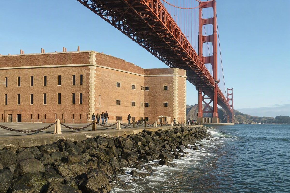
Fort Point is the brick fort directly beneath the Golden Gate Bridge’s south end—not the bridge plaza above it and not the coastal trail at Lands End. The best plan is to treat the fort as the anchor of a compact Presidio waterfront outing, with the bridge plaza or Crissy Field as an optional extension rather than a required loop.
Check the opening day before building your route
The fort is currently open Thursday through Monday, 10 a.m. to 5 p.m.; roof access closes at 4:30 p.m. It is closed on Thanksgiving, Christmas and New Year’s Day. The exterior remains accessible seven days a week, but arriving Tuesday or Wednesday means missing the historic interior (National Park Service hours).
Admission is free and no entrance pass is required for a standard visit (NPS fees and passes). Special programs are different: the NPS says its ticketed Candlelight Tour must be booked online, while short ranger talks are offered on days the fort is open (NPS ranger programs). Check the park calendar rather than assuming a program will fit your arrival.
Allow about two hours if the fort is your main stop. That leaves room to explore the casemates and exhibits, look up through the bridge structure and reach the roof before its earlier closing time. The NPS itself suggests allowing at least a few hours when adding the surrounding Golden Gate shoreline (NPS visit planner).
Choose the approach that fits your walking capacity
Transit: bus to the bridge plaza, then walk down
Muni’s 28 19th Avenue runs between Daly City BART and Fisherman’s Wharf and passes through the Golden Gate Bridge toll plaza (SFMTA route 28). From the plaza, follow signs northeast toward Fort Point at the base of the bluffs. Remember that the descent becomes an uphill return; a short map distance does not make this an effortless stop. This approach works especially well if you also intend to walk part of the Golden Gate Bridge.
There is no direct Presidio shuttle to the fort. If minimizing transfers matters more than minimizing walking, use a live trip planner for the 28 and treat Fort Point as an out-and-back from the bridge plaza rather than trying to force it into a larger Presidio loop.
Waterfront walk: approach from Crissy Field
For a more coherent walking day, approach along the waterfront from Crissy Field and return the same way, or continue only if you have already settled the climb and transit plan at the bridge plaza. This keeps the bay and bridge in view and avoids stitching together unrelated Presidio sights. The broader Golden Gate Promenade route is useful if the walk, rather than the fort, is your main event.
Driving or drop-off: use Marine Drive
Fort Point is at the end of Marine Drive. NPS lists parking as free, limited and first come, first served, with accessible spaces available (NPS directions). Do not plan around finding a space at a particular time.
A current NPS caution dated August 24, 2026, tells drivers to remove valuables and take wallets, bags, keys, phones and electronics with them before leaving the vehicle (NPS alerts and conditions). An empty-looking car is the sensible baseline, not a trunk packed after arrival.
A simple route inside the fort
- Start on the accessible ground floor. Use the exhibits and casemates to understand why the fort guarded the entrance to San Francisco Bay.
- Move upward only as conditions and mobility allow. The stairs can be damp and slippery, so use the handrails. The roof is the exposed payoff, but it closes 30 minutes before the rest of the fort.
- Finish outside under the bridge. This reverses the usual bridge-view experience: the structure is overhead rather than across the water.
The building was constructed from 1853 to 1861 as part of the defenses of San Francisco Bay. Its guns never fired in battle, and Golden Gate Bridge engineer Joseph Strauss later designed a special arch that allowed the bridge to be built over the fort rather than requiring its demolition (NPS history).
Accessibility and bad-weather plan
Accessible parking is available near the fort entrance, and the entrance and first floor are accessible. The first floor has a raised wooden boardwalk, video kiosk and tactile orientation maps; assistive-listening devices are available for ranger tours, theater videos and the bridge exhibit (NPS accessibility). Visitors who need a step-free plan should approach at fort level rather than relying on the stairs from the bridge plaza.
In rain or strong wind, shorten the outing: concentrate on the first-floor exhibits and casemates, skip the roof, and do not commit to a long waterfront extension. The fort is not a completely indoor attraction, and NPS specifically warns that steps can become slippery from weather and moisture (NPS safety).
Fort Point is not the Lands End coastal walk
Lands End is at San Francisco’s northwestern corner, where the Coastal Trail follows rocky ocean cliffs through cypress and eucalyptus. Fort Point is on the bay side beneath the Golden Gate Bridge’s south anchorage. They offer different days: choose Fort Point for military architecture and an under-the-bridge perspective; choose Lands End with transit planning for a longer, exposed ocean-cliff walk. NPS advises Lands End hikers to remain on the trails and keep away from cliffs (NPS Lands End guide).
Before leaving, recheck the official hours and alerts. Fort Point’s limited opening days—not its admission cost—are the detail most likely to determine whether the visit works.