
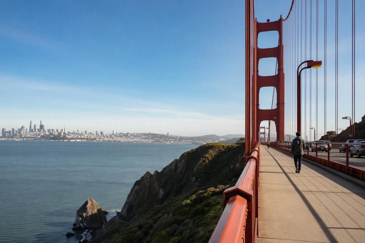
Yes, you can walk across the Golden Gate Bridge from San Francisco. Walking is free, and pedestrians use the east sidewalk during posted access hours. The important decision is not whether you can cross, but how far you should go and how you will return. The bridge is free to pedestrians and the seasonal access schedule applies.
For most first-time visitors, the San Francisco-side Welcome Center and plaza are the simplest base. From there, you can walk to a tower and return, cross once with transportation arranged from Marin, complete a full out-and-back, or continue beyond the bridge toward Sausalito.
Planning note: Bridge rules and standard pedestrian hours should be checked against current bridge-authority information. Transit, ferry service, parking, weather, construction, and temporary closures remain live variables that require a same-day check.
The essential facts before you walk
The Golden Gate Bridge is approximately 1.7 miles, or 2.7 kilometers, one way. A complete walk from San Francisco to Marin and back is therefore about 3.4 miles, before counting the approach from your bus stop, parking place, nearby viewpoint, or waterfront route. The bridge connects San Francisco with Marin County across the Golden Gate Strait; the Marin end of the span is not downtown Sausalito. The Presidio provides the official span length and identifies the south end as the main visitor starting area.
A steady walker might complete one crossing in about 35 minutes. For sightseeing, allow 35–60 minutes one way or 75–120 minutes for a round trip. These are planning ranges rather than promises. Wind, crowds, comfort level, photographs, and time spent near the towers can all slow progress. The Golden Gate National Parks Conservancy estimates approximately 45–60 minutes for a one-way walk, making that a useful allowance for visitors who do not want to rush. See the Parks Conservancy’s bridge guidance.
Pedestrians are permitted on the east sidewalk during posted hours. The generally published schedule is:
- Pacific Standard Time: 5:00 a.m.–6:30 p.m.
- Pacific Daylight Time: 5:00 a.m.–9:00 p.m.
Automatically controlled gates close at the stated evening time and reopen at 5:00 a.m., so pedestrians cannot cross overnight. Seasonal transition dates vary; use the bridge authority’s current posted schedule for your visit instead of trying to calculate the changeover yourself.
Check access on the day of your walk. Construction, high winds, special events, lane configurations, or other operating conditions can alter sidewalk access or cause an early closure. A saved itinerary or old screenshot should never take precedence over current official alerts.
Do not plan to reach the entrance just before closing. The posted closing time is when gate access ends, not a suggested starting time. Leave enough margin to finish your crossing or return while pedestrian access remains open.
A simple way to choose is:
- Under an hour available: walk partway and return.
- About two hours at the bridge: consider the full out-and-back.
- Crossing one way: confirm transportation from Marin before starting.
- Continuing to Sausalito: treat it as a separate, longer half-day route.
Choose the right version of the walk
The best route depends on your time, stamina, tolerance for wind and traffic noise, and willingness to organize a return journey. Decide on a preferred turnaround point before entering the sidewalk, but give yourself permission to shorten the walk if conditions are less comfortable than expected.
The bridge figures below use the documented 1.7-mile span and conservative sightseeing times. That guide estimates approximately 4–4.5 miles from the San Francisco side to downtown Sausalito.
| Route choice | Approximate distance | Planning time | Best for | Return logistics |
|---|---|---|---|---|
| Partial out-and-back | Flexible | Flexible | Short visits, families, uncertain weather, or limited stamina | Return to the south plaza on foot |
| Full one-way crossing | 1.7 miles | 35–60 minutes on the bridge | Visitors with confirmed Marin transportation | Pre-verified bus, rideshare, or pickup plan |
| Full bridge round trip | About 3.4 miles | 75–120 minutes | A substantial walk with simple logistics | Walk back to the south plaza |
| Continue to Sausalito | About 4–4.5 miles total one way | Longer half-day outing | Stronger walkers who want to combine the bridge with Sausalito | Ferry or bus only after reaching Sausalito; verify schedules |
Partial out-and-back
A partial walk is not a lesser experience. Walking to the first tower or toward the midpoint gives you close views of the cables, towers, roadway, water, and structural details without committing to the full span.
Choose a turnaround based on comfort rather than a rigid clock. The first tower can serve as an early assessment point: if the wind, noise, exposure, or crowding already feels tiring, turn back. If conditions are comfortable, continue toward the midpoint and reassess.
This option works especially well when the bridge is one part of a larger sightseeing day. You preserve time for Fort Point, Crissy Field, the Presidio, or the south-end exhibits while avoiding complicated return logistics.
Full one-way crossing
A one-way crossing covers approximately 1.7 miles and generally requires 35–60 minutes on the bridge. It makes sense only if you know how you will leave the Marin side.
Do not assume there will be an immediate bus, convenient rideshare pickup, or readily available taxi when you arrive. Check the current boarding or pickup location before leaving San Francisco. Save the relevant details to your phone and keep enough battery power to retrieve them.
One-way walking can be appealing because you avoid retracing the bridge. For a first visit, however, the logistical simplicity of a round trip often outweighs that advantage.
Full bridge round trip
The full out-and-back is approximately 3.4 miles. Allow 75–120 minutes for the walking itself, then add time for the visitor plaza, restrooms, exhibits, refreshments, viewpoints, and your approach to the entrance.
This is the simplest substantial option because you finish where visitor services and many San Francisco transportation connections are concentrated. It also gives you changing perspectives in each direction. Walking north emphasizes Marin and the bridge structure ahead; walking south can keep San Francisco views in front of you when visibility permits.
The drawback is exposure: whatever wind, sun, fog, noise, or crowding you experienced on the first crossing will still be part of the return. Before leaving the Marin end, confirm that you have enough energy and pedestrian-access time to walk back comfortably.
Continue to Sausalito
The northern end of the bridge is in Sausalito in Marin County 12 Tips to Walk Across the Golden Gate Bridge in San Francisco.
The same guide reports hills and limited services on the continuation, but those details should be treated as that publisher’s route account rather than a guarantee that every possible route has identical conditions.
Check current ferry and bus schedules before starting, allow a generous buffer, and retain an alternative return plan.
Choose Sausalito when you genuinely want a longer half-day outing—not because you assume it begins immediately beside the bridge.
For groups, plan around the slowest or least confident member. A route that is comfortable for the fastest walker can become stressful when someone else is cold, tired, anxious around bicycles, or worried about the return.
Start at the San Francisco-side Welcome Center
The most practical first-time starting point is the bridge’s south end in the Presidio, near the Golden Gate Bridge Welcome Center and visitor plaza. This area brings together orientation, pedestrian access, restrooms, exhibits, refreshments, and viewpoints, making it easier to organize the outing before entering the exposed span.
The Welcome Center provides visitor information, historical interpretation, exhibits, and souvenirs. Displays address the bridge’s history, science, engineering, and construction, while the Round House area offers coffee and refreshments subject to current operating hours. The official visitor page describes the Welcome Center, exhibits, and Round House.
Use transit as the default
For many first-time visitors, a transit-first plan is more practical than building the day around parking. Muni and Golden Gate Transit serve the bridge area, but routes, stops, fares, and schedules can change. Use the relevant operator’s current trip planner shortly before departure rather than relying on an old route number in a travel article.
When comparing directions, look beyond the stop name. Ask:
- How far is the stop from the visitor plaza?
- Does the service operate when you expect to return?
- Will you need to cross roads, climb stairs, or follow an approach trail?
- Does the trip planner reflect current construction or moved stops?
- If walking one way, does your return service leave from the Marin end or somewhere farther away?
Add approach time to your schedule. A 45-minute bridge crossing does not mean the entire outing takes 45 minutes. You still need to reach the plaza, orient yourself, use the restroom if necessary, locate the pedestrian gate, and later connect with return transportation.
If you drive
Paid parking areas beside the Welcome Center and off Merchant Road are documented options, but neither should be treated as guaranteed space. Parking near the bridge is limited, can fill, and may be affected by construction or operating needs.
If driving is necessary, identify a backup area and read its current restrictions carefully. Do not circle indefinitely at the Welcome Center while your pedestrian-access window shrinks. A more distant legal space may work, but include the added approach in your time and stamina calculations.
Pre-departure checklist
Before leaving your accommodation, verify:
- Official pedestrian-access alerts and closing time
- Current transit information or parking restrictions
- Weather and wind conditions at the bridge
- Your preferred turnaround point
- Your return connection if crossing one way
- Ferry or bus schedules if continuing to Sausalito
- Enough phone battery for tickets, directions, or pickup details
If any part of the return remains vague, use the south plaza as both your start and finish.
Follow the east sidewalk across the bridge
The route itself is straightforward:
- Orient yourself at the south-end plaza.
- Locate the east-side pedestrian entrance.
- Confirm that the gate is open and read posted notices.
- Follow the sidewalk north toward Marin.
- Reassess your comfort at the first tower or midpoint.
- Continue, turn around, or follow your prearranged Marin plan.
The experience differs from an ordinary city walk. You are on an exposed bridge beside active traffic, with persistent road noise, changing wind, limited shelter, and visibility that can shift as fog moves through.
In clearer moments, broad views can include San Francisco, the bay, the Pacific Ocean, the Marin Headlands, and passing vessels. Close at hand, the towers, cables, barriers, and suspension structure can become as important as the skyline.
A steady walker may cover the span in about 35 minutes, but 45–60 minutes is a more forgiving sightseeing allowance. That leaves room to slow near the towers, wait for space, and take photographs without turning the crossing into a race.
Walk predictably
Stay aware of people approaching from both directions. Depending on bicycle schedules and operating conditions, pedestrians may share the east sidewalk with cyclists.
Walk in a predictable line rather than weaving across the path. Keep your group from spreading shoulder to shoulder, and bring children close before congested or narrow areas. Look behind you before changing direction or stepping sideways.
When taking photographs, move out of the main flow where space permits. Prepare the camera first, take the image, and continue rather than holding a long photo session in a constrained section. Keep bags, tripods, and other equipment out of the travel path.
Turn around without regret
If you become uncomfortable, turn back. A first-tower or midpoint turnaround still provides close bridge views and substantial water scenery. It can also preserve time for a calmer viewpoint below or beside the bridge.
Do not let the idea of “completing” the span override fatigue, weather, closing time, or uncertainty about transportation. The right route is the one that leaves enough energy for the rest of your day.
There is no objectively best direction. Starting in San Francisco offers easier access to visitor services. Walking south from Marin can keep San Francisco ahead when visibility allows, but that direction makes sense only if you can first reach the Marin side through a confirmed transportation plan.
Plan the north-end exit before committing to one way
The Marin-side vista area has fewer visitor services than the San Francisco plaza. Do not expect equivalent choices for food, restrooms, shelter, orientation, or transportation at both ends.
For visitors who do not want to research or wait for onward transportation, the round trip is the simplest default. Walk north, pause at the Marin end if conditions permit, and return while pedestrian access remains open.
If you intend to finish at the Marin end, verify a current bus or rideshare plan before entering the bridge. Confirm:
- The precise pickup or boarding location
- Whether pedestrians can reach it by the route you expect
- The likely wait and operating window
- Whether your phone will have sufficient charge
- A backup if the first option is unavailable
Do not depend on a particular route number, frequency, or pickup point without checking the operator. Transportation arrangements can change faster than the bridge itself.
The Marin end is not a ferry stop
Sausalito is a separate extension beyond the crossing, not part of the bridge itself. Traveler accounts describing a bridge-and-Sausalito itinerary likewise place the ferry return after the additional walk into town. See the described bridge-to-Sausalito half-day route.
Before choosing that extension:
- Check current ferry and bus timetables.
- Note the last useful departure, not merely the final service of the day.
- Allow a generous buffer for navigation, hills, photographs, and food.
- Keep a bus, rideshare, or other alternative in reserve.
- Carry enough water for both the bridge and the continuation.
If fatigue or weather deteriorates before you complete the span, turn around while access remains open. If you have already crossed, use a transportation option confirmed in advance rather than improvising a long extension because the next connection is unclear.
Dress for wind, fog, sun, and fast-changing conditions
The bridge can feel colder, windier, and foggier than neighborhoods only a few miles away. Its exposure over the strait means a mild city forecast does not necessarily describe how the sidewalk will feel. The Parks Conservancy specifically advises visitors to expect rapidly changing weather, frequent fog, and strong afternoon winds. Check its current bridge conditions guidance before setting out.
Wear or carry:
- Comfortable, closed-toe walking shoes
- A light base layer
- A warmer middle layer when appropriate
- A wind-resistant outer layer
- Sunscreen and sunglasses when useful
- Water in a manageable bottle
Keep your bag light. Extra weight becomes more noticeable over a 1.7-mile crossing, especially if you intend to walk back. Secure loose hats, scarves, papers, and other items that could catch the wind.
Fog and visibility are variable. No month or hour guarantees an unobstructed view, and a clear start does not ensure clear conditions throughout the crossing. An initially foggy bridge may also change while you are there. Plan for the experience of the walk rather than making the outing depend on one perfect photograph.
Strong afternoon winds are a recurring concern, but mornings are not guaranteed to be calm, clear, warm, or uncrowded. Check live conditions and then judge what you encounter at the plaza.
Build extra time into your schedule when:
- Wind slows your walking pace
- Crowds require more cautious movement
- Fog or sun changes what you need to wear
- You expect frequent photo stops
- Anyone in the group is uncertain about the distance
Use a simple decision rule: if the exposed span feels uncomfortable, convert the plan to a partial walk. If even that feels unpleasant, choose a lower-commitment waterfront route or viewpoint instead.
Know the sidewalk rules and accessibility limits
Pedestrians are allowed only on the east sidewalk. Cyclists may also use that sidewalk depending on the operating schedule, construction, wind, and other conditions, so do not assume the path will be pedestrian-only.
Stay alert, walk predictably, and keep groups compact. Look for faster traffic approaching from behind before changing direction or moving around another visitor. Stop for photographs only where you can do so without obstructing the path.
Official bridge rules prohibit non-service animals, electric scooters, roller blades, skateboards, roller skates, pushcarts, wheelbarrows, and similar devices on the sidewalks. Drones are prohibited over or near bridge property. Service animals and pedestrians using permitted mobility devices such as wheelchairs are allowed during pedestrian-access hours. Review the bridge authority’s current pedestrian rules and access hours.
Accessibility requires individual planning
Legal permission to use the sidewalk does not establish that the complete trip is practical for every wheelchair user, stroller user, family, or person with limited mobility or stamina.
Available visitor information does not establish every grade, cross-slope, gate width, surface condition, seating interval, or accessible Marin-side return connection. Practical considerations include:
- A 1.7-mile commitment in each direction
- Wind and weather exposure
-
Crowding near popular stopping points
-
Potential interaction with bicycles
- The ability to turn and return before closing
- Accessible transportation from the Marin side
The Welcome Center has street-level automatic doors. Wheelchair-accessible restroom stalls are documented in a separate building across the south-end parking lot. These features are useful, but they do not prove that every part of a crossing-and-return itinerary will meet an individual traveler’s needs. The Presidio documents these south-end accessibility facilities.
Wheelchair and stroller users may prefer a partial out-and-back from the south plaza, where the route can be shortened without introducing Marin-side transportation uncertainty. The cited bridge rules do not provide a definitive classification for strollers, so visitors who need certainty should ask the bridge authority for current clarification before arriving.
Use the south-end services or choose a quieter alternative
The south end is the most convenient place for many first-time visitors to handle practical needs before committing to the bridge. Around the Welcome Center and plaza, visitors can find information, exhibits, restrooms, souvenirs, and food or coffee at the Round House area. Hours and availability can change, so do not make a late return dependent on a particular counter remaining open.
The exhibits explain the bridge’s history, science, engineering, and construction. Visiting before the walk can make structural details more meaningful; visiting afterward provides a way to extend the outing away from the exposed sidewalk. Official visitor information outlines the plaza’s exhibits and services.
Nearby viewpoints can extend the visit without requiring another crossing. Options include:
- Battery East Vista
- Golden Gate Overlook
- Pacific Overlook
- Fort Point
- Other Presidio overlooks and coastal locations
Crissy Field and Fort Point are lower-commitment alternatives for visitors who want bridge views without the full span’s traffic noise, wind exposure, or 3.4-mile round-trip distance. They are not identical substitutes—the perspective is from beside or below the bridge—but they can support a more relaxed outing.
San Francisco Know also publishes a separate self-guided Golden Gate waterfront walk linking the Marina, Crissy Field, and the bridge. Use it as a waterfront approach or companion itinerary, not as a source for official bridge hours, a complete crossing route, or Marin-side return logistics.
A flexible half-day might look like this:
- Follow part of the waterfront or begin at a nearby viewpoint.
- Reach the south plaza and check current pedestrian access.
- Use the restroom and adjust your layers.
- Choose a partial walk, one-way crossing, or round trip based on current conditions.
- Return for coffee, exhibits, another viewpoint, or a transit connection.
Before setting out, run through one final checklist:
- Access: Is the east sidewalk open, and when will the gate close?
- Route: Where is your planned turnaround point?
- Return: If you cross one way, is transportation confirmed?
- Clothing: Do you have layers and a wind-resistant outer layer?
- Supplies: Do you have water, sun protection, and a light bag?
- Time: Have you allowed for the approach, photographs, slower walking, and daylight?
- Transportation: Have you checked current transit, ferry, rideshare, or parking information?
For most first-time visitors, the simplest plan is to start at the south-end plaza and match the distance to the day you actually have. Turn around at a comfortable point for a short visit, complete the approximately 3.4-mile out-and-back for uncomplicated logistics, or cross one way only after confirming how you will return. Check official access, weather, and transportation again before leaving.
Is it free to walk across the Golden Gate Bridge?
Yes. Pedestrians can walk across the Golden Gate Bridge without paying a bridge toll or entrance fee. Use the east sidewalk during posted pedestrian-access hours. Motor-vehicle toll arrangements are separate and do not apply to someone crossing on foot.
How long does it take to walk across the Golden Gate Bridge?
Allow approximately 35–60 minutes one way for the 1.7-mile crossing. A steady walker may be near the lower end, while wind, crowds, photographs, children, or a slower pace can extend the trip.
For a complete out-and-back of approximately 3.4 miles, plan on 75–120 minutes, plus time at the plazas, restrooms, exhibits, or viewpoints. A bridge visitor guide documents the 1.7-mile distance and gives a shorter baseline crossing estimate.
What hours can pedestrians walk on the bridge?
The generally posted east-side pedestrian hours are 5:00 a.m.–6:30 p.m. during Pacific Standard Time and 5:00 a.m.–9:00 p.m. during Pacific Daylight Time. Automatic gates close at the posted evening time, and pedestrians cannot cross overnight.
Construction, high winds, special events, or operating conditions can change access or produce an early closure. Verify the official status on the day of your visit and do not begin a crossing close to closing time. The bridge authority publishes the current seasonal schedule and restrictions.
Can I walk across the bridge and take a ferry back?
Not directly from the bridge.
Independent guidance estimates the complete walk from the San Francisco side to Sausalito at approximately 4–4.5 miles one way. Check the current ferry schedule before starting, leave a substantial time buffer, and keep an alternative bus or rideshare plan.
If you want to cross only the bridge and stop at the Marin-side vista area, arrange a different return method or walk back to San Francisco.
Are dogs, scooters, wheelchairs, and strollers allowed on the bridge?
Non-service animals, including pet dogs, are prohibited. Service animals are allowed. Electric scooters, roller blades, skateboards, roller skates, pushcarts, wheelbarrows, and similar devices are also prohibited under bridge sidewalk rules.
Pedestrians using permitted mobility devices such as wheelchairs may use the east sidewalk during pedestrian-access hours. The official rules cited here do not definitively classify strollers, so anyone who needs confirmation should contact the bridge authority before visiting.
Permission should not be confused with universal accessibility. Wheelchair users, stroller users, families, and visitors with limited stamina should evaluate the distance, wind, crowding, limited rest opportunities, sidewalk conditions, and return arrangements individually. A partial out-and-back from the south plaza may be the more manageable option.