
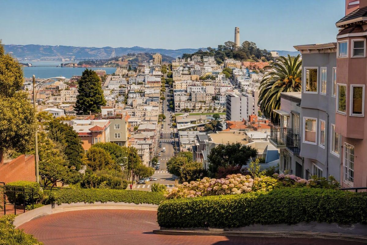
San Francisco is easier to understand as a collection of connected districts than as a checklist of isolated attractions. The useful question is not “Which neighborhood is best?” but “Which two or three parts of the city fit the trip I want?”
A visitor prioritizing museums and airport access may choose differently from someone planning waterfront walks, neighborhood restaurants, nightlife, or Golden Gate Park. Hills, weather, transit, lodging availability, and the location of each day’s first and last stop matter as much as atmosphere.
This is a selective visitor overview, not a definitive directory of every community or boundary. It uses familiar names, acknowledges fuzzy edges, and groups neighborhoods in San Francisco into practical sightseeing clusters.
Why San Francisco’s Neighborhood Map Changes Depending on the Source
There is no universally accepted count of San Francisco neighborhoods. Residents, planners, transportation agencies, historians, tourism publishers, and real-estate guides may use the same name for different areas—or different names for roughly the same area.
Part of the confusion comes from mixing several kinds of places:
- Major neighborhoods, such as the Mission or Chinatown
- Subdistricts, such as East Cut within the broader SoMa area
- Cultural or historical districts, which may overlap ordinary neighborhood boundaries
- Broad regional labels, such as the western side of the city
- Paired administrative areas, such as Castro/Upper Market
- Parks and public lands, including Golden Gate Park and the Presidio
- Tourism groupings, designed to orient visitors rather than establish official boundaries
San Francisco Travel presents 19 major neighborhoods, but it also says that the total depends on whom one asks and acknowledges that its visitor coverage does not include every named area. Its categories are therefore best understood as a travel overview, not a final census of neighborhood names. San Francisco Travel explains its visitor-oriented count and its limitations.
Government agencies organize the city for different purposes. SFMTA says its neighborhood transportation pages use San Francisco Planning Department neighborhood-notification maps. These pages collect local Muni information, projects, and updates, but administrative groupings such as “Downtown/Civic Center” do not necessarily reproduce how every resident describes an address in everyday conversation. SFMTA describes the mapping framework used for its neighborhood directory.
Large labels can also conceal smaller places. SoMa—South of Market—is a broad, internally varied section of eastern San Francisco that includes names such as East Cut, South Park, and Rincon Hill. Calling all of it SoMa may be convenient, but that does not mean every block offers the same surroundings, transportation options, or visitor experience.
Parks create another category problem. The Presidio is primarily a large park on a former military post. Golden Gate Park is likewise a park containing museums, gardens, recreation areas, and open space. Both influence the identity of nearby neighborhoods and appear in visitor guides, but neither should be counted as an ordinary residential neighborhood.
Some published lists repeat a claim that the Planning Department officially recognizes exactly 36 neighborhoods. The supplied reference carrying that number also displays a citation warning and repeatedly notes that neighborhood definitions vary, so this guide does not treat 36 as a definitive official total. The source itself flags its neighborhood list as needing additional citations.
The method here is deliberately practical: use names visitors are likely to encounter, recognize overlapping edges, and organize sightseeing by geographic cluster. A flexible map is more useful than false precision when the real decisions concern where to stay, how much climbing to expect, and which stops sensibly belong in the same half-day.
A Quick Neighborhood Chooser: Match the Area to the Day You Want
The table below is a non-comprehensive orientation tool, not a ranking. The transit column identifies common modes rather than every route or current service pattern. Terrain and weather are broad tendencies, not accessibility or climate guarantees. Where the evidence does not establish comparative lodging supply, the table says so rather than implying a current inventory.
| Area | Strongest visitor draw | Representative places | Main transit type | Terrain tendency | Weather tendency | Lodging context | Principal drawback |
|---|---|---|---|---|---|---|---|
| Union Square | Hotel choice and central connections | Union Square, shopping streets, nearby theaters | BART, Muni, cable cars | Mixed; climbs begin toward Nob Hill | Check the daily forecast | Major hotel concentration | Commercial setting; some travel guides find it less distinctive |
| Fisherman’s Wharf | Concentrated waterfront sightseeing | Pier 39, nearby Alcatraz departures | Muni, historic streetcars, cable cars | Waterfront stretches are comparatively level | Waterfront conditions can change quickly | Visitor-oriented lodging is available; verify current options | Crowds, noise, prices, and tourist intensity are recurring guide-reported concerns |
| Mission | Food, murals, parks, and nightlife | Valencia Street, Dolores Park, Clarion Alley, Balmy Alley | BART and Muni | Several manageable corridors; slopes rise toward adjoining areas | Do not assume a neighborhood forecast | Comparative inventory not established here | Parking difficulty and a longer trip to northern sights |
| Castro | LGBTQ+ history, culture, and nightlife | Castro Street and surrounding commercial blocks | Muni Metro and buses | Slopes increase toward nearby hills | Check current conditions | Comparative inventory not established here | Fewer direct links to northern waterfront sights |
| SoMa/Yerba Buena | Museums, conventions, venues, and connections | Yerba Buena Gardens, museums, Moscone area | BART, Muni, Caltrain in the broader district | Many broad corridors are relatively level | Check the exact destination | Options exist near downtown and convention facilities; verify current supply | Too large and varied to treat as one compact attraction |
| Chinatown and North Beach | Cultural streets, dining, cafés, and history | Grant Avenue, Dragon Gate, Washington Square, Telegraph Hill | Muni, buses, cable cars, walking | Mixed; steeper near Telegraph Hill | Check the daily forecast | Comparative inventory not established here | Busy principal streets and climbing near the hills |
| Nob Hill and Russian Hill | Cable cars, architecture, and views | Grace Cathedral, Huntington Park, Lombard Street area | Cable cars and Muni buses | Steep | Elevated routes may feel exposed | Some hotel choices, but no citywide comparison is established here | Demanding walking and difficult parking |
| Marina | Waterfront recreation and bridge views | Palace of Fine Arts, Chestnut Street, Crissy Field | Muni buses and walking | Waterfront generally level; inland approaches vary | Waterfront wind may affect a walk | Comparative inventory not established here | No direct BART and reported parking difficulty |
| Pacific Heights | Residential architecture and elevated views | Alta Plaza Park, Lyon Street Steps | Muni buses | Hilly | Check conditions at elevation | Comparative inventory not established here | Climbing and fewer conventional sightseeing anchors |
| Haight-Ashbury | Counterculture history and vintage shopping | Haight Street, Buena Vista Park, Golden Gate Park edge | Muni buses and nearby rail connections | Rolling, with steeper side routes | Conditions may differ toward the park | Comparative inventory not established here | No direct BART and a busy commercial corridor |
| Richmond | Park access, restaurants, and western streets | Golden Gate Park edge, Clement Street area, coastal access | Primarily Muni | Gentler corridors with local rises | Western fog is a common tendency | Comparative inventory not established here | Longer cross-city trips to downtown and the Mission |
| Inner Sunset | Golden Gate Park and neighborhood dining | Irving Street, nearby park museums | Muni light rail and buses | Mixed, generally less dramatic than the central hills | Western fog is common | Comparative inventory not established here | Longer journey to the northern waterfront |
| Outer Sunset | Beach-oriented western setting | Ocean-facing streets and nearby park access | Muni light rail and buses | Broad corridors with local slopes | Commonly characterized as foggier | Comparative inventory not established here | Distance from central sights |
| Alamo Square | Victorian architecture | Painted Ladies, Alamo Square Park | Muni buses | Elevated, with approach slopes | Check the daily forecast | Some guides report limited lodging nearby | A focused stop rather than a full sightseeing district for many visitors |
These are broad, source-attributed orientations rather than objective scores for walkability, price, climate, accessibility, or neighborhood quality. San Francisco Travel associates Union Square with hotels and multimodal transit, Fisherman’s Wharf with major tourism, the Mission with murals, SoMa with museums and venues, and the Richmond and Sunset with western fog. Commercial travel guides supply some of the subjective drawbacks, which should be treated as opinions rather than measured neighborhood facts.
Start with your non-negotiable priority. Choose Union Square if hotel choice and central connections matter more than a residential atmosphere. Choose Fisherman’s Wharf if Pier 39 and nearby Alcatraz departures dominate the itinerary, while accepting a more tourism-focused environment.
Choose the Mission for food, murals, Valencia Street, Dolores Park, nightlife, and BART access, but allow for a longer journey to the Golden Gate Bridge or northern waterfront. The Castro makes sense when LGBTQ+ culture and nightlife are central interests and Muni is useful to your itinerary.
Haight-Ashbury suits a day combining counterculture history, vintage shopping, and Golden Gate Park. Chinatown and North Beach work well as a compact cultural and dining cluster. Nob Hill and Russian Hill offer cable cars, views, and classic hilly scenery, with steep walking as the defining tradeoff.
The Marina is better suited to waterfront recreation than to direct BART access. Richmond and Sunset work well for parks, restaurants, beaches, and quieter western evenings, but they generally require more cross-city travel.
The Northern Waterfront: Fisherman’s Wharf, the Marina, and the Presidio
The northern waterfront is not one uniform neighborhood. Fisherman’s Wharf, the Marina, Crissy Field, and the Presidio offer different versions of a waterfront day, ranging from concentrated attractions to long open-space walks.
Fisherman’s Wharf is the most attraction-heavy part of this cluster. It contains Pier 39 and is near departure points for Alcatraz boats. That convenience can be valuable when those attractions are fixed priorities or when you want major sightseeing close to your lodging.
The tradeoff is atmosphere. A commercial tour guide describes the Wharf as convenient but also crowded, noisy, expensive, and strongly tourist-oriented. Those are judgments rather than measured facts, but they capture a recurring split in visitor advice: the same concentration of attractions that makes the district efficient can make it feel less residential. The guide presents both the practical advantages and perceived drawbacks of Fisherman’s Wharf.
West of the Wharf, the Marina shifts toward waterfront recreation and neighborhood commercial streets. Chestnut Street and Union Street offer places to stop before or after an outing. The Palace of Fine Arts is a prominent landmark, while Crissy Field opens a route toward views of the Golden Gate Bridge.
Waterfront corridors generally feel flatter than many interior parts of San Francisco. Do not translate that into a blanket accessibility claim. A path beside the water may be comparatively level while the route to a bus stop, restaurant, lodging entrance, or inland side street still climbs. Construction, surfaces, crossings, and temporary closures can also affect the exact route.
Adjacent Pacific Heights is more residential and elevated. Victorian houses, Alta Plaza Park, and the Lyon Street Steps make it appealing for architecture and views, but elevation is part of the experience. A route that looks short on a map may involve a sustained climb.
The Presidio should be understood primarily as a park on a former military post, not as a conventional neighborhood. It connects the northern waterfront with trails, trees, open space, and routes near the bridge. Its scale and landscape are quite different from the street grids of the Marina or Fisherman’s Wharf.
A practical half-day structure is:
- Eat in the Marina or along a nearby commercial corridor.
- Begin near the waterfront.
- Walk in one direction through or toward Crissy Field.
- Shorten or extend the route according to wind, weather, and energy.
- Use a preselected transit or rideshare plan instead of assuming you will retrace the entire walk.
San Francisco Know’s self-guided Golden Gate waterfront walk uses this one-direction structure, with flexible pacing, a separate return plan, and reminders to carry water and a layer. It is a planning model, not a guarantee that the route will suit every traveler. Mobility, construction, wind, and the exact starting point can change the experience.
Northeast and Central San Francisco: Chinatown, North Beach, the Hills, and Union Square
Chinatown and North Beach are adjacent enough to form one coherent cultural and dining cluster. They should not be reduced to one street apiece, but a first visit can use a few landmarks to create a readable route.
In Chinatown, Grant Avenue and Dragon Gate are recognizable starting points rather than the whole neighborhood. Side streets, food businesses, community institutions, and connections toward downtown and North Beach also matter. Cable-car access can be useful, although it should not be treated as a substitute for checking current bus, rail, and walking options.
North Beach gathers cafés, Italian restaurants, pubs, jazz venues, and Washington Square. A Chinatown–North Beach route can remain compact until you add Telegraph Hill or continue toward the waterfront. A local travel writer’s profiles identify the representative places used for this cluster.
Nob Hill and Russian Hill are central but physically demanding. California Street, Huntington Park, and Grace Cathedral provide a useful Nob Hill orientation. Russian Hill is associated with Ina Coolbrith Park, elevated views, and the Lombard Street area. Historic architecture and cable cars reinforce familiar San Francisco imagery, but steep grades and difficult parking remain important tradeoffs.
California Street has cable-car service, while the Powell–Hyde line serves the Lombard Street area. Because service can change, confirm the current operating pattern before building a day around either line. The visitor transportation guide documents these cable-car connections.
Cable cars can solve a particular uphill segment and add to the experience.
Union Square operates differently. It is primarily useful as a shopping, hotel, and transportation hub. Its BART, Muni, and cable-car access can make it practical for travelers arriving from the airport or moving between downtown and other districts.
Practicality does not automatically produce a strong residential atmosphere. Several travel guides describe Union Square as convenient but less distinctive than other parts of the city. That is a subjective impression, not a reason to dismiss it. A visitor who values hotel choice, elevators, front-desk services, and straightforward connections may rationally prefer it.
Hotel supply and neighborhood character are separate questions. Travel guides report that accommodations are concentrated around Union Square and the Financial District, while some residential-feeling areas have fewer conventional lodging choices. They also describe Nob Hill as hilly and difficult for parking despite recommending it. This lodging guide explains the mismatch between hotel-rich districts and preferred residential areas.
A logical day might begin at Union Square or Nob Hill, descend toward Chinatown, continue into North Beach, and finish near Washington Square or the northeastern waterfront. Plan transit for the return instead of automatically walking uphill to the starting point. Reversing the order can also work, but inspect elevation before committing.
Mission, Castro, and SoMa: Food, Murals, Nightlife, and Museums
The Mission, Castro, and SoMa all sit south of the classic northern sightseeing circuit, but they should not be treated as one continuous visitor district.
The Mission supports a substantial day of its own. Valencia Street provides a commercial spine, while Mission Dolores Park supplies an open-space anchor. Mexican food is central to many visitor itineraries, though the evidence does not support declaring one restaurant—or the entire neighborhood—objectively best.
Murals are another major reason to visit. Clarion Alley and Balmy Alley are frequently identified mural destinations, while the Women’s Building provides another recognizable public-art stop. The neighborhood’s visual culture extends beyond those sites, so allow time for the streets between named attractions instead of treating the alleys as isolated photo stops.
BART access distinguishes the Mission from many northern and western areas. Muni fills in other connections, and nightlife can extend a food-and-art itinerary into the evening.
The Mission is sometimes described as warmer or less foggy than western San Francisco. Without defined comparative climate data, treat such descriptions as broad perceptions rather than a forecast. Labels such as trendy or authentic are likewise opinions, not objective neighborhood qualities.
The Castro is associated with LGBTQ+ history, culture, and nightlife. A Mission–Castro outing works because the interests complement one another: food, murals, and Dolores Park can lead into historical sites, commercial streets, and nightlife.
SoMa, meaning South of Market, requires a different approach. It is too large and internally varied to summarize with one atmosphere. East Cut, South Park, and Rincon Hill are names used for subdistricts within the broader area, but the available evidence does not support a detailed visitor comparison among them.
SoMa contains museums, Yerba Buena Gardens, convention facilities, large venues, and substantial transportation infrastructure. Parts of the broader district connect with BART, Muni, Caltrain, and freeways. These are broad access categories, not a complete statement of current service to every destination. A commercial neighborhood guide documents SoMa’s varied transportation connections.
Plan SoMa around a named destination: a particular museum, Yerba Buena Gardens, a convention, a performance, or a train connection. Do not simply put “walk around SoMa” on the itinerary and expect such a large district to organize itself.
Broad warnings to avoid all of SoMa—or everything south of Market Street—are not useful. They collapse a varied part of the city into one label and are not supported here by current, geographically precise public-safety evidence. Evaluate the exact destination, route, time, and return plan instead.
Haight-Ashbury, Alamo Square, Richmond, and Sunset: Parks and Western Neighborhoods
Western San Francisco rewards a slower, geographically focused plan. Golden Gate Park, Haight-Ashbury, the Richmond, and the Sunset fit together more naturally than any of them fits with a hurried half-day at Fisherman’s Wharf.
Haight-Ashbury is closely associated with the 1960s Summer of Love and counterculture, and vintage shopping remains part of its visitor identity. Its position between Buena Vista Park and the eastern edge of Golden Gate Park makes it a useful transition between commercial streets and open space. A local travel profile documents these historical and geographic associations.
That position does not make the terrain uniformly easy.
Alamo Square is best known to many visitors for Victorian architecture and the Painted Ladies facing the park on Steiner Street. It can be a satisfying focused stop, but it does not need to consume a full day. The approach is elevated, and some lodging guides report relatively limited accommodation choices nearby.
Golden Gate Park is a park rather than a neighborhood. It nevertheless functions as the central organizing feature of western San Francisco. Representative attractions include the de Young Museum, Japanese Tea Garden, and California Academy of Sciences. A city travel overview identifies these park attractions and the Painted Ladies at Alamo Square.
The park is long enough that “visit Golden Gate Park” is not a complete plan. Choose a museum, garden, walking segment, or entrance area. Then pair it with one adjoining neighborhood rather than attempting to cover every edge.
The Sunset is a broad district, not a uniform environment. The Inner Sunset borders Golden Gate Park and includes the Irving Street commercial area. It works well for a meal before or after a park visit and has Muni connections.
The Outer Sunset is commonly characterized as quieter, foggier, and more oriented toward the beach. Those are comparative tendencies, not guarantees for a particular date or block. A clear afternoon can occur near the ocean, and cold, fog, or wind can affect other parts of the city.
The Richmond is similarly broad. The available evidence does not support a confident Inner Richmond versus Outer Richmond comparison. For lodging or detailed route planning, inspect the exact commercial corridor, transit line, and destination.
Richmond and Sunset suit travelers who value park access, neighborhood dining, beach proximity, and western settings.
For a half-day, pair one park destination with Haight-Ashbury, Inner Sunset, or a focused part of the Richmond. Do not combine a full western park schedule with Fisherman’s Wharf or the Golden Gate waterfront unless you have deliberately allowed for the cross-city connection.
Beyond the Usual Visitor Circuit: Bernal Heights, Bayview, Glen Park, and Southern Districts
Tourism guides disproportionately cover downtown, the northern waterfront, the central hills, and famous western parks.
Bernal Heights is the most clearly profiled southern area in the available evidence. It has elevated residential terrain, and Cortland Avenue is identified as its principal commercial street. The hills can provide broad perspectives, but they also mean a visit should be organized around an exact destination and return route.
Bayview–Hunters Point appears as a paired area in SFMTA’s neighborhood transportation framework. The T-Third light-rail line serves Bayview, and the Bayview Opera House is a named local institution. Those facts are not enough to support broad claims about the whole area’s present programming, atmosphere, boundaries, lodging, or suitability for a particular traveler.
SFMTA’s directory also includes Glen Park, Excelsior, Crocker Amazon, and Diamond Heights. The directory organizes neighborhood-level transportation information, but the supplied overview does not establish a complete visitor profile or full transit description for each area. SFMTA lists these southern areas within its neighborhood transportation structure.
That limitation matters. Equal respect does not require pretending that the same depth of visitor evidence exists for every neighborhood. Inventing attractions or atmosphere to fill a gap would be less useful than acknowledging it.
If you have a specific reason to visit one of these areas—a personal connection, business, event, institution, trail, or address—open the relevant current SFMTA page and map the exact destination. Check the nearest stops, walking grades, service schedule, and evening return rather than relying on a generic label such as “southern San Francisco.”
Turn the Neighborhood Guide Into a Hill-Smart, Transit-First Plan
The most effective way to use this guide is to choose one geographic cluster per half-day. Repeatedly crossing San Francisco adds transfers, walking, and more opportunities for weather or service changes to disrupt the plan.
Four combinations are especially coherent:
- Chinatown and North Beach: Begin near downtown or Chinatown, continue toward Washington Square, and decide separately whether Telegraph Hill fits your energy and mobility.
- Marina, Crissy Field, and the Presidio: Eat near the Marina, follow the waterfront in one direction, and arrange a separate return.
- Mission and Castro: Combine food, murals, Dolores Park, LGBTQ+ history, and nightlife using walking and transit.
- Haight-Ashbury or Inner Sunset with Golden Gate Park: Choose one adjoining commercial district and one or two park destinations.
Hills change the meaning of distance. Two points may look close while sitting at very different elevations. Before choosing to walk, compare the grade, direction of travel, and route after the final stop. A downhill outbound walk followed by an unplanned uphill return is a common itinerary mistake.
Your transportation toolbox includes:
- BART for airport and regional connections, plus selected city stations
- Muni Metro for several city corridors
- Muni buses for broad neighborhood coverage
- Historic streetcars on particular routes
- Cable cars for limited central and hill connections
- Walking when terrain, distance, and mobility make sense
- Occasional rideshares or taxis for awkward final legs, late returns, or individual mobility needs
BART provides service between SFO and downtown San Francisco, but it does not directly serve most northern or western neighborhoods. Confirm current schedules and transfers rather than treating a broad neighborhood transit label as a route plan.
Most visitors can plan a trip without renting a car, depending on their mobility needs and destinations. Reported parking difficulties in hill districts, the Marina, and busy central areas make a vehicle an imperfect default. A car may still solve a defined problem—particularly travel beyond the city—but it should not be added without considering parking and the days when it will remain unused.
Choose a base according to the corridor you expect to revisit. If several days begin or end downtown, Union Square’s hotel supply and connections may outweigh its commercial atmosphere. If the trip centers on western parks, staying farther west may reduce repeated cross-city journeys even though airport and waterfront trips become less direct. If hills are a concern, inspect the exact route between the property entrance and the nearest useful stop.
For more focused planning, use San Francisco Know’s guides to choosing a neighborhood base and building a hill-smart San Francisco day. These articles frame decisions involving repeat destinations, elevation, walking, and transit; they do not establish universal neighborhood rankings.
Before booking or finalizing a day:
- Map the exact lodging block rather than trusting a broad neighborhood label.
- Check the grade between the property and transit.
- Confirm current transit schedules, transfers, and service changes.
- Review accessibility information for stations, vehicles, paths, and attractions.
- Verify museum, garden, and venue hours.
- Check conditions for both the waterfront and western side of the city.
- Build a return plan before beginning a long walk.
Neighborhood choice is an itinerary decision, not a contest. Select one or two clusters that match your priorities, verify the exact lodging block and current transportation, account for hills and weather, and leave distant areas for another day instead of forcing the whole city into one route.
Frequently Asked Questions
How many neighborhoods are there in San Francisco?
There is no single universally accepted number. San Francisco Travel highlights 19 major visitor-oriented neighborhoods while acknowledging that more exist and that the total depends on whom one asks. SFMTA uses Planning Department neighborhood-notification maps for its transportation pages, but those administrative groupings do not necessarily match colloquial names.
Counts change depending on whether a list includes subdistricts, cultural districts, paired administrative areas, developments, parks, and broad regional labels. Treat any exact total as the product of a particular mapping method, not an uncontested fact.
Which San Francisco neighborhood is best for a first-time visitor?
There is no universally best choice. Match the base to your priorities:
- Union Square for hotel inventory and central BART, Muni, and cable-car connections
- Fisherman’s Wharf for Pier 39 and proximity to Alcatraz departures
- Nob Hill for cable cars, architecture, and views, if steep terrain is acceptable
- Mission for food, murals, nightlife, and BART
- Marina for waterfront recreation, with greater dependence on Muni
- Richmond or Sunset for parks, beaches, restaurants, and western settings
A first-time visitor often benefits more from staying near repeat destinations than from choosing the neighborhood most frequently praised by travel guides.
Which San Francisco neighborhoods are easiest to explore without a car?
Fisherman’s Wharf also has multiple transit options, although it lacks direct BART access.
“No BART station” does not mean “no transit”; it means you should examine the relevant bus, streetcar, or light-rail connection.
Which neighborhoods are flatter or easier for visitors who want to limit hills?
Waterfront corridors in the Marina, Fisherman’s Wharf, and parts of the Embarcadero generally offer flatter stretches than Nob Hill, Russian Hill, Pacific Heights, or Bernal Heights.
No neighborhood-level label guarantees an accessible or easy route. Approaches to transit, side streets, park entrances, surfaces, and lodging entrances can still climb or present other barriers. Compare exact elevations and current accessibility information before relying on a description such as “flat.”
Are some San Francisco neighborhoods safer than others?
The supplied evidence does not provide current, geographically precise public-safety data suitable for ranking entire neighborhoods. Conditions can vary by exact block, route, time, transportation choice, and current circumstances, so broad labels such as categorically safe or unsafe are not responsible planning tools.
Examine the exact lodging block and nighttime route, ask the property about entrances and transportation, and check current official information before the trip. Plan how you will return after evening activities and use the same situational precautions you would in another major city.