
Choose one section for your main outing, then use transit if you want to connect it with another.
Start here: choose which waterfront you mean
The phrase “waterfront San Francisco” can describe several distinct stretches of shoreline.
Port materials describe a managed waterfront approximately 7.5 miles long beginning at Fisherman’s Wharf. They differ slightly on its southern extent: the visitor guide describes the waterfront as reaching toward Heron’s Head Park, while the planning guide defines its corridor as running between Fisherman’s Wharf and India Basin. The difference is a useful reminder that the Port waterfront is a jurisdiction containing multiple subareas, not a single visitor promenade. See the Port’s Waterfront Plan.
The Marina, Crissy Field, and Golden Gate Bridge form a different shoreline experience. Visitors may include them in the broad idea of San Francisco’s waterfront, but they should not be folded into the Port’s documented corridor.
Use this decision rule:
- Choose Fisherman’s Wharf through the Ferry Building for food, shopping, sightseeing, public art, and maritime attractions.
- Choose the central or southern waterfront for parks, changing shoreline landscapes, and working-port context.
- Choose the Golden Gate shoreline when bridge scenery is the purpose of the outing.
A practical north-to-south orientation
Think of the Port waterfront as a sequence of areas rather than a uniform walkway.
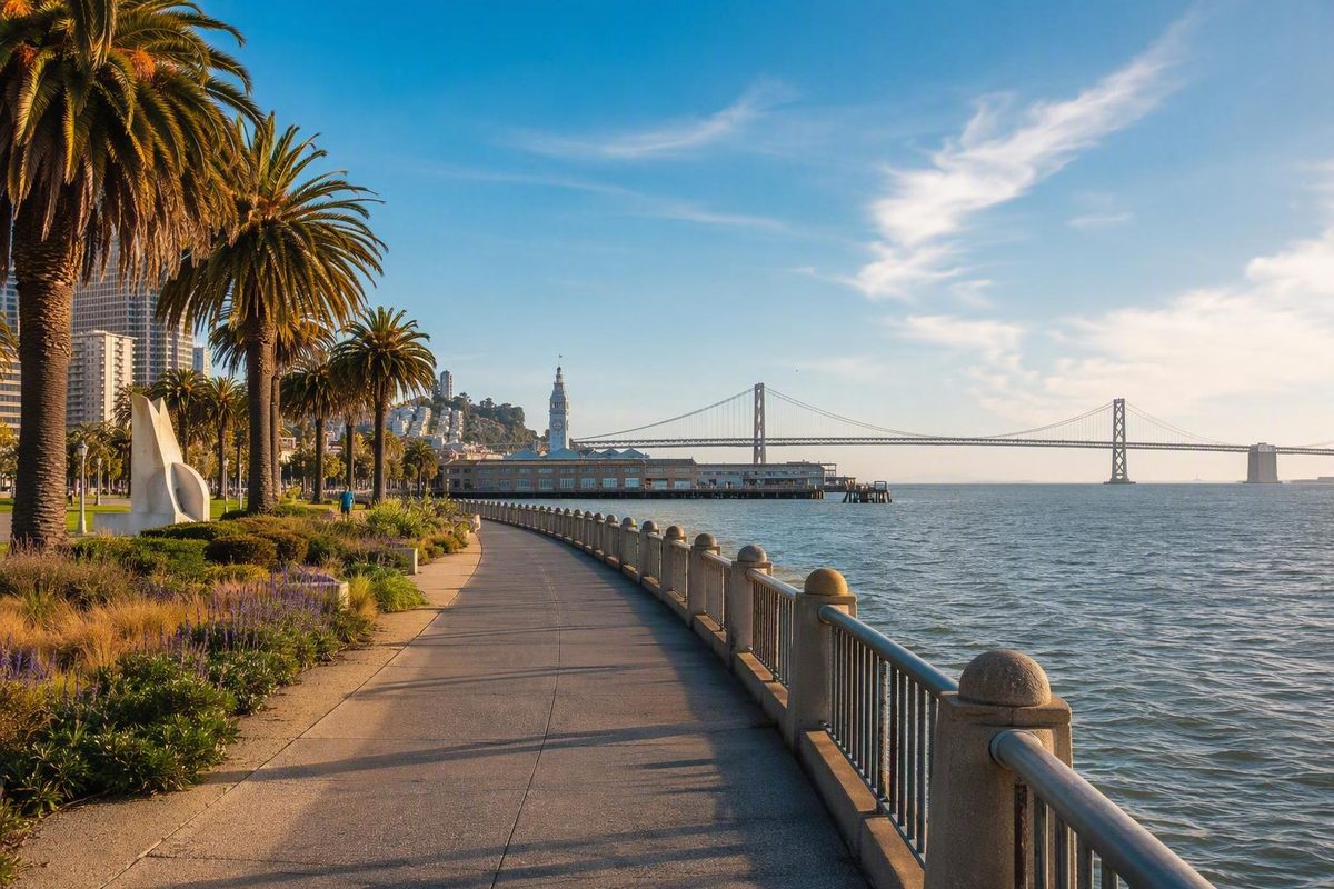
The northern visitor corridor begins around Fisherman’s Wharf and continues along the Embarcadero toward the Ferry Building. Official visitor materials associate this area with dining, shopping, public art, sightseeing, and maritime attractions.
The central waterfront continues past the Ferry Building toward the Giants ballpark area, Mission Bay, and Crane Cove Park.
The southern waterfront includes Islais Creek, India Basin, and Heron’s Head Park. Public spaces and natural shoreline settings therefore coexist more visibly with operational infrastructure.
These distinctions help prevent a common planning mistake: treating every named pier, park, basin, and neighborhood as a required stop on one route.
Pick a waterfront section by the experience you want
Choose the area that matches your main interest instead of trying to cover the entire shoreline.
| Area | Named anchors | Evidenced activity types | Working-port context and broad connections |
|---|---|---|---|
| Northern Port waterfront | Fisherman’s Wharf, Embarcadero, Ferry Building | Food, shopping, sightseeing, public art, maritime attractions | Visitor-oriented corridor; walking, historic streetcars, buses, ferries, and nearby rail connections |
| Central waterfront | Giants ballpark area, Mission Bay, Crane Cove Park | Parks, shoreline movement, maritime settings | Transition toward mixed public and maritime surroundings; walking and Muni connections |
| Southern waterfront | Islais Creek, India Basin, Heron’s Head Park | Nature, shoreline landscapes, industrial and maritime context | Cargo, freight, industrial, and operational uses are more prominent; connections vary by destination |
| Golden Gate shoreline | Marina, Crissy Field, Golden Gate Bridge | Bridge-focused scenery and shoreline walking | Separate from the Port corridor; plan the outbound walk and return connection independently |
The northern corridor groups several visitor-facing activity categories within a defined part of the waterfront. The central corridor presents a transition toward parks and maritime settings rather than an extension of the same attraction district.
Nature and public waterfront areas may sit near cargo, freight, industrial, and other operational uses, so visitors should not assume that access will be continuous.
For a bridge-focused day, treat the Golden Gate shoreline as its own outing. San Francisco Know publishes a separate Marina–Crissy Field–Golden Gate Bridge walk, but its route conditions, accessibility, and transit connections should be checked for the day of the visit.
Explore without a car by linking sections
Walking, ferries, Muni buses, historic streetcars, and rail service can help visitors explore portions of the waterfront. They work best as connections between selected areas, not as evidence that the entire shoreline forms one seamless route.
The F historic streetcars operate between the Ferry Building and Fisherman’s Wharf. For the central and southern waterfront, consult current Muni maps to identify the rail or bus stops serving the specific destination you have chosen. Do not build a trip around older destination summaries of T Third routing or station names, because operating patterns can change.
A practical car-free pattern is:
- Select one shoreline section as the focus.
- Walk within that section rather than committing to the full waterfront.
- Use a streetcar, bus, train, or ferry to reach a second section or return.
- Plan the return mode separately so the day does not depend on retracing a long walk.
Broad visitor guides do not establish current departures, fares, interruptions, or boarding arrangements. Check current SFMTA service information and the official operator page for any ferry you plan to use before departure.
Understand where public access can stop
No—visitors should not assume that every pier, apron, berth, or shoreline segment is open to the public.
San Francisco’s waterfront is also a working port supporting cargo, cruise, ferry, fishing, ship-repair, berthing, and industrial activity. Port policy encourages public access on pier aprons only where it is compatible with maritime security, safety, operations, applicable regulations, and economic feasibility. Where direct access conflicts with port activity, viewpoints or interpretive features may be used instead. The Port’s Waterfront Plan explains these access limits.
It may separate public space from an active maritime facility. Follow posted signs and remain on designated paths rather than treating adjacent pier surfaces as extensions of the promenade.
The plan also discusses additional berthing capacity, cruise facilities, shore power or other cleaner-energy systems, recreation, and public-access improvements. These are policies, objectives, or subjects for feasibility work—not evidence that a particular project has been approved, funded, constructed, or opened.
Use a flexible planning checklist
Before setting out:
- Choose the geographic section first. Do not make the entire Port waterfront—or the city’s full shoreline—a required walk.
- Plan outbound and return travel separately. This is particularly useful when combining a walk with a historic streetcar, bus, train, or ferry.
- Check current operations. Review live transit notices, ferry information, attraction hours, construction updates, major events, and temporary access restrictions.
- Verify accessibility destination by destination. General references to walking or transit do not establish step-free access. Check each path, station, stop, pier, vessel, and attraction you intend to use.
- Confirm water-use rules directly. Before swimming, kayaking, fishing, launching a boat, or seeking transient berthing, verify current site rules, designated access points, operating conditions, and safety information with the responsible agency or operator.
- Keep a second section optional. If conditions or timing change, finish after the primary area rather than forcing the original plan.
- Treat the Golden Gate shoreline separately. If the bridge is the main goal, plan the Marina–Crissy Field–Golden Gate Bridge outing independently of the Port corridor.
Frequently asked questions
How long is San Francisco’s Port-managed waterfront?
Port materials describe it as approximately 7.5 miles long. The visitor guide places its southern reach toward Heron’s Head Park, while the planning guide describes the corridor between Fisherman’s Wharf and India Basin. The official waterfront overview gives the 7.5-mile figure.
Is the Golden Gate Bridge part of the Port’s 7.5-mile waterfront?
No. The documented Port corridor begins at Fisherman’s Wharf and extends south along the eastern shoreline; it does not include the Marina, Crissy Field, or Golden Gate Bridge. Those locations form a separate Golden Gate shoreline outing.
Can visitors kayak or swim along San Francisco’s waterfront?
Potentially, but no general waterfront description establishes that a particular site is currently open or suitable for either activity. Confirm designated access points, current rules, water conditions, facilities, and any required authorization with the responsible operator or public agency before entering the water.
Choose one manageable shoreline section, connect by transit only if time and conditions allow, and verify live service, access, and accessibility details before leaving.