
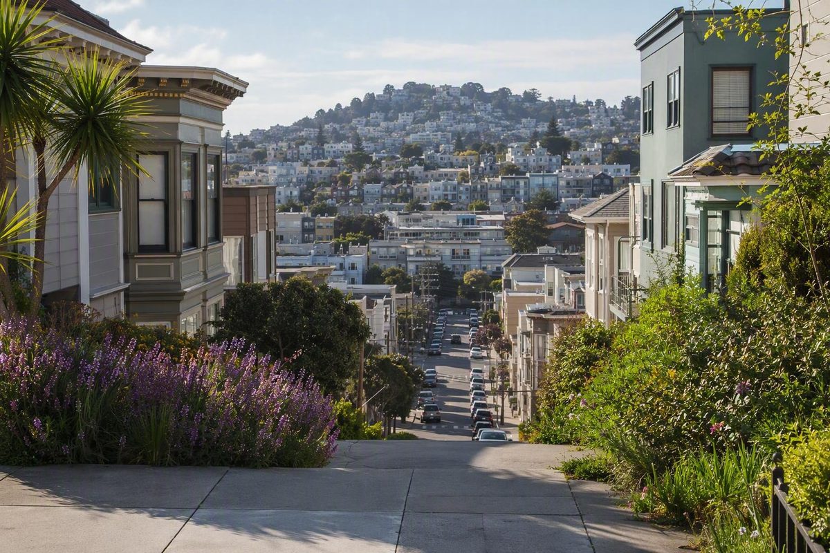
Start with a useful mental map of the Mission
The Mission District of San Francisco—usually called the Mission or La Misión—is a historic neighborhood southeast of downtown. It is better understood as a collection of commercial corridors, residential blocks, cultural institutions, parks, murals, restaurants, nightlife venues, and light-industrial areas than as one compact sightseeing zone.
Residents, maps, city agencies, and cultural organizations may use different edges for different purposes. For a first visit, orienting yourself around five corridors is more useful than trying to draw a definitive border:
- Mission Street: the principal commercial and transit spine.
- Valencia Street: cafés, bookstores, bars, shops, and contemporary dining.
- Dolores Street and Dolores Park: colonial history, civic landmarks, park time, and views.
- Calle 24: Latino cultural institutions, businesses, food traditions, and murals.
- The northeast Mission: manufacturing and light industry mixed with arts, technology, retail, dining, and nightlife.
The clearest transit gateways are 16th St Mission and 24th St Mission, the neighborhood’s two BART stations. Both are on Mission Street, making them useful anchors even when your main interests lie several blocks away. San Francisco’s Mission itinerary similarly distinguishes Valencia, Dolores, Calle 24, and the northeast Mission as different areas to explore (SF.gov’s Mission visitor guide).
These profiles reflect concentrations, not hard cultural borders. Latino institutions and legacy businesses are especially visible around Calle 24, while Valencia is strongly associated with destination dining and independent retail. Dolores Street connects historical and recreational stops. Farther northeast, production spaces and light industry coexist with newer commercial uses.
No single street represents the entire Mission. A practical first-visit method is:
- Choose one primary interest: Latino cultural context, murals, history, park time, food, shopping, or nightlife.
- Choose the corridor that best supports it.
- Add one or two nearby stops.
- Use one or both BART stations as anchors.
- Keep every detour optional.
This approach leaves time to notice relationships between places: a mural and the community concerns it records, a food tradition and the migrations behind it, or a colonial building and the Indigenous losses obscured by a simple founding story.
A short history: from Yelamu land to a changing Latino neighborhood
The Mission’s history does not begin with the Spanish mission. Available secondary historical accounts identify the area’s precolonial inhabitants as the Yelamu, a Ramaytush-speaking Ohlone group (overview of Mission District history). Because this guide’s evidence is secondary rather than a direct statement from a Ramaytush Ohlone organization, visitors seeking deeper interpretation should prioritize current community-led or tribal sources when available.
Spanish priests founded Mission San Francisco de Asís in 1776, giving the later neighborhood its name. Published accounts differ on the precise founding day, so the year is the sounder reference. The surviving church commonly called Mission Dolores was completed in 1791 (historical overview of the Mission District).
That context should shape how the site is interpreted. Mission Dolores is a significant surviving colonial structure, but its architecture cannot be separated from the system that produced it. A visit focused only on the building’s age or appearance leaves out Indigenous experience, coerced labor, deaths, and cultural disruption. It is also important to avoid language that confines Ohlone people to the past.
During the 19th century, the district became a working-class neighborhood shaped by German, Irish, Italian, Scandinavian, and other European immigrants, alongside industrial and commercial development. Growth accelerated after the 1906 earthquake and fire, when displaced residents and businesses moved into much of the Mission as San Francisco rebuilt.
Large-scale Mexican settlement began in the late 1930s. Central American migrants and refugees—including Salvadoran, Honduran, Nicaraguan, and Guatemalan communities—later arrived in substantial numbers, particularly during the 1970s. These migrations helped establish the Mission as a major center of Latino and Chicano life, with 24th Street becoming an especially important concentration of businesses, murals, institutions, and cultural activity (California Migration Museum’s Mission history).
That identity developed over decades rather than at one fixed moment. “Latino” does not describe a single uniform experience: Mexican, Central American, Indigenous, Afro-Latino, and other communities brought distinct histories and traditions. The neighborhood’s cultural landscape reflects those differences as well as shared organizing, commerce, art, and community life.
Later investment changed the district again. Technology-sector wealth, redevelopment, rising rents, evictions, and commercial turnover contributed to the displacement of residents and businesses, especially from the 1990s onward. The result is not a neighborhood with one old identity and one new identity, but a place where housing, cultural continuity, business ownership, public space, and redevelopment remain contested.
A concise timeline is:
- Yelamu land and community
- Spanish colonization and the mission system
- Working-class growth and European immigration
- Post-earthquake residential and commercial expansion
- Mexican and Central American settlement
- Latino and Chicano institution-building
- Technology-era investment, gentrification, and displacement
This history helps explain why Mission Street, Valencia Street, Dolores Street, and Calle 24 look and function differently. Their contrasts reflect generations of migration, community organizing, business formation, investment, and loss.
Choose the corridor that matches your priorities
There is no single best street in the Mission. The useful question is which corridor matches what you want from the visit.
| If your priority is… | Start with… | What the corridor offers |
|---|---|---|
| Latino cultural context and murals | Calle 24 | Latino businesses, food traditions, public art, and cultural organizations |
| Browsing and contemporary dining | Valencia Street | Cafés, bookstores, boutiques, restaurants, bars, and independent retail |
| History and park time | Dolores Street | Mission Dolores, Mission High School, Dolores Park, and a western neighborhood perspective |
| A direct commercial and transit spine | Mission Street | Both BART stations, restaurants, shops, and links to adjoining corridors |
| Mixed-use urban change | Northeast Mission | Light industry, manufacturing, arts, technology, dining, retail, and nightlife |
Mission Street: transit and everyday commerce
Mission Street is the most straightforward organizing line. Both neighborhood BART stations sit along it, while restaurants, shops, services, housing, and cross-town transit give the street an everyday commercial role. It is useful when you want a direct path through the Mission or an easy point of return after exploring side streets.
The street is not merely the space between Valencia and Calle 24. Its transit nodes, businesses, food, retail, and street-level activity offer a distinct view of the neighborhood. Conditions vary by block and time, however, so broad descriptions of the entire corridor are rarely useful.
Valencia Street: browsing, eating, and nightlife
Valencia Street is associated with cafés, bars, boutiques, bookstores, restaurants, and independent shops. It suits visitors who want to browse without scheduling every stop in advance, and its storefront-oriented character makes it easy to combine shopping, food, and a mural detour.
Valencia should not be treated as the Mission in miniature. Its contemporary retail and dining identity reflects independent commerce as well as more recent economic change. Enjoying the corridor and recognizing its relationship to gentrification are not mutually exclusive.
Calle 24: Latino cultural continuity
Calle 24—especially 24th Street from Mission Street toward Potrero Avenue—is the heart of the Latino Cultural District. It is an important concentration of Latino businesses, food traditions, murals, and cultural activity. San Francisco’s visitor material calls this stretch “El Corazón de la Misión,” or the heart of the Mission (SF.gov’s corridor overview).
Treat Calle 24 as a living commercial corridor rather than an attraction assembled for visitors. People are shopping, working, eating, meeting neighbors, making art, and carrying out everyday routines. Its significance lies in how culture operates through businesses, language, public art, community organizations, and street life—not only in what can be photographed.
Dolores Street: history, civic landmarks, and park time
Dolores Street connects Mission Dolores, Mission High School, and Dolores Park. Choose it if you want to pair historical interpretation with a break outdoors.
This corridor lies west of the most direct line between the BART stations, so it makes a station-to-station outing less direct. If colonial history or park time is central to your visit, make the detour an anchor. If Calle 24 and murals matter more, leave Dolores Street for another day.
Northeast Mission: industry, arts, and newer commerce
The northeast Mission has a different mixture of uses: light-industrial and manufacturing spaces alongside arts, technology, retail, restaurants, and nightlife. It may appeal to repeat visitors or anyone interested in how production spaces, redevelopment, work sites, and destination businesses coexist.
It is less convenient to combine with a first-time route focused on Mission Dolores and Calle 24. Consider it a separate theme rather than another requirement.
These are visitor-oriented profiles, not cultural boundaries. Latino life is not confined to 24th Street, contemporary dining is not confined to Valencia, and industrial activity does not stop at the northeast Mission. The profiles simply provide a manageable way to allocate limited time.
The landmarks that explain the neighborhood
A short list is more meaningful when the stops are organized by what they reveal.
For the colonial origin—and what that story can conceal
Mission San Francisco de Asís, commonly called Mission Dolores, explains where the neighborhood’s name came from. Interpret the site by beginning before Spanish settlement and keeping Indigenous coercion, forced labor, population loss, and cultural disruption central to the story.
The point is not to dismiss the building’s historical significance. It is to avoid treating colonization as a neutral architectural origin story. Notice how the site presents Ohlone history, which voices are included, and whether Indigenous experience is treated as central or peripheral.
For public space and a pause
Dolores Park offers a break between more interpretive stops. It is associated with picnicking, skyline views, and people-watching, but conditions vary. Do not build a plan around a promised crowd, mood, event, or atmosphere.
The park makes the most sense if you genuinely want time outdoors. A brief pause may be enough; a longer picnic may become the focus of the day. It need not be a compulsory detour simply because it appears on attraction lists.
For monumental public art
The Women’s Building at 3543 18th Street is a prominent outdoor-mural location. Its façade provides a different scale and setting from the neighborhood’s narrow mural alleys. The Roxie Theater at 3117 16th Street is another cultural stop for visitors interested in extending the day with film or local programming (San Francisco Travel’s Mission District guide).
Include the Women’s Building if public art, women-centered cultural institutions, or the 18th Street area fit your route. For the Roxie, confirm current screenings, event times, and ticket arrangements directly.
For concentrated mural viewing
Clarion Alley and Balmy Alley offer compact public-art stops in different parts of the neighborhood. Clarion fits naturally with a 16th Street and Valencia plan; Balmy fits naturally with Calle 24.
Their convenience can make them seem detached from their surroundings, but both occupy lived-in spaces. The murals often address political and community subjects that deserve more attention than a quick photograph.
For Latino commerce and culture as everyday life
Calle 24 is more than the route to Balmy Alley. Give the corridor itself time. Notice its food businesses, shops, services, murals, language, and cultural spaces instead of moving directly from one mapped landmark to another.
No single meal, mural, or storefront can stand in for the histories of Mexican, Central American, and other Latino communities. The corridor becomes more legible when approached as a place of work, commerce, memory, and organizing.
For planning purposes, distinguish between two categories:
- Enduring geographic and historical anchors: Mission Dolores, Dolores Park, Calle 24, Balmy Alley, Clarion Alley, and the Women’s Building.
- Time-sensitive details: opening hours, exhibitions, screenings, events, business status, menus, prices, reservations, and street closures.
Use an evergreen guide to decide where to go. Use current first-party information to decide when and how to visit.
See the murals as community records, not just photo stops
The Mission’s murals are among its most visible cultural forms, but visibility can flatten meaning. They should not be reduced to colorful decoration.
Three locations provide a practical introduction:
- Balmy Alley: between 24th and 25th streets near Harrison Street.
- Clarion Alley: off 17th Street between Valencia and Mission streets.
- The Women’s Building: a mural-covered façade on 18th Street.
Balmy Alley pairs naturally with Calle 24. Clarion Alley is convenient to the 16th Street area and Valencia Street. The Women’s Building can connect a Valencia segment with a Dolores Street detour. A local commercial guide confirms the two alley locations and describes their political, cultural, and community focus; because that source is promotional rather than a mural organization, use it for basic orientation rather than definitive interpretation (Mission neighborhood and mural guide).
The sites create different viewing experiences. The Women’s Building presents a larger public façade on a busier street. Together they show that Mission muralism is not one visual category confined to a single setting.
Avoid assigning an artist, date, sponsor, or exact meaning to an individual work unless you have current, direct interpretation. Symbols can carry meanings that are not obvious to an outside viewer, and a general neighborhood guide cannot establish the history of every piece.
Practical etiquette includes:
- Move through residential alleys without blocking doors, garages, sidewalks, or vehicles.
- Keep voices and music low.
- Do not treat residents, workers, or artists as part of the display.
- Avoid touching walls or placing belongings against murals.
- Look for plaques, artist statements, community tours, or mural-organization interpretation.
- Ask before arranging elaborate portraits or commercial photography near people’s homes.
- Spend enough time to examine the image rather than using it only as a background.
These are courtesies, not a claim that every site follows one universal code. The broader principle is that public access does not erase residential use.
As you look, ask:
- Which people, places, or events appear?
- What languages are used?
- Does the work commemorate, protest, celebrate, mourn, or demand?
- How does it relate to nearby businesses or institutions?
- What context might be missing for an outside viewer?
You do not need to produce a definitive interpretation. Careful observation and a willingness to seek community explanation are more useful than certainty.
Use food and shopping to understand the Mission’s layers
Food is one of the easiest ways to enter the Mission, but it can also encourage shallow summaries. Mexican and broader Latino food traditions are central to the neighborhood’s visitor identity, reflecting migration, family businesses, labor, adaptation, and regional difference. No single dish can represent that range.
A Mission-style burrito is commonly understood as a tightly wrapped tortilla containing ingredients such as rice, beans, meat, and salsa. Fillings and preparation vary. Claims about who invented it, which restaurant served it first, or where to find the best or most authentic version are disputed, promotional, or unsupported by the available evidence.
San Francisco Travel names La Taqueria, La Cumbre, and El Farolito as examples associated with Mission-style burritos (San Francisco Travel’s food and neighborhood overview). Treat them as leads to verify, not guaranteed recommendations. Confirm that a business is open, check its current location and hours, and review ordering or payment details directly before visiting.
Do not let a burrito search replace the broader food landscape. Mexican and Central American traditions in the Mission also appear through bakeries, markets, cafés, restaurants, prepared foods, sweets, and ingredients tied to different regions and communities. A practical strategy is to choose one current stop that matches your appetite and route rather than crossing the neighborhood to complete a famous-food checklist.
Calle 24 for Latino businesses and food traditions
Calle 24 is the stronger starting point when Latino cultural context is the priority. Walk slowly enough to notice businesses serving daily needs as well as those marketed to visitors. Food shops, bakeries, markets, bookstores, galleries, services, and restaurants collectively tell more of the corridor’s story than one destination.
A business does not need to be hidden or little known to be locally meaningful. Conversely, do not assume that a business remains under the same ownership—or is locally or Latino-owned—without current verification.
Valencia Street for independent retail and contemporary dining
Valencia works well for open-ended browsing. Its mix includes cafés, bookstores, boutiques, restaurants, shops, and bars, making it useful when people in a group have different interests.
Its visitor appeal also reflects neighborhood change. New commercial activity and older businesses coexist within a corridor affected by shifting rents, investment, and customer demand. Valencia should be reduced neither to a celebration of trendiness nor to a symbol of everything the Mission has lost.
Mission Street for range and convenience
Mission Street offers direct access to both BART stations and a broad commercial mix. It can be a practical place to eat before departure or to find an alternative when a planned stop is closed. Its value does not depend on being your primary cultural corridor.
Tourism and merchant guides have commercial selection bias: they promote selected businesses and streets rather than offering complete, neutral inventories. Any fixed business list therefore has a short shelf life. Hours, prices, menus, ownership, reservation systems, and payment practices can change.
A durable food-and-shopping plan is:
- Select a corridor.
- Identify two possible stops.
- Verify both on the day.
- Choose one based on current hours and appetite.
- Leave room for something you notice while walking.
Spending at a locally rooted business or cultural organization can be thoughtful when its current ownership and mission are verified.
A flexible first-visit route between the two BART stations
The following is an illustrative, unmeasured route. It is not a verified promise about distance, duration, terrain, accessibility, safety, restrooms, or suitability for wheelchairs or strollers. Use it as a sequence of choices rather than a fixed walking prescription.
1. Begin at 16th St Mission BART
This station provides access to the northern part of the neighborhood, including Mission Street, Clarion Alley, Valencia Street, and the broader 16th Street area.
Before leaving, review your return options and current service notices. If elevators are important to your trip, verify their operating status through BART’s current official tools rather than assuming availability.
2. Make Clarion Alley the first mural stop
Clarion Alley is a logical early detour from the 16th Street area. Move through quietly, keep entrances and service access clear, and spend time with the imagery and text rather than photographing every wall in quick succession.
The alley also creates a natural transition from Mission Street to Valencia Street.
3. Browse a selected stretch of Valencia Street
Choose a limited segment instead of trying to cover the entire corridor. Stop at a bookstore, café, shop, or restaurant only if it suits your interests and is currently open. The goal is to experience the commercial rhythm, not finish a list.
At this point, decide whether to keep the route relatively direct or add a western branch.
4. Optional western detour: Mission Dolores and Dolores Park
Turn west if colonial history, architecture, park time, or skyline views are priorities. Visit Mission Dolores with the Yelamu story, coerced labor, and Indigenous loss in mind. Continue to Dolores Park if conditions and your energy make an outdoor break appealing.
This branch is optional. Omitting it does not make the visit incomplete. If Calle 24 and murals are your priorities, stay closer to Valencia and continue south.
5. Add the Women’s Building if it fits
The Women’s Building can connect Valencia with the Dolores area or work as a focused mural stop before you head south. Include it because its art or institutional role interests you—not because every route must contain every landmark.
If you have already spent substantial time at Clarion Alley or Dolores Park, reserve it for another visit.
6. Continue toward Calle 24
As you approach 24th Street, shift from attraction collecting to corridor observation. Latino institutions, murals, food traditions, and businesses are especially concentrated here. Allow time to browse and choose a meal or snack without assuming an old recommendation remains operational.
Mission Street provides the more direct approach, while Valencia offers a parallel browsing route. Choose according to your interests and current conditions.
7. Visit Balmy Alley
Pair the alley with time on Calle 24 instead of treating it as an isolated photo stop.
Afterward, retrace only as much of the route as necessary to return toward Mission Street.
8. Finish at 24th St Mission BART
Ending at the second station avoids requiring a return to the starting point. This one-direction structure remains useful even if you skip half the proposed stops.
Use current BART tools for train service and elevator information. For Muni, walking, bicycling, driving, accessibility resources, regional connections, and active disruptions, consult the SFMTA trip planner and transportation guidance. Do not rely on old forum posts for fares, pass rules, routes, or late-night service.
Three shorter versions
For 16th Street and Valencia: Begin at 16th St Mission BART, visit Clarion Alley, browse part of Valencia, and return to the same station or continue using current transit information.
For history and park time: Use the 16th Street area as your gateway, focus on Mission Dolores and Dolores Park, and omit Calle 24 and Balmy Alley.
For Latino culture and murals: Begin at 24th St Mission BART, explore Calle 24, choose a current local food or shopping stop, visit Balmy Alley, and return to the station.
Shortening the route is often the better plan. It leaves time to look, eat, rest, and respond to what is actually open.
Visit a living neighborhood, not a frozen cultural attraction
The Mission’s present character emerged through repeated migration and neighborhood change. Yelamu history, Spanish colonization, European immigration, Mexican settlement, Central American migration, Chicano organizing, artistic production, and newer investment all shaped the district. None of those histories erases the others.
Rising rents, evictions, redevelopment, and technology-sector investment have contributed to the displacement of residents and businesses, particularly since the 1990s. These pressures affect who can remain housed, which organizations can afford space, whether artists can continue working, and whether established businesses can retain their leases and customers (California Migration Museum’s account of neighborhood change).
Valencia Street and Calle 24 illustrate different aspects of that change. Valencia has a stronger association with newer retail and destination dining, while Calle 24 remains an important concentration of Latino businesses, institutions, and murals. An old-versus-new judgment is still too simple: both corridors contain continuity and change, and neither has one uniform constituency.
Murals, cultural institutions, housing, and commercial space are connected. A mural celebrating community survival can remain visible while the people or institutions it represents face displacement. A longstanding business can function as both an economic enterprise and a cultural gathering place. A new restaurant may occupy a storefront shaped by broader changes in rents, investment, and consumer demand.
Visitors do not need to resolve these tensions, but they should avoid behaving as though the neighborhood exists primarily for consumption. A restrained visitor ethic includes:
- Allowing more time than a checklist requires.
- Patronizing locally rooted organizations and businesses when their current status can be verified.
- Treating alleys and residential streets as lived-in places.
- Reading murals for political and historical content.
- Avoiding descriptions of the neighborhood as uniformly “authentic,” “gritty,” “safe,” or “dangerous.”
- Recognizing that an enjoyable visit and the pressures associated with tourism and investment can coexist.
For current reporting, Mission Local covers community life, housing, business, public safety, immigration, arts, government, education, and technology. Check recent coverage if your plans depend on an event, closure, protest, construction project, business change, or street condition.
An evergreen guide can explain why Calle 24 matters or how to structure a route. It cannot reliably tell you whether a restaurant is open tonight, whether a screening has tickets, whether an elevator is operating, or whether transit service has been disrupted. Verify those details directly.
Frequently asked questions
Which BART station is best for visiting the Mission District?
Neither station is universally better. Choose according to your route:
- 16th St Mission is the more convenient starting point for Clarion Alley, Valencia Street, the Women’s Building, Mission Dolores, and Dolores Park.
- 24th St Mission is the more direct gateway to Calle 24 and Balmy Alley.
- Both stations work well for a one-direction visit beginning in the north and ending in the south, or vice versa.
Check current service and elevator information before traveling. Disruptions or mobility needs may change which station is more practical.
What is the difference between Valencia Street and Calle 24?
Valencia Street is more strongly associated with cafés, bookstores, boutiques, restaurants, bars, and contemporary independent retail. It is practical for browsing and dining without a tightly scheduled itinerary.
Calle 24 is the heart of the Latino Cultural District and an important concentration of Latino businesses, food traditions, murals, and cultural activity, especially from Mission Street toward Potrero Avenue.
These are tendencies rather than strict boundaries. Latino culture extends beyond Calle 24, and Valencia contains both older and newer businesses.
What is a Mission-style burrito?
A Mission-style burrito is commonly described as a tightly wrapped tortilla containing ingredients such as rice, beans, meat, and salsa. Ingredients and preparation vary by restaurant and order.
It is a recognizable part of the neighborhood’s food reputation, but it should not be treated as a summary of Mission cuisine. Mexican, Central American, and broader Latino food traditions in the district are much more varied. Treat claims about an inventor, original restaurant, or single most authentic version cautiously.
Can I combine the Mission District and the Castro in one day?
Yes, provided the plan is selective. The Mission Dolores and Dolores Park area can serve as a transition toward the Castro, but the day may become rushed if you also attempt all of Valencia Street, Calle 24, both mural alleys, a long meal, and several additional neighborhoods.
A manageable combination might focus on Clarion Alley and Valencia, or on Mission Dolores and Dolores Park, before continuing toward the Castro. Another option is to begin around Calle 24 and keep the Castro portion brief.
Use current transit-planning tools and account for your available time, mobility, tolerance for hills, and daylight. Do not depend on an old forum itinerary for present-day routes or fares.
Where can I check current Mission events, transit changes, and neighborhood news?
For community reporting, housing issues, business developments, arts, government, immigration, and neighborhood politics, consult Mission Local.
For Muni routes, service changes, walking connections, regional links, and accessibility information, use SFMTA’s current transportation resources. For BART train service and elevator status, use BART’s current official tools.
Confirm screenings, events, restaurant hours, shop information, and cultural programming through each venue’s current website or contact channel. Neighborhood guides help you choose an area; they should not be treated as live sources for hours, fares, closures, prices, or programming.
Plan for depth, not completion
A rewarding Mission visit comes from choosing a clear corridor and a few connected stops rather than collecting attractions. Mission Dolores, Dolores Park, Clarion Alley, the Women’s Building, Valencia Street, Calle 24, and Balmy Alley make more sense when viewed through the neighborhood’s Indigenous, colonial, immigrant, Latino, artistic, and displacement histories.
Anchor the visit to one or both BART stations, verify live transit and business information, and leave enough time to experience the Mission as an active neighborhood rather than a themed sightseeing district.