
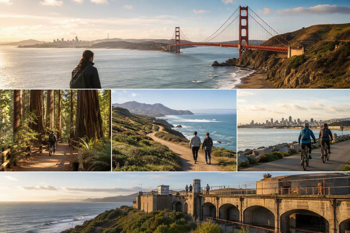
First, get the name and geography right
The formal name is Golden Gate National Recreation Area, commonly abbreviated GGNRA—not Golden Gate National Recreation Park. The National Park Service manages it as a collection of natural and historic places rather than one enclosed park. Its official overview describes 37 natural and historic sites and more than 130 miles of trails. Explore the National Park Service overview of GGNRA.
Those sites are distributed across San Francisco, Marin, and San Mateo counties. Some face the Pacific Ocean, others line San Francisco Bay, and still others encompass headlands, forests, former military properties, islands, ridges, and urban waterfronts. There is no single gate or parking lot through which every visitor enters.
That geography changes how you should plan. A search for “Golden Gate National Recreation Park” may suggest one destination near the Golden Gate Bridge, but the recreation area extends well beyond the bridge corridor. Lands End and Alcatraz are in San Francisco; the Marin Headlands and Muir Woods are north of the city; and Mori Point, Milagra Ridge, and Sweeney Ridge extend the visitor map south into San Mateo County.
The headquarters address—201 Fort Mason, San Francisco, CA 94123-0022—is an administrative and mailing location, not a universal entrance or automatic starting point. NPS directions emphasize that the recreation area consists of separate sites and advise visitors to consult the map, hours, and alerts for the particular place they plan to visit. See the official NPS directions and headquarters information.
GGNRA is also not the same place as Golden Gate Park. Golden Gate Park is a separate urban park within San Francisco. If you intend to visit attractions there, do not use directions for the Presidio, Marin Headlands, Fort Mason, or another GGNRA destination and assume you are heading to the same place.
Use this planning sequence:
- Choose the experience you want.
- Choose a county cluster.
- Select a specific site.
- Check that site’s directions, operating information, current conditions, and applicable rules.
This article is therefore an orientation and site-selection guide, not a substitute for current information from the National Park Service, transportation agencies, or the responsible operator for a ticketed destination.
Choose a cluster instead of trying to see one giant park
For planning purposes, divide the recreation area into three geographic groups: San Francisco, Marin County, and San Mateo County. These are orientation clusters, not official itinerary boundaries. Places in the same cluster may still have different management arrangements, operating hours, transportation systems, reservation procedures, and visitor rules.
San Francisco
The San Francisco group works well when you want an urban outing combined with waterfront scenery, bridge context, Pacific coastal landscapes, or major historic sites.
Prominent choices include:
- The Presidio, a broad cultural and historic landscape near the southern approach to the Golden Gate Bridge
- Crissy Field, on the bayfront east of the bridge
- Fort Point, beneath the southern end of the bridge
- Lands End, on the city’s western coast
- Ocean Beach, facing the Pacific
- Alcatraz, reached through separate ferry and visitor arrangements
These places are not interchangeable. Crissy Field and Fort Point fit naturally into a bridge-focused plan. Lands End and Ocean Beach belong to a western-coast outing. Alcatraz is an island experience with fixed transportation logistics, so it should not be treated as a casual addition to an already crowded day.
Even within San Francisco, do not assume every destination can be combined comfortably. Your transportation mode, walking preferences, current access, fixed reservations, and desired time at each place should determine how much you include.
Marin County
North of the Golden Gate, the Marin group includes open headlands, former military landscapes, coastal views, historic sites, and redwood forest.
Useful starting points include:
- Marin Headlands for broad coastal and bridge-area landscapes
- Fort Baker for a former Army setting near the bay
- Point Bonita for coastal geography and lighthouse context
- Fort Cronkhite and nearby former defense landscapes
- Nike Missile Site SF-88 for Cold War military history
- Muir Woods for coast redwoods
The Marin Headlands can anchor either a scenery-focused outing or a military-history plan. Fort Baker offers a different setting closer to the bay, while Point Bonita has its own access pattern. Muir Woods should be researched separately because its transportation and visitor arrangements cannot be inferred from general Marin guidance.
“Marin County” does not mean every destination is immediately adjacent or operationally connected. Select a primary site first, then consider additional places only after reviewing current routes and access information.
San Mateo County
The San Mateo group is essential to understanding how far the recreation area extends beyond San Francisco and the bridge.
Three useful places for initial orientation are:
-
Mori Point, where coastal open space meets the Pacific
-
Sweeney Ridge, a ridgeline setting with regional and historical context
These sites provide opportunities to encounter coastal scenery, habitat areas, ridges, and former military landscapes outside the most familiar San Francisco and Marin destinations.
Plan a San Mateo visit on its own terms. A place may appear close on a simplified regional map while requiring a different approach, transit connection, or trailhead. Avoid making it the final addition to a day already spread across San Francisco and Marin.
A cluster is a planning tool, not a shared pass
Grouping destinations geographically does not mean they share:
- Tickets or reservation systems
- Parking rules
- Ferry access
- Operating hours
- Visitor centers
- Dog or bicycle rules
- Tour schedules
- Permits
- Accessibility features
- Management arrangements
Begin with geography, but finish with site-specific research. That distinction matters particularly for places such as Alcatraz and Muir Woods, where the experience depends on more than arriving in the surrounding area.
Match the site to the experience you actually want
There is no single useful ranking of GGNRA attractions. A bridge-view outing, redwood visit, coastal walk, and history-focused day answer different visitor needs. Use the following options as a decision guide rather than a list of universally “best” places.
For Golden Gate Bridge context
Consider Crissy Field, Fort Point, the Presidio, bridge-area overlooks, or the Marin Headlands.
Crissy Field places the bridge within a bayfront landscape. Fort Point connects the bridge anchorage with an earlier coastal-defense setting. The Presidio provides a broader historic landscape south of the span, while the Marin Headlands offers perspectives from the north side.
Both ends of the Golden Gate Bridge connect with recreation-area landscapes, trails, vista points, and overlooks. The bridge also has its own visitor information, so confirm bridge-specific access instead of assuming that general recreation-area guidance covers every detail. Review the Golden Gate Bridge visitor information.
Choose one side of the bridge as your anchor unless your transportation plan clearly supports moving between sides. Several perspectives within one area can form a coherent outing; trying to collect every possible viewpoint usually creates more movement than time spent enjoying the landscape.
For an urban waterfront outing
Focus on the Marina–Crissy Field–bridge corridor. This keeps the day oriented around San Francisco’s northern waterfront rather than scattering stops across the city.
Crissy Field can serve as the central landscape, with the Presidio, Fort Point, or a bridge-area viewpoint added according to your interests. The route can work as a walk, a transit-supported outing, or a combination, but you should decide in advance how you will finish or return.
San Francisco Know publishes an optional self-guided Golden Gate waterfront walk connecting the Marina, Crissy Field, and the bridge. Treat it as an independent route-planning companion, not as an official NPS route or a source of live access information.
For coastal scenery and walking
Consider Lands End, Ocean Beach, the Marin Headlands, Mori Point, or another shoreline destination within your chosen cluster.
These places differ in terrain, route design, exposure, and facilities. Decide whether you want a defined walk, a viewpoint-centered visit, a beach-edge outing, or a broader headlands landscape. Do not infer suitability or accessibility from route length alone.
Check current site guidance before departure. Trail access, shoreline conditions, restoration work, and temporary protections may change, and a general attraction map cannot establish whether a particular route is appropriate for your visit.
For redwoods
Choose Muir Woods and plan it as a distinct experience rather than a quick stop among several Marin destinations.
A general GGNRA map does not answer those operational questions.
Establish how you will reach Muir Woods before adding anything else to the day. Only then decide whether another nearby activity fits your transportation plan.
For military and coastal-defense history
Build your visit around Fort Point, Fort Baker, Fort Cronkhite, the Presidio’s former Army landscapes, or Nike Missile Site SF-88.
These places represent different periods and functions. Fort Point connects coastal fortification history with the southern bridge anchorage. Fort Baker and Fort Cronkhite preserve former Army settings on the Marin side. The Presidio contains overlapping military and urban histories. Nike Missile Site SF-88 introduces a Cold War defense story.
A history-focused visit is often more coherent when it follows one theme. You might examine the relationship between the Golden Gate strait and coastal defense, or compare older fortifications with later missile-era infrastructure. If an interior, tour, or program is important to you, confirm that it is operating before making it central to the plan.
For incarceration and Indigenous-activism history
Choose Alcatraz. The island served successively as a fort, military prison, and federal penitentiary. Indians of All Tribes later occupied it for 19 months beginning in 1969, making the island important to the history of Indigenous activism. Read an overview of Alcatraz and other GGNRA destinations.
Treat Alcatraz as the anchor of that part of your day. Ferry arrangements, tickets, departure procedures, operating schedules, and tour availability require verification through the responsible official operator. Settle those fixed details before adding other activities.
For wildlife and habitat interests
Think of GGNRA as a network of terrestrial, coastal, and marine environments, not as one wildlife-viewing location. Its landscapes include forest, grassland, ridges, shoreline, bayfront, and Pacific coast.
Choose the habitat first: redwood forest, headlands, coastal ridge, beach, or bayfront. Then consult current site guidance for access restrictions, temporary protections, and restoration activity. Posted rules at the selected site take precedence over a general list of attractions.
A practical first-visit framework
Begin with one primary experience:
- Urban waterfront
- Coastal walking
- Redwoods
- Bridge viewpoints
- History
Next, choose one county cluster. Within that cluster, select one anchor site and only a small number of optional priorities. Confirm that “nearby” is meaningful for your transportation mode rather than relying on a simplified tourism map.
These frameworks are planning models, not guaranteed itineraries. Current access, traffic, parking availability, transit service, reservations, and the amount of time you spend at each place can change what is practical.
Framework 1: San Francisco waterfront and bridge context
Use Crissy Field as the geographic center. Then choose one or two of the following:
- A Presidio landscape or viewpoint
- Fort Point
- A bridge-area overlook
This framework suits visitors who want bayfront scenery and bridge context without building a cross-county itinerary. It can also support a military-history emphasis if Fort Point is the priority.
Before leaving, check access to the particular road, path, facility, or transit stop you intend to use. Reaching Crissy Field does not establish that every nearby feature is open.
Framework 2: Western San Francisco coast
Center the outing on Lands End and Ocean Beach. Lands End provides a coastal landscape with walking routes and views toward the Golden Gate, while Ocean Beach shifts the setting to the Pacific shoreline.
Treat this as a coast-focused plan rather than a waterfront-and-bridge checklist. Review current trail and coastal conditions before departure. If one part of the plan is unavailable or unsuitable, keep the other as the primary destination rather than forcing the original combination.
Framework 3: Marin Headlands and a related site
Make the Marin Headlands the anchor, then choose one nearby scenic or historic emphasis:
- A bridge-facing overlook
- Fort Cronkhite or another former defense landscape
- Point Bonita
- Fort Baker
- Nike Missile Site SF-88, if current access supports the visit
Do not attach fixed driving times to this framework. Routes, closures, parking, and local access patterns may change. Confirm the approach and operating information for each stop before departure.
Framework 4: San Mateo coast or ridge
Choose one San Mateo anchor rather than trying to connect every southern site:
- Mori Point for a coastal landscape
- Milagra Ridge for habitat and military remnants
- Sweeney Ridge for a ridgeline setting and regional context
Select the landscape that best matches your interest, then check the current access route and site guidance. Avoid assuming that the three destinations share a trailhead, parking arrangement, or set of rules.
Framework 5: A separately planned destination
Choose Muir Woods or Alcatraz as the main experience and organize the day around its operational requirements.
For Muir Woods, establish transportation and confirm any current parking or reservation arrangements. For Alcatraz, settle ferry and ticket details first. Only after the primary logistics are fixed should you consider adding a secondary activity.
This approach protects the main purpose of the day. It is more reliable than treating a transportation-dependent or ticketed experience as something that can be inserted wherever space appears in an itinerary.
A short decision tree
Use this order:
- Desired experience: Bridge views, waterfront, coast, redwoods, history, or habitat?
- County cluster: San Francisco, Marin, or San Mateo?
- Transportation mode: Transit, car, bicycle, walking, ferry, or a combination?
- Current conditions: Are the relevant roads, trails, facilities, and services operating?
- Final selection: Which anchor site and optional nearby priorities still make sense?
For a first visit, a focused day in one cluster generally allows more time at the selected landscape than an attempt to cover all three counties.
Getting around without treating Fort Mason as the entrance
Directions to GGNRA become useful only after you select a particular site. Fort Mason is the headquarters location, but it is not the entrance for Lands End, Muir Woods, the Marin Headlands, Mori Point, Alcatraz, or the recreation area’s other destinations.
By car
At a regional level, NPS identifies Highways 1, 101, and 280 as approaches from the north and south Bay Area and Interstate 80 via the Bay Bridge from the East Bay. The correct exit, local road, parking arrangement, and final approach depend on the destination. Consult the NPS directions page for road and transit orientation.
Do not enter only “Golden Gate National Recreation Area” into a navigation service and accept whichever point it selects. Use the full site name, then compare the proposed route with the official map and current information for that destination.
A navigation route shows how to reach a geographic point; it does not establish whether parking, reservations, permits, shuttles, or temporary restrictions apply.
By public transit
The NPS directions information, last updated in 2024, directs visitors to 511.org for live regional public-transit planning and lists these examples:
- The Muni F Line toward the Alcatraz ferry terminal at Pier 33
- Muni 28 and Presidio Go near the Golden Gate Bridge toll plaza for access toward the Presidio and Fort Point
- Muni 30 for Crissy Field and Presidio Tunnel Tops
- Presidio Go and Marin Transit as additional car-free planning resources
These are orientation examples, not permanent timetables. Verify current routes, stops, frequency, and service with the transit operator or live regional planner on the day of travel.
For Muir Woods, NPS points visitors to the dedicated Muir Woods transportation website. General Marin transit guidance does not by itself resolve current parking, shuttle, or reservation questions.
For Alcatraz, distinguish between reaching the ferry terminal and obtaining the ticket or transportation needed to visit the island. City transit may take you toward Pier 33, but it does not replace confirmation of ferry operations.
By bicycle or on foot
NPS states that pedestrians and bicycles may use park roads except where temporary or wildlife-related closures apply. This general guidance does not mean every road, trail, path, tunnel, or facility is open to both modes.
Cyclists should confirm route-specific bicycle rules and current closures. Pedestrians should check current information for the intended route rather than assuming that every mapped connection is open or suitable.
For the San Francisco waterfront, the independent Marina–Crissy Field–bridge walk described earlier can help organize the sequence. Use official sources to confirm live access and transportation details.
The landscapes carry more than one history
GGNRA brings together beaches, forests, coastal and marine environments, monuments, historic structures, and former military properties. Those places are not merely scenery around the Golden Gate Bridge. They reflect changing relationships among land, water, defense, migration, incarceration, recreation, conservation, and urban growth.
The story does not begin with European settlement or the United States military. These lands have formed part of the homelands of Coastal Miwok and Ohlone peoples for thousands of years. Later historical layers include the Spanish and Mexican periods, maritime activity, the California Gold Rush era, coastal defense, incarceration, and San Francisco’s expansion. The National Park Foundation identifies 11 former Army posts within the recreation area. Read the National Park Foundation’s cultural and historical overview.
The recreation area was established in 1972, and much of its land had previously been used by the U.S. Army. That history helps explain the forts, batteries, parade grounds, bunkers, missile infrastructure, and repurposed military buildings found on both sides of the Golden Gate. See the recreation area’s establishment and geographic background.
Alcatraz brings several layers together in one place. It served as a fort, military prison, and federal penitentiary before becoming a major location in the history of Indigenous activism. Visiting only for the penitentiary story leaves out an important part of the island’s meaning.
The natural context is equally broad. NPS identifies GGNRA as part of a UNESCO Biosphere Reserve and describes it as a diverse complex of terrestrial, coastal, and marine environments. Redwood forest, open ridges, Marin headlands, Pacific shoreline, and San Francisco bayfront therefore produce very different visitor experiences.
You do not need to master the recreation area’s entire history before arriving. Recognize that its landscapes contain overlapping Indigenous, colonial, military, carceral, conservation, and urban stories, then let the site you choose determine which layer you explore more deeply.
Check the details that can change before you leave
Make the official NPS website your final planning checkpoint. Open the current conditions and alerts information from the GGNRA overview shortly before departure rather than relying on a notice copied into an older article.
For the exact destination you selected, verify:
- Operating hours
- Current maps
- Road and trail access
- Visitor-center information
- Construction or restoration work
- Temporary wildlife protections
- Transit service
- Parking arrangements
- Tickets or reservations
- Ferry details
- Tours and programs
- Permits
- Campground availability
Conditions may differ even between nearby places. A restriction affecting one road, route, facility, or habitat area does not necessarily describe the rest of the recreation area.
Visitors with mobility, sensory, or other access needs should use the visitor-accessibility resource linked from the official NPS overview and contact the relevant site when necessary. Do not rely on a broad label such as “accessible” without confirming the route, surface, grade, facility, transportation connection, and service you need.
Dog owners should likewise open the current NPS dog guidance for the exact destination. GGNRA does not have one assumption that can safely be applied to every beach, trail, habitat area, or historic site.
Cyclists should confirm the rules for the intended road or route. General permission to use park roads does not override temporary closures, trail restrictions, construction controls, or wildlife protections.
For Alcatraz, Muir Woods, tours, camping, and other operationally complex experiences, confirm details with the responsible official operator. Do not infer a current price, reservation requirement, parking arrangement, availability, or departure schedule from an undated guide.
For general information, the National Park Service lists 415-561-4700 as the GGNRA contact number. It is a general planning resource, not an emergency line. Confirm contact and visitor-planning information on the NPS overview.
Frequently asked questions
Is Golden Gate National Recreation Park the official name?
No. The formal name is Golden Gate National Recreation Area, often shortened to GGNRA. “Golden Gate National Recreation Park” is a common search phrase, but it is not the official designation. The listed NPS unit is Golden Gate National Recreation Area.
Is Golden Gate National Recreation Area the same as Golden Gate Park?
No. Golden Gate National Recreation Area is a dispersed National Park Service unit with sites in San Francisco, Marin, and San Mateo counties. Golden Gate Park is a separate urban park within San Francisco.
Check the complete destination name before requesting directions. “Golden Gate Park,” “Golden Gate Bridge,” and “Golden Gate National Recreation Area” can lead to different places.
Does Golden Gate National Recreation Area have one entrance?
No. It is a non-contiguous collection of places rather than one enclosed park with a single visitor gate. The Fort Mason headquarters address is not a universal entrance. A regional overview describes GGNRA as a non-continuous system across three counties.
Choose the specific destination—such as Crissy Field, Lands End, the Marin Headlands, Mori Point, Muir Woods, or the Alcatraz ferry terminal—before looking up directions.
Can I visit Golden Gate National Recreation Area without a car?
Many sites can be approached using some combination of Muni, Presidio Go, Marin Transit, ferries, walking, or cycling. Feasibility depends on the destination and current service.
Use live transit information rather than assuming that a route serving one part of GGNRA will work for another. Muir Woods and Alcatraz need especially careful transportation planning because each has separate operating arrangements.
Where should I check current closures, accessibility information, and dog rules?
Begin with the official National Park Service GGNRA website. Check current conditions and alerts, then open the accessibility or dog guidance relevant to your exact destination.
Because the recreation area is dispersed, do not generalize a closure, access description, or dog rule from one site to every other location.
Make one clear choice before you go
Golden Gate National Recreation Area is not one park to arrive at but a network of distinct landscapes and historic places. Choose one primary experience and one geographic cluster, then verify that site’s current access, transportation, operating information, and rules.
For a first-time visitor seeking less movement and more time at each destination, a focused San Francisco waterfront outing, western-coast visit, Marin Headlands day, San Mateo coastal or ridgeline plan, or separately organized Alcatraz or Muir Woods experience is usually more workable than attempting to cover all three counties at once.